Quantcast
Channel: Urban Scale Richmond
Viewing all 42 articles
Browse latest View live

The Biophilic Cities Project and the Urban Imagination

$
0
0

From the point of view of the citizen, wilderness, however beautifully it is ordered in an ecological sense, represents   
a chaotic and destructive force. It is the job of the city to organize and channel the forces of nature into patterns that 
support the art of living together.


NEWS: The Biophilic Cities Project at the University of Virginia School of Architecture is a multiyear initiative engaging cities across the globe. From Oct. 17 to 20, 2013, it hosted the launch of a “Biophilic Cities Peer Network” to advance the theory and practice of planning for cities that contain abundant nature. Biophilic cities care about, seek to protect, restore and grow nature, and strive to foster deep connections and daily contact with the natural world, said Tim Beatly, Teresa Heinz Professor of Sustainable Communities, chair of the Department of Urban and Environmental Planning and a self-described “biophilic urbanist.”


Professor Beatly is seen here in a natural setting. Courtesy of UVAToday

When asked “What is a biophilic city?” Tim Beatly, Professor of Sustainable Communities at the University of Virginia’s School of Architecture and a founder of the Biophilic Cities Projectresponds that “perhaps the simplest answer is that it is a city that puts nature first in its design, planning and management: it recognizes the essential need for human contact with nature as well as the many environmental and economic values provided by nature and natural systems."
Urbanismo prides itself on putting the city itself first when it comes to design, planning and management, but we understand about the innate human requirements that are met by parks, gardens, and forests. We have written previously on Richmond’s “great, wet, Central Park.” And we have charted, in Tyler Potterfield’s Nonesuch Place: A History of the Richmond Landscape, the growth of a city-wide park system. Richmond’s “urban forest” sprang directly from municipal determination to make the benefits of public landscapes and street foliage available to the citizens from the earliest days. 
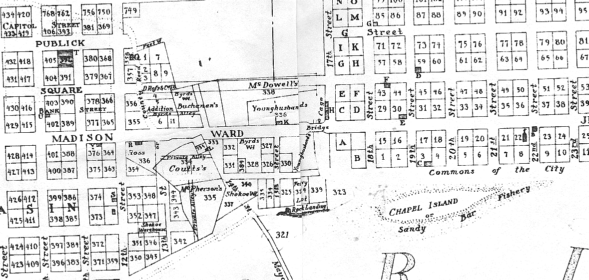
Residents of the town and city of Richmond have enjoyed open access to natural settings for recreation and work since its founding in the 1730s. William Byrd’s original plat provided common land along the river and Shockoe Creek for activities like walking, fishing, and washing laundry. Richmonders later set aside public squares, planted trees, and made both private and public gardens in which they strolled, to played, and found a respite from the heat and summer sun. Mostly, however, they attempted, in an inevitably flawed way, to provide an approximation of “the good life” for themselves. Over time, the settlement at the falls of the James developed markets, court and education systems, extensive parks, and a great tradition of public and private architecture. The perennial city as the site of civil life materialized, in spite of inherent challenges, along the unpredictable, untamable James River.  
The hopeful arguments underlying the marketing of Biophilia as a new kind of urbanism are based in a popular idea-- that there is a deep psychological connection between humans and natural processes-- posited by biologist and naturalist E.O. Wilson. The Biophilic Cities Project merges this idea with a utilitarian goal of increasing contentment and productivity and an up-to-date foreboding about the future. According to Tim Beatly, Biophilic cities may be “partly defined by the qualities and biodiversity present and designed into urban life, but also the many activities and lifestyle choices and patterns, the many opportunities residents have to learn about and be engaged directly in nature, and the local institutions and commitments expressed, for instance, in local government budgets and policies.” 

The Biophilic Cities vision, as articulated on the official website, consists of a series of concepts grounded in the Green and Sustainability movements. Many of these appear to be self-evident, even banal. Residents of Biophilic cities feel a deep affinity with the unique flora, fauna and fungi found there.” People are happier, more relaxed, and more productive, in the presence of nature.” Not only is it true that a “near-constant ability to see and experience nature is an important antidote to the stresses of modern life,” but the experience of nature in the city may “supply the essential background and building blocks for creativity, imagination, and artistic expression.” 

Biophilic architects assert with confidence that "the benefits of natural daylight and ventilation have been proven to improve productivity and reduce sick days in office workers." 

The project anticipates that things may turn unpleasant in the coming years, perhaps as resources grow scarce. Biophilic gardens and natural features will, however, “help to make cities and urban residents more resilient in the face of a host of likely pressures and shocks” to come in the future.
The project to build a Biophilic City may seem, at first, like an attempt to recover some of the architectural and social features that have gone missing from urban landscapes over the past fifty years. A loss of intensity in public life can be seen to have a close relationship with ongoing developments in technology. These included mass transit systems, which, by the 1890s, enabled workers to live outside the city center in new streetcar suburbs. The changes were extended by newer transformative technologies like the automobile and air conditioning. Over time, the schools, commercial centers, office buildings, and manufactories that were not relocated to the outskirts of the city were sealed off from direct exposure to natural forces. 
The public square, once the focus of political, commercial, and social interaction, has been depopulated. New building materials and technologies have made possible the nearly complete industrialization of the architectural and building professions, even as much of the population has moved into the “leafy” suburbs. In fact, the move to semi-forested suburbs like those around most American cities may represent Wilson’s biophilic urge at its peak.  It is possible that the Biophilic movement will even lead us toward a merging of suburb and city center-- a hybridizing process which we might be tempted to call “surbanism.”     
The Biophilic use of the word nature seems to us to suffer from a lack of clarity. There are several definitions of nature that range from “everything there is and how it works” to “everything there is except man and all his works.” The second definition sets the city apart from natural things, giving it a license to control and exploit the world. Bringing nature into the city would then be introducing a kind of anti-matter into the streets and squares of the city, unable to engage with the civilization they channel and support.
On the other hand, if the city is itself natural, the nonhuman elements of nature that are incorporated into the urban fabric would “naturally” participate in the city’s project of perfecting the life of its inhabitants. In other words, trees and water and animals, including wildlife, would take their place in the urban order, along with public art, rotary clubs, civic buildings, squares, and streets. 

From the point of view of the citizen, wilderness, however beautifully it is ordered in an ecological sense, represents a chaotic and destructive force. It is the job of the city to organize and channel the forces of nature into patterns that support the art of living together. For instance, we are sure that urban parks, in order to be useful and used, are best planned as responses to essentially urban activities. 
Stephanie Pincetl, Director of the California Center for Sustainable Communities, which studies the “urban metabolism” of “human created ecosystem[s]” like Los Angeles, is onto something when she says: 
Nature surrounds us everywhere in the city, we live in the midst of it all the time, but are not even aware of it. Buildings are made from concrete, made with aggregate and water. Roads are asphalt, from fossil fuel. The resources that we build with and make all our daily items with are sourced from nature. When we begin to be more aware of that, it helps us understand the fundamental materiality of cities and how much they are made from nature, far flung, perhaps, and remanufactured, but nature nonetheless. That kind of awareness can better inform our decisions about building materials, their energy intensivity -- or how much energy is embedded in the things we make -- and how the built environment is both the product of transformed nature and then transforms nature where we build.

As we have written elsewhere, “nature includes not only the natural objects around us, such as plants, animals and rocks, but the system of principles by which things can be explained according to reason and which were true prior to their discovery. More importantly, nature provides the mark against which rational judgment is made possible, the moral order which allows us to state confidently that democracy is the best form of government because it has as its goal the good of every citizen, and the goal of all our efforts as human beings.”   

Any failure in our relationship with the natural world is a failure, not of access, but of imagination. City dwellers will recognize that Richmond’s problems do not stem at all from lack of access to the river. We already drink from it, drive over it, and keep its powerful image in our imaginations, where rivers and other similarly potent forces of nature do their most effective work. In fact, the heart of the city is most certainly not the James River: real wilderness has only a small place in the city’s necessary order. Our life as citizens- practicing politics- the great art of living together- is at the heart of the city.  

Neglecting our urban life and its finely crafted architectural setting, we have somehow abandoned a shared understanding of what it takes to build and maintain a good city. Our sidewalks have been depopulated, the prosperity that serves the civic good has fled, and our schools seem unable to fully reform themselves. Richmond’s fragile urban connective tissues should be of more immediate interest.

In the end, we devoutly disagree with the goals of the Biophilic Cities Project, simply because the project fails to engage with the most pressing questions posed by our city(s). Its set of proposals, presented as an alternative to traditional urbanism, constitutes an end-run around the existential crisis which afflicts the city.

RICHMOND'S BALLPARK CONTROVERSY: PLANNING FOR THE MARKET SQUARE IN SHOCKOE BOTTOM

$
0
0


Richard Worsham, Proposed First Market fountain, thesis, Notre Dame, 2011. 
"Even as places like Austin and Seattle are thriving, much of the country is failing to adapt to the demands of the creative age. . . . They pay lip service to the need to "attract talent," but continue to pour resources into recruiting call centers, underwriting big-box retailers, subsidizing downtown malls, and squandering precious taxpayer dollars on extravagant stadium complexes. Or they try to create facsimiles of neighborhoods or retail districts, replacing the old and authentic with the new and generic---and in doing so drive the creative class away."    Richard Florida, author of The Rise of the Creative Class
At Urbanismo, we have been putting our heads together this week, sounding out the best way to respond to the Mayor’s announcement of the proposed redevelopment of the 17th Street Market area as the setting for a new baseball field. We have championed the market for years, bought our produce and handmade Christmas wreaths there for decades, and researched its history in considerable detailWe have even adapted it for a master’s thesis towards a degree in architecture. Most recently, we developed a design for its full rehabilitation as a major civic asset, in response to a request for proposals from the city, although our proposal was not selected from among those submitted. All of this attention should have made us feel a little possessive of the currently “down at heel” district, were it possible to “own” a public space that holds such potential for the entire city’s benefit. 


Detail of proposed Shockoe Bottom project, showing the historic Market Square as a redesigned "promenade,"
 a long esplanade leading to the ball park and filled with a meandering "water feature." 

We have decided to focus our attention here on the Market Square itself, rather than the totality of the baseball diamond project, which is already the subject of much contention and  critical attention. This ill-conceived land deal will transform the heart of a gritty, vital urban district into what will be, in essence, a shopping mall development, and an economically risky one at that. It seems to us that the Market Square is the most vulnerable part of this long-contested area known as “Shockoe Bottom.” 


Detail of the "Promenade" to replace the First Market Square
 from the city's official proposal for the Shockoe Bottom Development.  

When the city's intention for First Market Square was described by Lee Downey, Richmond's director of Economic and Community Development as "establishing a 'Shockoe Promenade' that links Main Street to Broad Street," we realized that the city has been approaching the project from exactly the wrong direction all along. The goal of making the "square" into a pass-through to the ballpark is just what is illustrated in the renderings shown above. The new "promenade" represents the transformation of a historic square, with its inimitable textures and special character, into yet another extended suburban-style pedestrian mall. 


The Market Square as polling place in 1865, after the Civil War's end.   

What is remarkable about the Market Square is the astonishing layering that characterizes its historic associations. Only a few of the buildings that define its edges actually date from before 1880, yet the square embodies over 300 years of built history. It has been the scene of celebration, petty crime and public shaming, political rallies, riots, public announcements, parades, and, most of all, the highly regulated sale of the foodstuffs required to feed the households of a city. While the market was not directly associated with the selling of slaves, a function which was mostly carried on, out of sight, a few blocks away, it is, nevertheless, intimately associated with every aspect of Richmond’s history, both good and evil. 


Historic paving at Arch Alley Seen from the Market Square
As part of the rich, bottom-up, market-driven development that has characterized the area along Shockoe Creek since the late seventeenth century, the area around the Seventeenth Street or First Market is an increasingly vital neighborhood in its own right. Most of what is significant about the market area is embedded in its street layout, its pavement, and its shape. The curbing, street pavement, and sidewalks carry its history as strongly as the buildings that surround it. 

While it is very likely that the designs published for the proposed ball park do not accurately represent the final appearance of the Market Square, it is clear that the project's planners treat the square simply as a corridor leading to the ball park. It isn’t acceptable, however, to treat the square as if it was just a link in a grand scheme seen from a privileged, bird’s eye perspective. There are subtle formal and historical distinctions that must be made in order to take full advantage of the gifts this valuable civic resource offers to the city.

Market Square, Richmond, boundaries, 150 x 300 feet, 1793.
The Market Square is made up of at least two parts. The earliest part of the present square is the southern half. Its legal boundaries laid out in 1792. It contained the two-story building that served as the market house, municipal building, assembly hall, records office, and seat of justice. This building was later rebuilt and expanded to the north as far as Franklin Street. Most importantly, its two main sections were linked by a central archway in the form of a tower that spanned “Arch Alley” midway along the market, permitting movement from east to west across the square. The elongated form of the now-vanished market buildings is defined by the cobbled streets and the granite curbing, each of which dates to the heyday of the market in the nineteenth century. In the late nineteenth century, the market extended all the way to Grace Street in a series of shed-like buildings that diminished as they moved north.

Market Square in 1889 from Sanborn Map. Note the archway corresponding
to Walnut or Arch Alley.
The square did not evolve as an open piazza. While the edges of the square are formed by building facades on the south, east, and west, there is no closure at the north. The square was meant to be filled with architecture. This does not mean that it cannot be adapted for use as a piazza designed to serve the civic good. It is, however, long and narrow and “leaky” at the corners. Without careful handling, it will appear merely as an unusually wide street running uninterrupted from Main to Grace.

Market Square from Beer's Map of 1876.
We suggest that, if the project isn't going to involve our preferred option, rebuilding the Market Hall, the following points should be considered:   
  • this place has been at the heart of commerce in Richmond for over two hundred years. This area with a growing population should retain a market function, preferably with a number of permanent stalls.
  • it is essential that cars and trucks be, at least during the daylight hours, able to travel along the existing streets through the square. As the recent Richmond Downtown Master Plan indicates, areas without traffic do not feel safe, seem empty, and suffer commercially. 
  • “pedestrianization” sounds humane, but, except in certain high density areas, can be deadly to an area. Cars underline the activity in the area and parked cars even make visitors feel safer on the sidewalks. Keep the cars! 
  • retain existing pavement, not only in the square , but along the adjacent streets that, in some cases, is the principal reminder of the historic context. 
  • pave the central part of the Square to match the granite street pavers and curbs in color, so that the square visually flows from sidewalk to sidewalk. A central granite walkway from north to south could represent the central aisle that defined each of the three previous market halls on the site.
  • keep the brick sidewalks to help define the edge of the square in Richmond's traditional manner, reinforcing the continuity of the city and the square. Paving with one flat plane from one side to the other will look just like Short Pump Mall! 
  • widen the sidewalk in front of the restaurants along the east side of the square, where the street is too wide for comfort. 
  • don’t “brand” the Market Square with aggressively stylized benches, trash receptacles, or light fixtures. Use historic lamp standards less than ten feet tall in order to meet a pedestrian scale.
  • the Market Square is the site of the first public water fountain in Richmond, fed by pipes from a spring on Church Hill. Consider adding a well-designed, substantial, traditional fountain in an off-center location, but not any other sort of “water feature.” 
  • avoid filling the Market Square with franchise restaurants, as is typical in many similar downtown rehabilitation projects (see downtown Chattanooga). Go out of the way to make the Market Square friendly to owner-operated small businesses.  

Shopping yesterday for a Christmas wreath with Lucille Allen (seen at right above) and her son. 
With her sister, Rosa Fleming, she has been selling home-grown vegetables and
hand-made Christmas decorations on the market for more than fifty years. 
In short, by treating the project with the care it deserves, the Market Square can become, once again, as flexible, serviceable, and exciting as any American public square or Italian piazza of today. 

MAPPING FIRST (SEVENTEENTH STREET) MARKET SQUARE IN SHOCKOE BOTTOM

$
0
0


These maps showing the development of the Seventeenth Street Market over time 
were prepared at StudioAmmons by Gibson Worsham and Dolly Holmes.


STUDIOAMMONS: A PROPOSAL FOR THE REHABILITATION OF THE FIRST MARKET SQUARE

$
0
0


StudioAmmons submitted a proposal over a year ago for the redesign of the historic Seventeenth Street or First Market Square in Shockoe Bottom. The members of Urbanismo were closely involved in the preparation of the detailed plan for the redefinition of a great urban place.  We publish the proposal now in the hope that it will help to clarify widely-held concerns about the City’s recently published Ballpark plan. The baseball stadium was not part of the “First Market Square” proposal originally solicited by the city. We are convinced that the ballpark plan will negatively affect the quality of the Market Square and its neighborhood.

StudioAmmons’ proposal is intended to revitalize the First Market Square by ensuring that it will serve the city in multiple ways:
  • as an active framework for urban life
  • as an engaging and flexible public place
  • as an attraction in its own right to increase tourist visitation to the neighborhood
  • as a catalyst for the relocation of small business to the area, including artists, creative businesses, and restaurants 
  • as an embodiment of the local ethos to ensure longterm vitality

The Public Square and the City

Planners have recognized the economic and cultural potential associated with healthy civic places. The reclamation of outdoor public places is increasingly emphasized by advocates of thriving and healthy American cities. Most city squares ceased to function in the latter part of the twentieth century as urban centers declined, traditional community activities slowed, and commercial functions moved to the suburbs. More importantly, the loss of public space for assembly, socializing, and reflection has resulted in an impoverishment of civic life. The failure of many large-scale rehabilitation projects to fully realize their part in the public realm results from an emphasis on economic development without consideration of the direct benefit public places can provide to the community as incubators of the civic good.


As stated in the Shockoe Economic Revitalization Strategy of 2011, a major goal of the new First Market Square should be “reinforcing Main Street Station’s position as an epicenter driving the culture, creativity and identity” of the Shockoe neighborhood. The market, by incorporating flexible programming, top-notch design values, and ‘round-the-clock scheduling, should be a catalyst for the success of the larger neighborhood. A fully functioning square could underline the kinds of urbane values conducive to the creative entrepreneurship that has already transformed the Shockoe area into a dynamic place to live and work.

Essential to the long-term success of any commercially-oriented public precinct, such as a market square, is its adaptability over time and under unpredictable economic conditions. Large static developments undertaken by direct public or private investment are particularly liable to loss of market share over time as the infrastructure deteriorates and the inflexibility of programming prevents them from adapting to changing circumstances. A highly structured project like the network of proposals associated with the Shockoe Bottom Baseball Stadium will actually undermine public values over its limited lifetime. The fine grain of the traditional city, in contrast, permits countless quick adaptations at each cumulative sign of cultural and economic change. Richmond’s First Market has survived two centuries of flooding and cyclical change by relying on this kind of nimble adaptation.


Sanborn Map of First Market Square, 1887. Main Street is at the left and Grace Street
to the right. The main Market Hall faced Main Street. The archway between 

segments of the Public Market is shown spanning Arch Alley midway 
between Main and Franklin streets. Note the narrowing of Market Square 
that occurs north of Franklin.  


Place, Form, and Meaning

As we have explored in detail in this post, the proposed First Market Square represents the sixth intervention at the site of Richmond’s historic city market. From its earliest days on the bank of Shockoe Creek, the City Market has been an accretionary, transformative place, changing its character with the changing shape of the city. The Market Square was originally placed on the edge of the settlement. One contemporary remembered the “green pasture” of the town's Common, which extended from the Market House down to Shockoe Creek. Eventually the area around the market was lined with shops and it took on a more enclosed form. Like its predecessors in Europe, Richmond's First Market Square embeds centuries of change and growth, although over time it assumed the form of a conventional enclosed square. In fact, American public places like First Market Square have traditionally embodied the kinds of urbane social and economic values that we usually associate with European plazas. 

The market, which began in the half-block between Main Street and Arch (Walnut) Alley, was extended over time as far as Grace Street, two blocks to the north. In this it showed similarities to markets which extend along the center of widened streets such as those in Charleston and Philadelphia. The First Market buildings, as they were extended along this armature, embodied their functions in a hierarchical manner, diminishing in scale and elaboration as the shopper moved away from Main Street, from a butchers' hall to an open produce shed, and so on to ranks of pushcarts filled with farm products. The Market Square was eventually surrounded by brick buildings housing grocers and butchers' shops. As time passed, the dynamic nature of the market, changing in response to shifting economic forces, resulted in a gradual replacement of most of the early shops with a layered mixture of commercial buildings of every period and style. 


Guiding Ideas


The Urban Scale


Urban Scale Architecture is design at the level of the city at large. Design at this scale gives form and direction to the urban fabric. It supports the importance of living in community. 

Saverio Muratori and his school, including Mario Gallerati, have explored the meaning of “architettura a scala urbana.” According to this approach to urban morphology, fully developed cities operate on four scales, the territorial, the urban, the aggregate, and the building. Architecture at the urban scale is manifested in at least three ways: (1) by the provision of specialized buildings to serve the civic life, (2) by the placement of these buildings in relation to each other on a scale larger than that of the urban fabric, and (3) by a deliberate overlay of serial, rhythmic design to unify the urban tissue.  

According to urban historian Carroll William Westfall, design at the urban scale serves the city by underlining a hierarchy in which the civic life takes precedence over the private. It is the elements of design at the urban scale that make cities not only meaningful but legible, even after centuries of alterations and more recent decades of forgetfulness and crisis.  The most important public places receive the highest levels of ornament and the most thorough treatment. Public architecture can make sense of the city for its users by clarifying the political, social, commercial, and civic order by which the inhabitants strive together to live the best life.


A Market Square

Richmond’s redesigned First Market Square, without its current central market structure, will be transformed into an urban form at once new and familiar. The building walls that define the square will become more obviously the boundaries of a great urban room, and the central area will be less clearly defined. The square will be more clearly rectangular and the missing building fabric at the north end will be more obvious. The greater width of Seventeenth Street along the eastern side will make it harder to unify the space.

The City has made it clear that the new First Market Square will function in a dual role: civic space and market space. This double role is informed by a further requirement that the square serve as an attractor for tourism and the arts. The civic function will be accommodated by a provision of an open area for larger gatherings and festivals, as well as a potential for subdivision at times for use by outdoor cafes, small groups, and individuals.


Looking south along the market stalls flanked by planted margins and shaded by trees.


A Market

The square will function as a market at specified times each week. A miniature street grid of temporary canopies will be set up either in the main plaza or in a subsection reserved for more diverse activities. It is also probably desirable to provide for the regular stall holders who are at the market on most days. To provide for a year-round market and close off the north end of the square, StudioAmmons suggests placing a new Market Hall on the original part of the square that extends north of Franklin Street to Grace Street, now a city-owned parking lot, but once part of the market square.

One of the key characteristics of the historic First Market was the way its form changed and diminished as it proceeded to the north. The site retains clues indicating the value to designers of reasserting the progressive nature of movement through the square. The crossing point of Arch (or Walnut) Alley, the cobblestone alley that bisects the Market Square at mid-point, served as a telling division for the first architectural transformation from a two-story to a one-story market building. The extraordinary bell tower arch that spanned the alley and gave it its name provides a built-in opportunity for place-making that is built into the site.

Open to Traffic

It is essential to the square that it retain its historic articulation into both traffic and marketplace zones. Historic curbs and spallstone paving enhance its definition as an historic part of the city. Pedestrianization does not reinforce commercial success. Vehicles (both cars and delivery trucks) and people are part of the urban environment and can be integrated into the square in ways that promote a sense of safety and a necessary level of activity. It will be important to come up with strategies to integrate traffic, parking, and foot traffic with the special activities characteristic of this public square. This can be done by prohibiting vehicular traffic at certain times of the day and week while retaining the minimal differentiation of street, sidewalk, and plaza paving.

Street Lighting

Streetlighting will be completely redesigned based on what has proved effective in other successful plazas. Richmond historic precedent should be followed as closely as possible to avoid the generic quality typical of many urban projects. This would indicate small, pedestrian-scaled streetlights augmented by gaslight-style lanterns attached to buildings at corners and along the sidewalks to add warmth and character. Moonlighting, used in New York’s Bryant Park, could be employed to create an attractive wash of light over the central portion of the square. 

Furniture

Permanent furniture should be avoided as limiting flexibility, and instead temporary furniture, including market stalls, seats, tables, planters, and cafe dividers, should be used wherever possible. Low steps, placed so as to avoid serving as barriers to mobility, provide effective seating for visitors.

A Fountain and a Bell

The city's first public fountain, piped from a spring on Libbie Hill, stood in the Market Square. Like the fountains in many historic European markets, a new fountain should probably be placed off-center to permit flexible use of the square and to enhance the perspective of views from the fountain. The basin should be raised on a stepped base to enhance seating. The market bell, which survives in the current market shed, marked opening and closing times and raised the alarm in case of a fire or other emergency. The market bell should be suitably housed in the marketplace and should once again sound the hours.


Overview of the Design

The analysis of the form and history of First Market Square suggests several design ideas capable of a range of alternative expressions: 

(1) First of all, the urban ensemble might mimic the progressive formal transformations that were experienced by the historic visitor in moving from south to north. This shading of form could be implemented in a number of ways:

    • a central circulation spine could recall the market aisle that ran for nearly two blocks. 
    • the half of the square south of Arch Alley could be kept clear of permanent structures and plantings for the purpose of concerts and other gatherings
    • the northern half of the square could be provided with plantings, providing diffused shade as well as stormwater management. 
(2) Squares from the time of the Renaissance have often gained aesthetic depth and clarity of purpose from internal subdivisions. The loggia form, with its capacity of openness and shelter from the weather, has been associated with markets, including Richmond's First Market, since ancient times. An arcaded structure (loggia) at the central point would not only recall the former archway, but would serve as an engaging market-themed focal point to attract the attention of passers-by. 

Such a structure would, at the same time: 

    • form a gateway to a temporary enfilade of market tents 
    • make a crossing point for the alley 
    • serve as a platform for overlooking or lighting the square
    • creates an opportunity to apply a different character to the northern and southern halves of the square without losing a sense of the whole. 
    • provide shelter during bad weather 
    • serve as an event backdrop

(3) It is important to emphasize that the buildings, not the streets, form the edge of the square. This can be emphasized by blending the paving materials so that the textures and colors minimize the difference between the streets and the central part of the square. For instance, the central area could be paved in granite spallstone in a contrasting pattern, while the brick paving of the sidewalks would be maintained to form a outside border. In the same way, placing most of the streetlights and other furniture along the sidewalks, rather than in the center, will visually confirm the full width of the square. Finally, widening the sidewalk on the east side of the square by 10–12 feet would diminish the apparent width of that street and provide space for outdoor cafes without sacrificing a lane of parking, a key to the success of small businesses around the square.

(4) The essence of a traditional square or piazza is its sense of enclosure, forming what some historians of the city refer to as an “urban room.” Most American squares fail in this regard because they are too large or too open at the corners. The vacancy at the north end of First Market Square will become much more apparent once the existing market shed is removed. This “leaky” north end will make it difficult, if not impossible, to fulfill the promise of the square as an “urban room.” This would be an excellent place to put a new public building. 

A new market building, reminiscent of the old First Market Hall, could be added in a later phase. With an open first floor, it would meet flood control regulations by allowing water to flow through its arcades. A new First Market Hall would permit a more powerful connection with the form of the historic market, reinforcing the sense of place by firmly grounding the square in the local context.


Summary

The rehabilitation of First Market Square presented here is intended to be lively, flexible, engaging, and sustainable. In summary, we propose the following interventions:

  • A wide, open plaza at the south half of the square which:
    • permits complete flexibility
    • houses movable furniture for cafes and visitor seating
    • features a broad central area of smooth flagstone
    • has aisles along the sides paved with spallstone to match the adjacent streets
    • has a sunken area in front of the central loggia defining a projecting apron or stage
  • Stone paving designed to reinforce the shape of the market as defined by the building walls on three sides, not by the curbing around the central plaza.
  • A central arched element (loggia) which will:
    • form a focal point when seen from the Main Street
    • serve as a focus and crossing point for Arch (Walnut) Alley
    • recall the archway that formerly spanned the alley midway along the market.
    • provide a backdrop for concerts and other productions taking place in the square
    • separate the square into hierarchical sections with distinct functions and shared forms
    • be small enough not to interrupt the flow of the eye along the full length of the square
    • use forms traditionally associated with markets
    • recall the tripartite form of the Market Hall of 1794
  • A widened sidewalk on the east side of the market will permit outdoor dining. 
  • A green northern half, with a central walk flanked by plantings along the sides, which:
    • is structured to contain temporary market stalls and other uses on specified days
    • permits sustainable plantings to help control conventional water runoff
    • accommodates shade trees along the sides as well as informal seating in the shade
  • An off-center fountain south of the loggia which:
    • recalls the historic early public water source at the market square
    • provides a focal point for seating
    • imparts the refreshing sound and sight of moving water
  • An optional short market shed building extending north of the loggia which could provide a shaded area during the day for regular stall holders and shelter during rainy weather for visitors.
Digital and watercolor renderings by Bay Koulabdara and Richard Worsham 
for StudioAmmons, 2012-2013

THE MATRIX ROUTE IN RICHMOND

$
0
0
Main Street looking West in 1865 [LOC] showing early nineteenth-
century one-, two-, and three-story brick basic buildings in the
process of replacement by four-and five-story commercial
blocks and hotels during the period preceding the Civil War. 


“All this is evident in colonial towns such as New York or Buenos Aires in which routes were not originally traced with different cross-sections or with complimentary roles, but as a chessboard of joint blocks. Time has produced in them a more or less exact hierarchy, yet partially compensating for the sequential nature of the plan, because it gives rise to routes with an insufficient cross-section to bear their hierarchical role. . .” 
Gianfranco Caniggia, Understanding Basic Building, 185

Italian School of Processual Typology 

Americans tend to think of their cities as two-dimensional grids of streets that were gradually infilled as the population grew. In fact, the way cities evolve is much more complex and interesting. Cities actually form along connecting routes in obedience to rule sets that can be recreated by a critical reading of their current fabric. According to the Italian School of Processual Typology, founded and developed by Saverio Muratori and his students, city development follows predictable patterns that are analogized to biological processes. 

As understood by this highly developed theory of urban morphology, cities grow in direct relation to generative “matrix routes.”  The routes (and the building tissue along them) are “polarized,” not only by distant destinations, but by nodes that occur along their lengths, where two routes intersect or where a route branches off. This polarization affects the intensity of development along a route, a factor which changes both in relation to factors of time (diachronic diversification) and location (diatopic diversification).  


During periods of “civil continuity,” when “spontaneous” (traditional or vernacular) building is operative, serial building tissue multiplies along a matrix route and along the secondary “planned building routes” that the city provides parallel to it. The building tissue is made up of buildings constructed according to a “typological process,” whereby the maker is guided by a mental plan that corresponds to an invisible grammar of building, passed down among owners and builders over time.  

As the city expands, it develops “aggregations” of buildings that correspond to building types.  Most aggregations are made up of basic buildings (the least personalized  kind of urban building, conditioned for the use of one or more families over time and space) or specialized tissue, which includes aggregates that correspond to special building types, like those serving government, religious, or other communitarian functions. Building tissue can exhibit seriality (made up of interchangeable elements) or organicity (characterized by peculiar shape or position). Building types continually change as specialization increases or functions are spilt off. 

By reading the city’s tissue, it is possible to recreate its development and reconstruct the formerly invisible rules by which basic and specialized tissue has been extended. Then, the planner or architect makes use of “critical conciousness” to place new buildings or features into the existing city in a way that reinforces, rather than undermines, its form.  


Richmond's Matrix Route during the eighteenth century (shown diagonally from lower right to upper left). The route corresponds to Main, Governor, and Broad streets.

The Matrix Route

Each matrix route is lined with two “pertinent strips” (a series of “built lots" along a route that relate to it). In Richmond, the form of the pertinent strip was conditioned by surveying practices learned by colonial officials and an energetic cadre of surveyors during the seventeenth century, from experience in laying out towns in Virginia over a period from the platting of the new town at Jamestown in 1620 to 1680 when twenty new towns were ordered by the government [Hughes 70]. It was also affected by the lack of previous European settlement on the land, although the influence of Indian uses on the placement of routes, river crossings, landings, fields, and settlements on European adaptation of the Virginia landscape should not be underestimated.  

By the second quarter of the eighteenth century, a century of development had resulted in a regional surveying tradition. By now, however, the planning of towns was no longer performed at the order of the government, but was done for individual landowners speculating in land. It was undertaken by roughly trained county surveyors or untrained proprietors.  The form of towns was often the result of the simple production of the requisite number of half-acre lots on a given tract of land, sometimes without regard to topography. Four of the lots were often combined into a square block. As Sarah S. Hughes has observed, similar gridiron plans are typical of towns founded by the English along the eastern seaboard and, more generally, by Europeans wherever foreign territory has been colonized, since the expansion of the Greek civilization [Sarah S. Hughes, Surveyors and Statemen: Land Measuring in Colonial Virginia. Richmond VA: Virginia Surveyors Foundation (1979) 59].  


Detail from the c1865 Mickler Map of Richmond showing First, Second, and Third 
Streets crossing Main Street, showing how lots were subdivided and buildings 
placed over time in a residential area
The uninflected nature of the blocks in the gridded town of the colonial period made it possible for the lot holder to orient the buildings toward whichever of the two streets that formed the outer border of the lots. This choice was directly related to which of the two streets was the more significant route within and through the town. Since all of the first lot owners in a town were involved in promoting or conducting commercial endeavors, lot orientation was entirely based on the volume of traffic reaching each business.

Lots were rapidly subdivided along the most intensely used routes. Development in new towns was limited to the sides of a main street or other route (including river landings or cross streets) linking the town to sources of trade or production.  During this initial development period the majority grid may have been less than fully apparent. As the town progressively developed and expanded its range of functions, services, and civic activities, the grid was manifested in an ever-changing hierarchical relationship with the changing routes of the principal traffic.           

The grid was undoubtedly placed so as to be as closely aligned with existing routes as possible, especially when, as at Richmond (and the corresponding town of Petersburg at the falls of the Appomattox River), there was an extant, less formal settlement already on the ground adjacent to the proposed town. In an all-encompassing grid plan like that extending over the several sections of Richmond, the same process of infilling was even slower, and the grid, although there from the start, was only manifested over a period of decades as development required it. Where geography intervened, the grid was circumvented or suppressed. In this way, the grid of planned streets and blocks can be seen as a matrix which conditions the form of the aggregations of buildings and of routes, but does not block the orientation or the position of the routes and aggregates themselves. Caniggia suggests in the quote at the head of the post that American gridded cities prevent a full expression of urban hierarchy. 

The city extended along the “matrix route,” which took the form of an armature that extended from the eastern end of Main Street at the port of Rocketts to its western boundary on Broad Street. The route climbed the steep side of Shockoe Hill by means of a curving “county road” that became Governor Street. All taverns, hotels, shops, and many houses were at first located directly along this matrix route, and all civic buildings were placed in relation to it, whether facing towards it or placed deliberately away from it. 

Poles, Nodes, and Axes

The route through Richmond ran historically from the intensely settled areas to the east (Jamestown, Williamsburg, and later cities like Hampton Roads) to the resource extraction sites in the west (Siouan-speaking Indian trading centers, coal mines, tobacco plantations). The road from the east, originally “Powhatan’s Road” ran from near Jamestown to the falls and connected to an ancient path towards the mountains, later known as the Three Chopt Road. These destinations gave polarity to the city’s principal route.  According to a contemporary account, British forces, who traveled to Richmond from Westover along “the common road” entered Richmond through a wooded area between the river and the bluffs. This road intersected with a road from the high ground to the northeast which descended to the new town by following the ravine now occupied by 26th Street. The main road ran along the gently sloping terrace above the river until it reached Shockoe Creek. The road continued beyond the town to the west as a trading route. 

Nodes are significant points where routes intersected and where routes meet significant geographic features. In eighteenth-century Richmond these included the crossing of Shockoe Creek (and the falls that blocked shipping), and, to a lesser degree, the intersections of the Brook Road and the Westham and Three Chopt roads west of town. The earliest, the informally organized settlement known to William Byrd II as “Shackoes” was the site of the first tobacco warehouses. These had for many years been located on the high ground on the west side of Shockoe Creek, forming what was probably the most important node in the early eighteenth century community, before it was absorbed and obscured by urban growth. 

On a matrix route, building tissue forms at a pole or at a node between poles. The settlement established by William Byrd II at Shockoes at some point before 1730 was just such a place. It is what Caniggia would call a “proto-urban nucleus,” a village with commercial and industrial functions. The irregularity of the lots shown on the west side of Shockoe Creek on maps in the early nineteenth century show the signs of spontaneous building along a pre-existing route. This was followed by the regularizing of the matrix route within the grid of planned building routes, beginning in 1737, except where geography intervened on the slope of Shockoe Hill. Near the nodes where the routes split west and north of the city grew up small settlements at Bacon’s Quarter Branch and Scuffletown, later absorbed by the expanding urban agglomeration. 

Each urban nucleus has a center and periphery. In the same way each town is made up of secondary nuclei that exhibit their own centers, outskirts, and boundaries. These nuclei or neighborhoods exhibit both linear nodalitiy (routes that act as elongated nodes) They are measured across from the axis of the matrix route to the outskirts on either side) and punctiform nodality (a point on a route). These are measured from the center of a nucleus to its outskirts along the path of the route. Both are directly related to the matrix (principal) and secondary routes. In this kind of a system, Caniggia notes, “a complex system of hierarchies naturally forms between axes and boundaries and between nodes and anti-nodes, whose complexity depends on the expansion of the urban nucleus under review” [168].  In modern cities there are often centralizing axes (commercial streets) and dividing axes (traffic routes). Along the streets in between will be found warehouses and parking.   

Punctiform Nodalities

Important special buildings will tend to be found at the intersections of nodal axes, where their organic form makes them difficult to place in the body of basic buildings. These buildings often have a single large room, such as a church, theatre, or hall. The special buildings, like branch libraries, schools or markets, that serve neighborhoods and their catchment area and function can change over time, and they can lose significance as the building use diversifies and expands into other building types. This can be seen in the sequence Market House [18th c]; Market House, City Hall, Assembly Hall, Jail, and Firehouses [19th c]; Market House(s), City Hall, Exhibition Hall, City Courthouse, Sheriff's Office, Police Stations, Jail, and Firehouses [20th c]. By the late twentieth century, changes in transportation had rendered the First Market House, which had once housed most of the official uses of the city, nearly obsolete.    

Neighborhoods

Each neighborhood (to use another name for what Caniggia calls “sub-modules” within the town or city) has its own axis, center, and boundary and over time, the building tissue resounds to these forces in a variety of ways. In the eighteenth century, for instance, the parallel “planned building routes” flanking Main Street in the oldest part of the city- Franklin and Cary streets- held residential accommodations. By the mid-nineteenth century, these squares and lots housed mostly industrial tissue. Today these lots have been returned to use for residential purposes, albeit with a very different building type in play. At the same time, the block of Main Street between 13th and 14th Streets was perhaps the most intensely commercial street in the city in the late nineteenth century, and those commercial uses spilled onto Cary and Franklin in that area. 

Hierarchy of Urban Routes

The position of each element in the city and neighborhood, whether a route, a building, or a square,  in relation to nodal or antipodal points or axes, determines its identity, role, and level of continuity with its neighbors. Special buildings are also placed in relation to nodes and axes. By this rule there is also a hierarchy of routes within a neighborhood, in relation to the axis and the boundaries. For instance, according to Caniggia, the first route flanking a commercial street will sometimes be the least likely to have shops along it, rather providing access and service functions for the main street, while the second flanking street will be more likely to fill up with stores [184].       

For example, the pressure of the commercial uses along Broad Street from the late nineteenth through through the mid-twentieth century meant that it lost its former residential character as commercial tissue expanded onto Leigh, Grace and Franklin. 


Sanborn Map showing Second Street north of Broad Street in 1950
The importance of Second Street as a cross thoroughfare meant that the lots on the east-west streets like Leigh and Clay were realigned so that even some corner buildings faced Second Street (see map above). This street served as the center of African-American life in the early twentieth century, requiring a second, separate set of special buildings, such as theatres, churches, lodges, and funeral homes, to serve the segregated community. Another example of change over time is in the area along South 17th Street near the First Market in the era from 1897 to 1907, as studied by Drew Patenaude as part of an urban studies class at the University of Richmond. He documented the gradual replacement of small businesses operated by African-American merchants with consolidated warehouses and light industrial operations located between the market and the city docks.  


Sanborn Map showing the 600-800 blocks of Broad and Grace Street in 1886
Sanborn Map showing the 600-800 blocks of Broad and Grace Street in 1905
Similarly, Charles Hancock traced the changes along the 600-800 blocks of Grace Street from 1884 to 1924 (see the three maps above). This street, one block south of the commercial axis along Broad Street, was occupied by houses and churches. By 1905 hotels and small shops were found among the houses, but by 1924 changes in population caused the residential and commercial uses to be crowded out by the expansion of the churches and hotels.   

Infill


Infill building, according to Gianfranco Caniggia, occurs where serial tissue (such as row houses) fills both sides of a matrix route. At this point the back yard (pertinent area) of the buildings occupying corner lots increase in value and is “changed into a buildable, albeit undersized lot from its previous role as unbuilt are annexed to a house.” This practice is apparent throughout Richmond, conforming to  Caniggia observation that these infill lots tend to acquire variants of the adjoining basic building, but of later date and smaller scale [Caniggia and Cataldi. Interpreting Basic Building, 139]. See the Sanborn maps above for examples.


MORE TO FOLLOW


URBS IN RUS: COURTHOUSE SQUARES IN VIRGINIA

$
0
0

Hanover County Courthouse of c 1740 (VDHR], where the arcaded piazza,
at grade, fronts a raised courthouse interior.
 
In eighteenth- and nineteenth-century Virginia, the civic architecture built in the rural counties that spanned the state, such as courthouses, was always closely related to the public buildings  found in cities and towns. The Capitol at Richmond, like its predecessor at Williamsburg, stood at the heart of a political system that was housed in public buildings erected at a series of crossroads hamlets. By their form and ornament, mostly derived from provincial English sources, these meticulously imagined structures illustrated for their users the way in which the political order could promote the common good. By the 1730s, a continuous hierarchy of substantial civic buildings was in place, from the courthouses and jails at the local level to the capitol, prison, and governor's house at the state level. Local and state leaders, spurred by Thomas Jefferson, successfully undertook a thorough reformation of civic architecture at every level. They projected a new series of civic buildings in order to set a rigorous standard, worthy of the new republic, for architectural achievement in both the public and private realms. Local leaders adapted regionally appropriate building types (like the basilica-plan courthouse with a piazza and a curved end wall) that served specific political orders, and transformed them through a careful use of classical and Renaissance architectural forms.  

The Virginia Courthouse Square

In the overwhelmingly rural context of eighteenth- and nineteenth-century Virginia, county courts were the dispensers of justice, regulation, and administration for most of the widely dispersed population. County government involved a monthly gathering of the county's elected political leaders at a central point located along the county's most important route. The two most important buildings associated with county government in colonial Virginia were a courthouse in which to conduct the basic functions of local government and a “prison” or “gaol” in which to hold two sorts of individuals: those who were awaiting trial and/or punishment and those who had been identified by the court as debtors. Given the absence of towns or villages in many counties, public buildings were often placed on an enclosed tract of one or two acres, entirely surrounded by an open agricultural landscape, usually referred to as the "public square."

The courthouse square is closely related to the market places of medieval and Jacobean England.  The English market square typically included a government building in the form of a town hall/ market hall equipped with a loggia, piazza or portico, as well as a market cross, the venue for official announcements and the public administration of justice. The rural nature of Virginia counties precluded regular markets held in the same building that housed local government, such as was the case in England and in larger Virginia towns such as Richmond and Fredericksburg, but fairs and court days brought the public square and the area around it to life on a monthly or semi-annual basis. In much the same way, the stocks and whipping post found in courthouse squares were instruments long associated with the conduct of justice at the local level on both sides of the Atlantic.


The Capitol at Williamsburg (1705, reconstructed 1934)
stood at the top of the hierarchy of colonial government.  
The central "piazza," entered through brick arches, is 
related to architectural forms associated with town halls 
in England. The curved apses, ultimately derived 
from ancient Roman basilicas, contained seating 
for political and judicial authorities. 
The King William County Courthouse (c 1730). Beginning
about 1730, county courts began using more permanent
construction materials.  Arcades or "piazzas" not unlike 
the central piazza at the Capitol began to appear at 
some courthouses, along with curved back walls 
containing, like those at the Capitol, the seats from which the 
political and judicial leaders exercised their authority. 


The arched piazzas at eighteenth-century Virginia courthouses (and at the Capitol in Williamsburg) are related to a long tradition of civic architecture, and were provided provided for both practical and symbolic reasons. Their models were found not only in the market halls of England, but in the courtyards of mercantile structures in London, Oxbridge colleges, and local buildings such as almshouses. The ultimate reference, recognizable to classically educated Virginians, was to the Roman forum, particularly as interpreted by Andrea Palladio. The forum was seen as a significant precedent for enclosed courtyards and for the larger public square. Carl Lounsbury has pointed out how Christopher Wren made the arcade at Trinity College Library in Cambridge “according to the manner of the ancients, who made double walks . . . about the forum” [Carl Lounsbury, The Courthouses of Early Virginia: An Architectural History, 2005].  

When Leonard Bacon (1801-1881), a nineteenth-century Congregational clergyman, explained the reasons behind the creation of the New Haven Green, he echoed what countless other classically trained civic leaders understood. The public square was "designed not as a park or mere pleasure ground, but as a place for public buildings, for military parades and exercises, for the meeting of buyers and sellers, for the concourse of the people, for all such public uses as were reserved of old by the Forum at Rome and the ‘Agora’ (called in our English bibles ‘the market’) at Athens, and in more recent times by the great Square of St. Mark in Venice; or by the ‘market place’ in many a city of those low countries, with which some of our founders had been familiar before their coming to this New World"[see Early British and American Public Gardens and Grounds].

According to Lounsbury, the pre-Revolutionary courthouse was often a small and undistinguished building. However, as the eighteenth century progressed, members of the principal county families began to see the courthouse and the church as arenas for architectural expression. They became the most architecturally developed buildings at the scale of the county, and increasingly combined permanent materials, regional architectural forms, and cosmopolitan classical features imported from abroad. The floor plan was adapted to include the special features required for local government in Virginia. Courthouses began to include a semi-circular seating area for the judges facing the entrance that, as we have seen, was ultimately derived from the curved ends of the basilicas where justice was administered in the Roman forum.

The building was the scene of a solemn enactment of the rituals associated with the administration of justice at this local and most familiar level. Although the deferential society of Virginia enforced a clear demarcation, socially and architecturally, between the sitting justices and the majority of the county's population, the local scale meant that justice (at least for the free members of the community) was rooted in the close relationships of all the participants. These included the justices, the plaintiffs, the jury (when empaneled), and the spectators, each of whom took a part in the action. 

The Virginia Capitol preceded Jefferson's successful 
campaign for a proto-typical county courthouse by some 
years. As he hoped, the temple form eventually prevailed 
over older courthouse types. The architectural relationship 
of many courthouses to the Capitol underlines the 
hierarchical connections between local and state government.
The Charlotte County Courthouse (1823), part of the
transmission of Jefferson's program of revised civic 
architecture across every level of government. After the 
1820s, versions of the temple-form courthouse became 
closely associated with county government.


With increasing prosperity in the nineteenth century, county leaders sought to replace their aging public buildings. Thomas Jefferson proposed a new prototype for the courthouse that was very influential in determining the form that Virginia courthouses would take for next 100 years. According to Charles Brownell, Jefferson made the case for a temple-form building, scaled and ornamented appropriately for local government, using Palladio's Tuscan order to "wrap" the traditional basilica form that had been developed in Virginia over the previous two centuriesThe eighteenth-century piazza was replaced by a classical pedimented portico, but the floor level remained nearly at ground level, where it continued to provide a transition between interior and exterior and act as a sheltered place to transact legal business, make deals, and take cover in the busy, fair-like atmosphere associated with the special days on which court was held. 
   
The Goochland County Courthouse is one of the finest examples of Jefferson's program to improve the quality of civic architecture at the local level. 
The Tuscan order as employed here results from a careful inculcation of classical principles among a cadre of designers and workmen.
The courthouse square received an increased level of attention in the first decades of the nineteenth century. County officials began to place new buildings in symmetrical locations flanking the courthouse and to clean up the roughly kept grounds. At the same time that the public square (Capitol Square) in Richmond was landscaped and enclosed with an elegant iron fence, counties began to make efforts to order the local landscape by adding ornamental gates, fences or brick walls, intended, not only to prevent the entry of cattle and pigs, but to set the public square apart from the rural land for civic use. 


Hanover Courthouse by Benson Lossing. This drawing documents the Courthouse Square in the early 1850s. Note the well and the trees surrounding the courthouse and how the paths from the tavern (center), the jail (right), and the clerk's office (left) run through the arcaded porch.

For example, Goochland County saw an intensification of activity related to the courthouse that begin in 1820. County leaders were clearly resolved to upgrade the architectural character of the public buildings and the square in which they stood. A higher level of expense was required to achieve these goals in response not only to increasing prosperity, but to the program of architectural improvement widely promoted by Thomas Jefferson. These included the use of permanent materials and improved adherence to normative standards of classical design. The county went great lengths to improve the square. A new post and rail fence with handsome gates was built round the square and it was planted with ornamental trees in the spring of 1820. The county court ordered a brick wall to enclose the square in 1840.


The Goochland County Public Square in 1929. The "crier's platform" shown is otherwise
 undocumented, may also be associated with the location of the stocks and pillory
 [Goochland County Historical Society].   

The courthouse square was the scene of the county’s shared social and political life: festive court days, somber executions, political rallies, and the celebrations associated in Virginia with voting days. As new civic buildings were added, they were often placed to flank the courthouse, following the tripartite form used earlier at grand Virginia plantation houses. These were ultimately derived as well from eighteenth century pattern books with Palladian origins. When the Hanover County court added a clerk's office in the second decade of the nineteenth century, they carefully placed it as a dependency to the side of the main building. Later, when they built a new jail, it was placed in the corresponding position at the other side.  A similar layout can be seen at nearby Goochland County's public square, where the courthouse of 1827 is flanked by the jail and the clerk’s office, dating from 1825 and 1847, respectively. 


Goochland's Public Square in 1915. The one-story Clerk's Office is at the far left. Note
 the three building along the rear line of the square. Other privately owned buildings stood
 along the sides and front (see 1929 map above) [Goochland Historical Society]. 

In many courthouses, landholders bordering the public square sold off in small lots for use in constructing law offices, inns, and even Masonic lodges. This can be seen in miniature rows of tiny law offices opening off the public squares in towns like Woodstock and Culpeper and in the several brick and frame structures that around the square in early twentieth century Goochland. Even thought these lots were not located on official streets, their owners thought it appropriate to informally front their private buildings directly on the green, as a kind of nascent urbanism.


Powhatan Courthouse Tavern, Powhatan County, Virginia a late eighteenth- or early nineteenth-century tavern [Powhatan County Historical Sites].

Hanover Tavern, dating from 1791, placed directly across the main road from the courthouse [VDHR].
The Goochland Courthouse Tavern, operated by Benjamin Anderson, stood directly
opposite the courthouse. An "Old Tavern" and a lodging house stood on either side of the square,as can be seen in the plat below [Goochland Historical Society]. 
1822 Plat of the Goochland County Prison Bounds (area within which certain prisoners
 were allowed to move about). It shows the T-shaped courthouse that proceeded the
 present 1827 courthouse, the taverns, stable, and the old jail [Goochland County Deed
 Book 25: 325].

In rural courthouse communities, the tavern, located along one side of the square, provided the essential counterbalance to the courthouse. At Hanover, the rambling tavern, rebuilt in 1791 and enlarged several times afterwards, faced the courthouse from across the road. It served as a home for visitors from outlying parts of the county during court sessions. It was the setting for much of the social exchange that bound together farmers and planters at the county level. By the late eighteenth century, Virginia taverns in the both urban and rural locations often were fronted with a long porch for warm-weather seating and social life.

In Cumberland County, the courthouse of 1778 did not face the tavern. In 1818 the new courthouse was positioned directly across from tavern. As Marc Wagner observed,
whether or not it was intended, the "interesting relationship of portico facing portico . . . created a town center where outdoor gathering would have had appropriate ceremonial legitimacy [NR nomination, Section 8, footnote 6]."

In its fullest form, the extended tavern porch formed one side of a partially enclosed public square. It served as the counterpart to the piazza of the courthouse, each symbolically extending toward the other. Together, they represented a porous boundary for the model of the civic realm that was enacted each month in the public square. 


CEREMONIAL ROUTES: A HISTORY OF CIVIC RITUAL IN RICHMOND

$
0
0
A triumphal arch constructed as a temporary 
entry gateway to the massive Street
Carnival held on Broad Street
in 1900. 
The ritual aspects of Richmond's spatial organization were embodied in the regular parades and ceremonial entries by military heroes and presidents that punctuated the city’s collective life. At the same time, the solemn processions such as the city's post-Civil War Emancipation Day parades could embody the collective aspirations of a disenfranchised section of the population. The city's street were also the scene of spontaneous parades and even riots, when residents wanted to attract political attention to an issue. 

The classical foundations of nineteenth-century liberal arts education guaranteed that many of the Richmond’s political leaders viewed contemporary cities as the inevitable heirs of an ancient civilization. Ancient Roman practice included the erection of a multiplicity of architectural memorials to the dead, whose virtue could instruct the city, of heroically scaled images of rulers and military leaders, of trophies celebrating victories in war, and of public structures, such as loggias and fountains, that allegorized the natural world even as they provided for the public good. 


Ceremonial routes were associated with the armatures identified among imperial Roman cities by William McDonald, which formed around the connecting links (the principal streets and squares), the important public buildings, and the "architecture of passage," which consisted of public amenities such as fountains and arches and marked segments or stages along the route [McDonald, The Architecture of the Roman Empire: An Urban Appraisal, 3]. These routes provided the setting for the adventus, in which the emperor formally entered the city, either following a military campaign or as part of a tour or progress through the realm.  This practice continued into early modern times as the festivity associated with the ritual entry and greeting of a prince by the civic authorities, followed by a ceremonial meal. 


The 1905 Emancipation Day Parade moves west along Main Street following Richmond's
 traditional parade route. Its solemn and determined participants demonstrated their

 resolve to celebrate and perpetuate freedom to observers at upper floor windows. 

Processions and parades at the Urban Scale


Before the erection of the Washington Monument in Capitol Square in the 1850s, the city’s processional route was marked by civic architecture at the urban scale, including the Henrico County Courthouse, the city's Market Hall, the City Hall (after 1816) and the Capitol as the markers of a ceremonial adventus armature. However, in 1824, triumphal arches greeted Lafayette in almost every city he visited. One large arch extended over Main Street from the Union Hotel to the building across from it [Charles Poindexter, Richmond: An Illustrated Guidebook, 1907, 47].  Three arches, dedicated to Generals Lafayette, Nelson, and Green, spanned the three upper gates to Capitol Square, in which stood a central four-fronted arch and an obelisk in honor of other officers [Christian 102]. 


Here, in a detail from a Harper's Magazine
 illustration of the fall of Richmond, a resident
 watches the celebration in the street from a balcony above Main Street. 
Early nineteenth-century store/houses did not have exterior balconies. These were
developed during the antebellum period.  Here, on Bank Street in Petersburg, is a mid-
nineteenth-century cast iron balcony, typically located at the windows of the first floor of
 the living quarters above a shop, from which residents could watch not only civic processions  but the daily activities of the street. 
Regular annual celebratory processions on the Fourth of July and Washington’s Birthday (which replaced the King’s Birthday from pre-revolutionary times) served to reinforce the  American sense of community by delineating lines of social and political organization.  This kind of unifying civic ritual was transformed in many cities, after the 1840s, into an “ethnic festival” designed to bring out differences among the citizens.  

The civic parade is a particularly American invention, where, according to Mary Ryan, the city displayed itself, organized into corporate groups, for public view. It took the form of a long procession of marching units, many uniformed in keeping with their position in the city, and was open to any group who wished to participate [Mary Ryan, “The American Parade: Representations of Nineteenth-Centry Social Order,” in Lynn Avery Hunt, The New Cultural History, U of California P, 1989, 131-138]. These were part of the rich political life of the street, where blocks of voters, drills of militias, and even spontaneous riots moved along the city’s streets to the view of spectators and building occupants.  

The appearance of a "commemorative procession" following the death of George 
Washington in 1799, Philadelphia, PA [Detail, Birch's Views of Philadelphia, Plate 11].

Like the parade that accompanied Lafayette’s entry into Richmond in 1824, Washington's birthday parade in 1832 formed at the Henrico Courthouse, proceeded past the market, and ended at the Capitol [Christian 103]. The funeral procession for Jefferson in 1826, which also followed the route from courthouse to capitol, showed the city and state hierarchically arrayed in its full integrity: Governor, Council, Officers of state, officers and soldiers of the Revolution and Society of Cincinnati, clergy and relatives of the deceased, Federal and State Committee of Arrangements, the mayor and corporate authorities of Richmond, citizens of Richmond, and the military [Christian]. The Washington Monument parade of 1858 also embraced the traditional ceremonial route, starting at 21st and Main and ending at the dedication of the monument. 

The "funeral car" for the civic ceremonies in 1852 honoring the recently deceased
 political figures John C. Calhoun, Daniel Webster, and Henry Clay,  in New Orleans. 
Richmond funeral parades undoubtedly employed similar memorial trappings.
Jefferson Davis's funeral caisson in 1893.

As the city’s monuments multiplied over time, entry and military parades were routed to take advantage of the overlay of civic symbolism provided by public art as an "architecture of passage" to the city’s relentless grid of streets. Since the object of the celebration was absent, most of the civic birthday and funeral parades had been entirely symbolic. The funeral for Jefferson Davis in 1893 was very different, owing to the specific demands of the burial in Hollywood Cemetery. The procession, the culmination of a extended train cortege originating in New Orleans, was viewed by thousands as the hearse moved from the Capitol to the cemetery. In a similar way, the private funeral procession, moving slowly behind the hearse on its way to Hollywood or one of the city's other cemeteries, links the mourners' private remembrance to the ongoing life of the city


Teddy Roosevelt’s entry into the city took place along along Main Street in 1905 and appears to have turned north here at Fifth Street for a gentle climb to Capitol Square.  [Shockoe Examiner].
After the completion of Monument Avenue, the armature of the entry ritual changed from Main Street to Monument Avenue, with arrival of dignitaries at Broad Street Station and an end point, as always, at Capitol Square. They included the processions for Marshall Foch, Richard E. Byrd, Winston Churchill, Dwight Eisenhower, and Queen Elizabeth, wife of King George V. past the many representations of Confederate military and political leaders and the equestrian statue of Washington [Monument Avenue Preservation Zone NR form, 1969]. 

Political processions, designed to promote the campaigns of candidates, were never absent from the streets of the city. In 1892, city Democrats organized several rallies, the "most notable of which was the night of September 23rd. There was a parade and torchlight procession and thousands gathered at the Academy of Music to hear Adlai E.Stevenson and Isadore Rayner speak" [Christian 426]. The victory of Grover Cleveland that November led to a massive celebration and "one of the greatest parades in her history. . . . thirty-eight squares long . . . . There were torches, tableaux, and floats, which made a brilliant spectacle" [Christian 426].  

Military parades, originally designed to showcase the marching skills of fighting units, became, with the advent of large-scale war in the late nineteenth century, both an element of national propaganda and a way of commemorating those who died in war. Victory parades resembled, not only the entry of soldiers into defeated cities, but the "triumphs" of successful armies, laden with booty and prisoners, processing into the Roman forum. Typified by the Bastille Day parade in Paris, established under the Third Republic in 1880, the modern version of these events included massed military units, wagons and caissons, and eventually, tanks and other armored vehicles. Over time, military components tended to supplant the display of civic order typical of early nineteenth-century processions. The inaugural parade for Gov. William O'Ferrall in 1894, featuring the First, Second, Third and Fourth regiments, marked a new era of state pageantry. "There was more pomp and ceremony attuning this inaugural  than any since war" [Christian 434]. When local regiments of the Virginia troops marched to the station for the Spanish American War in 1898, the streets were lined with supporters [Christian 459].


March written for the Street Carnival in 1900.

In 1900, a massive "Street Carnival" was organized by the city's commercial interests to promote or "boost" the city. The carnival was deliberately modeled on the growing Carnival celebrations in New Orleans and Mobile, harnessing entertainment to commercial  growth. The first day featured a parade of floats celebrating local companies, followed by floral, military, and children's parades on subsequent days. A large triumphal arch formed an impressive gateway to the festival. "Broad Street was filled with novel and beautiful booths and all the houses were decorated. At night it looked like fairyland. . . . Day after day there were thousands of people on the street, and all seemed to enter into the spirit of the occasion" [Christian 471]. 

In October of the following year, the organizers gave the street festival a new theme, "The Electric Carnival." An archway resembling the Eiffel Tower was located in the center of the street, edged with lines of incandescent lights and topped by a star-shaped cluster of lamps. Much of the lighting was provided by electric railway headlights. According to a trade publication, "Its object was the betterment of the city, extension of its business, advertising its climate, industries and manufactures; it was directed somewhat after the style of the New Orleans "Mardigras," the night pageants being very beautiful; in fact the celebration was a street fair and carnival combined. Ten thousand electric lights were strung across Broad Street for about half a mile, making it as bright as day" Exhibits included an animal show and a display called "the Streets of Cairo" [Street Railway Journal, XVIII:20 (1901) 738].  

The tower was remotely illuminated at the opening remotely by President Roosevelt from the White House using a telegraph key [Ward 215]. The carnivals proved very popular. Unlike the carnivals in the deep South, however, the Richmond Carnival, without a direct relation to local traditions, proved to be a short-lived effort. The success of the temporary arches appears to have prompted the United Daughters of the Confederacy to propose a monumental arch in 1902 over Broad Street at the intersection of Twelfth Street as a memorial to Jefferson Davis, but this was never built. The role of urban promotional event was taken on by the Tobacco Festival, with its pageant and parade, beginning in 1949.

This arch was proposed for a site in Monroe Park soon after Jefferson Davis' death in 1889.
In 1901, the United Daughters of the Confederacy proposed placing an arch over Broad Street
[City on the James, 1893].

The dedication of monuments in Richmond often began with a parade. In the case of the Lee Monument, hundreds of citizens were recruited to pull the statue through the streets. The Jefferson Davis Monument, finally realized on Monument Avenue, was dedicated as a part of the large Confederate reunion of 1907 and took place at the culmination of an impressive parade.

318th Infantry Regiment’s homecoming parade through a temporary triumphal arch into
 Capitol Square in Richmond, Virginia about June 1919. From the regimental history of the


Here is a brief film of a 1918 military parade moving along Broad Street and Monument Avenue and ending at the Capitol.

GOOD AND BAD GOVERNMENT

$
0
0
"Peace" from the Allegory 
of Good Government
Urbanismo spends a lot of time making parallels between traditional American urbanism and old-world cities in Italy and England. Martha Banta, in her book One True Theory and the Quest for an American Aesthetic (Yale U Press, 2007, 104-5) makes a significant point about the most important uses of public art, one that we would do well to consider:
"Washington DC was unable to provide what the Italian tradition had so much of- well-trained artists and artisans possessed of many skills, the cooperation of guildsmen and bureaucrats, and the willingness of the communes to pay the necessary costs in money and patronage- yet there are certain similarities between what Florence and Rome achieved through their art and architecture and the motives that lay behind America’s capital. Some of these connections are strong, others are loose, but together they provide comparative perspectives that aid in a better understanding of what is involved in making a public art that matched public policies. Both decided that what mattered most was the celebration of the virtus of government power, not the virtu of good government. . . . 
But what is present in Siena’s Palazzo Pubblico and sorely missed in the Capitol are frescoes that are visual indicators of what is required of a country’s civic leaders if they wish to advance beyond mere economic and military victories. The three walls in the Sala della Pace (or Sala d’Nove) are covered by Ambrogio Lorenzetti’s murals of 1338-39, allegories known as the Good Government and Bad Government. Beyond their great beauty and the proud position they hold in art history for initiating major innovations in theme and technique is their quiet affirmation of the importance of the city’s commitment to a system based on serving the people with honesty and justice.”  

Detail of Bad Government -The figure of justice lies bound at the feet of tyranny


                                                 Detail of Good Government - The inscription reads:  
“Turn your eyes to behold her, you who are governing, who is portrayed here [Justice], crowned on account of her excellence, who always renders to everyone his due. Look how many goods derive from her and how sweet and peaceful is that life of the city where is preserved this virtue who outshines any other. She guards and defends those who honor her, and nourishes and feeds them. From her light is both requiting those who do good and giving due punishment to the wicked."
The Allegory and Effects of Good and Bad Government in Sienna's Palazzo Publico (Town Hall) was commissioned in the 1330s to remind the assembled councillors of the importance of virtue in government, by contrasting just republican government with corrupt tyrannical rule.  

PUBLIC ART AND COMMUNITY MEMORY: RICHMOND'S MAGGIE LENA WALKER

$
0
0

In the following essay, we will attempt to trace the history and character of monument-making in Richmond and how it might affect the proposed memorial to Maggie L. Walker, one of the city's great pathfinders. 
Urbanismo attended a public meeting on April 5 at the historic Third Street Bethel African Methodist Episcopal Church. It was presented by the City of Richmond’s Public Art Commission.  Two separate meetings were scheduled, each intended “to provide input on commemorative public art in Jackson Ward honoring the life and accomplishments of Maggie L. Walker.”  About thirty people attended the second meeting, held on a Saturday morning. 

Maggie Walker’s memorial will enrich the city’s collection of monuments, but only if it is designed to support and transform the larger civic realm. According to art historian Michael J. Lewis, traditional monuments embody “a single powerful idea in a single emphatic form, in colossal scale and in permanent materials.” Even more important, monuments are effective to the degree that they are “made to serve civic life.” As understood in Richmond and in the cities of the past from which it took its pattern, monuments assist in ordering the city, making legible its structure and origins, both literally and figuratively. Traditionally, a city without appropriate monuments could make no claim to be a place of civility or a center of virtuous political life. While the term “monument” is frequently applied to significant works of public architecture, here we are referring to amenities at the urban scale which have as their principal role the orientation of the citizen in both time and space.

Installation of the equestrian statue of Washington in 1858.

The Maggie L. Walker memorial can be placed within the category of monument typically identified as “public art.” Provision of public art, mandated in certain situations by city authorities, can prove to be a source of controversy in a republic with a weak sense of common purpose. The history of most of the public sculpture in Richmond since the mid-nineteenth century shows that the conflicting expectations of those with an interest in the work of art often leads to political difficulties in its realization. It also shows that citizen groups working together can, in spite of inevitable conflict, produce work that positively reinforces local civic life and organizational patterns. Richmond’s Public Art Commission has recognized the inevitably local character of public art with this statement: “Great cities of the world inspire, uplift, instruct and heal with their particular brand of great art [our italics].” This local character results, not only from regional materials and shared traditions of artistic expression, but from the way that the community has, over time, incorporated memory into its urban fabric. The Richmond tradition of outdoor public statuary began with a monument to Virginia’s role in the nation’s founding, first proposed in 1817. After years of inaction, a committee of citizens proposed a competition for the monument, which was held in 1849. The popular and successful monument was not only a tribute to George Washington as military and political leader, but an elaborate allegory linking Virginia with the national polity. 

Among the most recent monuments to participate in the tradition is the effective and powerful Virginia Civil Rights Memorial in Capitol Square. The monument, completed by artist Stanley Bleifeld in 2008, depicts eighteen figures, some historical and some representative, placed on four sides of a stone plinth and telling the story of the long struggle for equality. The sculptural ensemble avoids the sentimentality that characterizes some of the sculptor's work in other cities and takes a place among the very best monuments of recent decades. 


Virginia Civil Rights Memorial, Capitol Square, Richmond, 2008
Partly as a result of its mid-nineteenth-century role as “national capitol,” Richmond acquired an extensive and more urbane collection of public art, surpassing other state capitals of comparable size. The armature of memorial statuary extending along Monument Avenue from the old city into the projected suburbs to the west was the serendipitous result, not of public planning, but of the intentions of the Allen family, who wished to enhance the value of their property for development. These sculptures, most of which were privately organized and subscribed, vary widely in the degree to which they match memory with fact. Since that time, a wide variety of public art has been added across the city, but the city remains characterized by its collection of heroic outdoor statuary. Some are undeniably successful, but one or two of them cross the line into what James Branch Cabell, in dismissing the public art at Jamestown, described as “a collection of serio-comic sculpture” [Cabell, Let Me Lie, 51].


Maggie Lena Walker occupies an outstanding place in the list of great Virginians. As a child of former slaves, she showed a path forward in business and education among Richmond’s black population. She played an important national role based in her energy, political wisdom, and organizational powers. She promoted high standards for self reliance and education within the Richmond community. As the gifted leader of the influential Independent Order of St. Luke, she broke new ground as a black woman when she founded and managed the St. Luke Penny Savings Bank. Mrs. Walker is regarded today as one of the most important leaders in post-War Virginia and the nation. A high school is named for her and her house is maintained by the National Park Service as a national historic landmark dedicated to her achievements. At one time a small motion picture theater (incorporated into today's Virginia Rep on Broad Street) was renamed after her.

Maggie L. Walker, plaster bust,
commissioned by the 

Independent Order of St. Luke in 1934 [NPS]
In spite of her many honors, Richmonders have noted for decades that there is no monument to Maggie L. Walker on the city’s streets, as there are dedicated to so many who opposed the improvements she championed (there is a monument to her in front of Maggie L. Walker High School, based on the plaster bust of 1934). In Richmond, a city of monuments, the most important memorials to heroic individuals typically take the form of statues. Supporters of recent efforts to realize a Walker memorial have usually referred to the monument as a statue, with the primary intention of the perpetuation of the memory of her personal achievement as a recognizable individual beyond the current era. Although one private organization's effort to put up a statue to Maggie Walker at the intersection of Broad and Adams streets was supported by City Council in 2010, the cause is now entirely in the hands of the official Public Art Commission using public funds mandated for art.

The meeting was organized and professionally led using a popular consensus building format designed to guide groups into “ownership” and to detach individuals from any conventional viewpoints, including those that favor lifelike, representational statuary, consistently presented to the participants as the “traditional” option among many equally significant kinds of public art. Members of the Richmond Public Art Commission made presentations, one on the process for obtaining a monument and one on the various ways in which it is possible to memorialize an individual. 

Anne Fletcher (Corporate Art Administrator at Capital One) explained that a figural or narrative monument was one choice among many that would be appropriate as a memorial to Maggie Walker, including gateways, gardens, plazas designed as integral sculpture installations, and non-representational “place-making” art that can even be whimsical. We were asked to keep our minds open on the form and location of the monument, relying instead on the artists who will be asked to submit proposalsLisa Freiman, Director of Virginia Commonwealth University's Institute for Contemporary Art, had told the group at the previous meeting that "the best works of art are ones where we don't control the artist, rather we allow them to interpret the history into art."It became clear during the question and answer period that one of the tasks that the Commission had assigned itself was the creation of a much larger definition of “monument” than that held by some members of the community, including a few more vocal members of this audience. These individuals voiced their concern and expectations in the question and answer period about the way that decisions would be made about the location and appearance of the monument. 


Public meeting held at Sixth Mount Zion
Baptist Church on April 1, 2014 [Public Arts Commission]
The Public Art Commission is not alone in the manipulative use of the facilitated small-group meeting, nor is its minimizing of traditional statuary entirely unreasonable. Conflict can be divisive over location and content, as was witnessed in the execution of the Arthur Ashe Monument, which was privately promoted and funded. Figural sculpture can be, and often is, poorly executed. According to Michael J. Lewis, “monuments and memorials today are discursive, sentimental, addicted to narrative literalism, and asking to be judged on good intentions rather than visual coherence."  We sometimes seem, as a nation, to have lost the ability to imbue civic art with clear, serious, and appropriate meaning. Giving unlimited scope to the artist can work against the goals of the community in sponsoring a memorial. In the words of art historian James E. Young, "even as monuments continue to be commissioned and designed by governments and public agencies eager to assign memory and meaning to complicated events, artists increasingly plant in them the seeds of self-doubt and impermanence."  

The city has, in any case, embraced public art as an device for economic and cultural improvement and seeks every opportunity to minimize conflict by avoiding debate. From this point of view, the overlay of a Modernist understanding of public art over the diverse expectations of the community reduces the likelihood of badly conceived art by raising the level of the conversation from the merely local to the international.  


Skyrider, a suspended sculpture at Main Street Station 
sponsored under the city's public art funding program
In the case of this project, we were informed that professional artists from around the world will be asked make proposals which will be evaluated by the Public Art Commission and the monument's Site Selection Committee. In effect, the members of the commission, with the protection afforded by their professional facilitator, successfully uncoupled the critical faculties of their audience and imposed an approach to art and remembrance very different from the traditional concepts shared, not only within the larger community, but with heroic individuals like Maggie Walker herself. In the words of Douglas Dunlap, a member of the Commission, "It's a commemorative piece of art and the reason why we're not using the term "statue" is because at the end of the day, once we go through our site selection process and the community engagement process, what we've said is we want each person coming into the process to come in with an open mind" [RVA March 24, 2014].  

The meeting continued with a tabulation, using an electronic button pad, of a series of tightly controlled questions designed to channel participants’ thoughts in directions away from the conventional. These questions concerning opinions were designed to elicit agreement with the Public Art Commission’s primary goals of producing “world-class” art works that will stimulate the city’s “community and economic development.” The questions helped transform the participants into supporters by the unswerving direction of their concerns. “On a scale of one to five should the memorial be more narrative or more poetic?” “Should the monument be more forceful or more subtle?” “Which aspects of Maggie Walker’s achievements should be emphasized?”  This was followed by a series of discussions held among groups divided and placed at small tables.

Maggie L. Walker, marble bust,
commissioned by local councils 

of the International Order of St. 
Luke in New York for the order's 
annual convention in 1925. This 
portrait sculpture touched Mrs. 
Walker deeply. She wrote in her
diary that "to live to be so 

honored is a joy inexpressible" 
[NPS]. 
This radically open-ended scenario was designed not to collect ideas, but to dispel alternate visions, generate consensus, and garner support. Members of the public, several of whom brought from their life experiences very clear ideas of the nature of a monument (specifically a statue representing the transcendent figure of Maggie Walker), were required to suspend their judgement of what constituted an appropriate monument. They were asked to concentrate, instead, on the meaning that they would like to see presented by the monument, whatever its form. When several people asked questions betraying conventional expectations, they were made to understand that their assumptions were simplistic, if only because they had been expressed outside of the Commission’s pre-established processes.    

One of the marks of the traditional city is a shared understanding among residents of the form and uses of urban features like architecture and public art, what Italian architectural theorist Gianfranco Caniggia has referred to in another context as “our common heritage of specific focussed knowledge.” Instead of this formerly shared understanding, he said, “we possess substantial uncertainty, masked in apparent freedom to do many different things or anything.” In the face of this radical uncertainty, planners and leaders turn to outside experts, who produce “highly personalized, scarcely interrelated objects.” While we, as a society, have largely rejected traditional academic artistic formulations, we have not lost the notion of the artist as a prophetic source set outside the shared values of a community. Caniggia understood the modern era to be a period of “crisis” in which traditional urban criteria are no longer available to decision makers, resulting in arbitrary cultural products that, by their poor fit, can cause sustained damage to the urban environment. 

The “crisis” in the local understanding of the role of public art means that those for whom it is intended are excluded from its production. The works that are realized appear as arbitrary consumer products disconnected from the ongoing dialog that characterizes civic life. Furthermore, the loss of a common language involving civic and artistic topics has been accelerated as bureaucracies adopt an opaque process (now quite widely used) to achieve the effect of a consensus that can be tabulated and manipulated to reduce discord and achieve visible results. 

Urban Scale Richmond takes as its focus the rediscovery of the rules, both explicit and implicit, that have guided the building of the city and give to its art and architecture a unique character. One way to achieve this result (and to reduce the diminution of local conventions and the disempowerment of citizens) is for planners to actively reconstruct the city’s operative patterns. The way in which monuments proceed from a nexus of community expectations is an important part of those patterns. By engaging critically with local issues,  it will be possible to confirm and stimulate healthy growth and change in the city. 

The way in which monuments are procured has an effect on the quality of their “fit,” although there is no consensus on the best way to control the process. Design competitions have been used since the eighteenth century to solve the interpretive disconnect between a monument’s promoters and the artist who must make it. The design control is exercised by means of a process of selection undertaken by representatives of the community from a roster of possible solutions. This remains the best means for achieving a critically successful monument, although history is littered with competition winners who later lost their position to political or financial pressure. The most complicated part of making a monument is in connecting it in some tangible way, not only with local tradition, but with the expectations of the various constituencies for which it is intended. This is only achieved through careful consideration of location, materials, scale, form, and viewer expectations. Urbanismo hopes for the best!


“In an age that denies universal values, there can also be no universal symbols, the kind that monuments once represented. The monument is a declaration of love and admiration attached to the higher purposes men hold in common...An age that has deflated its values and lost sight of its purposes will not procure convincing monuments.”              

                                       Lewis Mumford, 1949

Notes:
See Gianfranco Caniggia and Gian Luigi Maffei, Interpreting Basic Buildings and Carroll William Westfall, Architectural Principles in the Age of Historicism to trace the sources of some of these ideas.   The James E. Young quote is from “Memory/Monument” in Robert S. Nelson and Richard Shiff eds, Critical Terms for Art History, 2nd ed. U Chicago P, 2010, 236. Michael J. Lewis addresses issues concerning monuments in “The Decline of American Monuments and Memorials,” Imprimis (41:4) April 2012]

RESUSCITATING URBAN FORMS AT HISTORIC NAUVOO, ILLINOIS

$
0
0
Lewis Henry, Nauvoo, 1854
  
The city of Nauvoo, Illinois, is one of the most fascinating of the phalanx of utopian communities that appeared in the American Midwest in the period leading up to the Civil War.  Gibson Worsham spent two years at 3north Architects managing the development of a strategy for resuscitating urban forms at Historic Nauvoo, a destination heritage site for members of the Church of Jesus Christ of Latter-day Saints, located on the banks of the Mississippi River. Our task was to assist in making sensitive additions to the city in order to house an expanding variety of programs associated with its unusual historic importance, including visitor facilities. The 3north design team began with an analysis of the city's organizing principles set out during the formative period of 1839-1846 and adapted during later periods of development. 


Introduction

Nauvoo was the home of the Church of Jesus Christ of Latter-day Saints during the six-year period after the followers of Joseph Smith were forcibly expelled from Missouri and lasting until he was killed and his followers left for Utah under the charismatic leadership of Brigham Young. During its remarkably short time of occupancy (late 1830s to 1846), Nauvoo grew with extraordinarily rapidity. Hundreds of masonry buildings, both private and public, were erected on lots placed in an expansive street grid.  As many as 96 buildings survive from the period.   

Following the departure of the Mormons in 1846, the town grew slowly as a local commercial center. The LDS church has re-purchased large portions of the historic city over the past fifty years in order to present an important portion of its history to church 
members and to the general public. The largest project has been the impressive reconstruction (in 2002) of the limestone temple completed in 1846 and later destroyed. The city contains a late-nineteenth-century business area, a large historic district, and the interpretive apparatus of a modern historic restoration, quite effectively informed by the restoration ethos of Colonial Williamsburg. Restored and furnished buildings are staffed by energetic volunteer retired couples, who populate the buildings and provide entertaining musical and theatrical programs. Other important buildings in Nauvoo, inherited by Joseph Smith's family in 1844, are maintained and exhibited by the Community of Christ, a separate branch of the Mormon tradition based in Independence, Missouri.  

Reconstituting the City

Carroll William Westfall in his book, coauthored with Robert Jan van Pelt, titled Architectural Principles in the Age of Historicism has explored the way cities are made and how they can be revived. One of the first principles of classical design, both for cities and the buildings which make them up, is that urban form is derived from political form. When the two work together, the ancient goal of achieving the “good life” is approached. As Westfall has said: “ just as there is only one politics (the art of living together in order to perfect the nature of each individual) so too there is only one architecture (the art of building serving that politics). In that sense politics and architecture are both conducted according to normative principles. Their purpose is to facilitate the good life, the life of happiness, the one in which the individual may aspire to reach the normative.”

Each city is embedded in a complex web of past solutions to the same questions, local traditions of building, and regional climatic and geographic necessities. Over time, principles emerge with increasing clarity about the best ways to build. Cities hold a layered texture of past responses to these principles. This texture forms a civilization’s conventions.  The answers to urban and architectural questions are embedded in their political and physical locales. It is possible to examine, study, and extract the buildings, architectural form, and materials of cities from their contexts.


Classical Urban and Architectural Design 

Nauvoo's classical vocabulary was derived from the common heritage of the west and adapted by Joseph Smith and a small team of architects and builders to fit the city's political structure and the difficult economic conditions under which it grew. 

According to Westfall, the traditional city is made up of a legible hierarchy of building types and building components. As Westfall has observed, “the complementary poles of continuity and distinctiveness accommodated within this system satisfies one of the principal aims of traditional city building and urban practices whether Roman or otherwise" Just as buildings are related by common materials, finishes and patterns of composition, they are differentiated in the urban order by the chosen material, level of finish, and organization of the parts. In the Western city, including Nauvoo, the builders'“kit of parts” and the underlying system of relationships has been provided by the classical orders. Understanding local patterns which had informed building in the Mormon context of the historic of the city will aid in making decisions about the form and materials of new building fabric. 


Temple and Great Tabernacle in Salt Lake City 
Joseph Smith, the chief designer, was driven by a vision of the heavenly Jerusalem (where the good life might be fully manifested both politically and architecturally). Smith’s inspired vision often overcame the literalism of his bookish architects and builders, but the urban and architectural expression was fundamentally American and classically republican, as leaders acknowledged when they affirmed the New England meeting-house roots of the temples, tabernacles, and assembly halls built in the antebellum era. Not until Brigham Young determined the form of the Salt Lake Temple was the special character of the central Temple set apart from the workaday classicism of the Morman city. This was manifested in the use of an otherworldly version of a rediscovered Gothic. Otherwise, classical temple forms continued to be used for civic architecture long after Nauvoo was abandoned. A good example can be seen in the Salt Lake Theater of 1861-62, an elegant version of a Greek Doric "distyle in muris" temple.


Salt Lake Theatre, 1861-62

Gustavus Hall's Map of Nauvoo, 1842

The Government of Nauvoo

The city of Nauvoo was governed at first by a council of religious leaders. In previous locations the distribution  of goods and land to church members had followed a communal system. By the time they arrived in Nauvoo in the late 1830s, church leaders had instigated a return to private enterprise for a number of practical reasons. In 1839, Nauvoo received a charter from the state similar to that of Chicago, which had been authorized  two years before. The city government consisted of a mayor and council, justices of the peace, and various officials. More unusually, however, the charter granted the city the right to organize a virtually independent militia, the Nauvoo Legion, and a university. 

Although organized as a secular government, in effect many of the church leaders held influential dual roles in the religious and civic spheres. The city was at first divided into four wards that intersected at the northwest corner of the Temple Lot. The Nauvoo Legion, a large and active defensive force, was based in an armory placed at this symbolic and functional center of the city. The wards were the smallest units into which the political and religious order of the city were divided. Each was to provide schools and a community meeting house.


Urban Design in Nauvoo

“No one lot, in this city, is to contain more than one house, and that to be built twenty-five feet back from the street, leaving a small yard in front, to be planted in a grove, according to the taste of the builder; the rest of the lot for gardens; all the houses are to be built of brick and stone [Joseph Smith, Plat of the City of Zion, 1833].”

The landscape at Nauvoo was carefully ordered and organized according to visionary Mormon precepts. The city was built with great energy in spite of unrelenting political and economic pressure. It was still incomplete when abandoned but its pattern was clearly established.  The land in the "flats" along the river owned by the church was laid out in a grid of streets outlining four-acre squares or blocks, each containing four one-acre lots, also square. Smith had set out the church's principles for town planning in 1833, with the revelation of the "Plan of Zion", the layout for a sacred city proposed for a site in Missouri. The main idea embodied in the plan of Zion was that each member family would be ensconced on a lot that was large enough to provide room for gardens, orchards, and other immediate domestic support activities. “An individual plot of ground was viewed as an integral part of the larger concept of “sacred space” [Hamilton 23]. 

As in earlier settlements influenced by the Plan of Zion, the residents were intended to live on large one-acre lots, although population pressure later led to subdivisions. As
uniquely dictated by the plan, the houses on each block faced either north-south or east-west in a checkerboard pattern, not favoring any street with a line of tightly spaced buildings, but giving a suburban openness to the city, a “rural lifestyle in an urban setting” [Leonard 60]. The city was to appear like a garden, with each citizen maintaining crops and orchards on their acre. 

A Nauvoo paper editorialized in 1842 “Let each citizen fill his spare ground with fruit tress, shrubbery, vines, etc., tastefully arranged. . . . Let the division fences be lined with peach and mulberry trees, the garden walks be bordered with current, raspberry, and gooseberry bushes, and the houses surrounded with roses and prairie flowers, and their porches crowned with the grape vine, and we shall soon have
formed some idea of how Eden looked [Times and Seasons, 1 Feb. 1842].” So luxuriant was the summer of 1845, that the twelve-foot-tall corn crop concealed all but the rooftops
of Nauvoo from view. Many had farms on the edge of the city. The community also provided a collective “Big Farm” of nearly four thousand acres where landless citizens could raise crops.


Revised Plan of Zion, 1833, prepared for a city to be built in Missouri. The central  square
 holds twenty-four temple-form public buildings.

In Smith's "Revised Plan of Zion" of 1833, the city is a residential grid centered on several squares holding a core of ecclesiastical and public buildings (a temple, church offices, houses of worship, schools, offices, and government buildings) in the form of numerous temples. These squares were framed by two wide parallel thoroughfares running through the city in each direction. The rest of the streets were narrower and undifferentiated in width. 

Commerce was not envisioned in the Plan of Zion, because its utopian vision included a law of consecration, where all property was held in common and distribution of goods was made from central storehouses. Heavy industry and agriculture were set outside the city in a green belt. The houses in almost all of the cities based on the plan of Zion were to be oriented in a basket-weave pattern so that no house faced the front of any other and each was to be set back twenty-five feet in a garden setting. 

The grid at Nauvoo was largely undifferentiated, with streets slightly less than 50 feet wide. The only exceptions were the 87-foot width of Main Street, running north to south and planned as the main thoroughfare, and Water Street along the southern waterfront, planned to be the site of an important canal (to provide passage past a set of falls in the river) and given a width of 64 feet. No land was originally provided for a temple. In 1841, a central, four-acre Temple Lot on additional land to the east became the center of the city. Joseph Smith did not intend for the land around the temple to become a commercial section. However, over time, businesses gathered in two areas, on Main Street near the river landing on the flats, and around the temple on the bluff and along Mulholland Street, the main route into the city from the east. Tradesmen and craftsmen worked out of their homes or nearby annexes. By 1846 there were as many as thirty merchants in Nauvoo, 25 of whom were in the area around the temple and east along Mulholland Street.

 
Housing orientation at Nauvoo [3north, 2008]. We were able to determine that a majority of the houses at Nauvoo 
conformed to the unique basket-weave plan propounded in the “Plan of Zion.” The angled plat at the 
upper left is the earlier, failed town of Commerce, Illinois.

The reality of urban planning at Nauvoo was complicated by its unique geography and by fierce economic and historical pressures, but our analysis and the resulting diagram indicates that the authorities continued to encourage the same pattern. 


Temple Square, Nauvoo, showing the canvas
Tabernacle in front of the Temple in 1842

Sacred Geometry

The builders ignored Baroque axial planning in favor of the Mormon concept of sacred geometry and central enclosed sacred precincts. 

The public buildings on the Plan of Zion were not meant to be arranged like the houses on their lots, but were to be sited in free-standing locations on the public land at the center of the city. Their orientation in unclear, but the sacred buildings were undoubtedly to be oriented in an east-west direction, as seen in the temple design for Zion presented by Joseph Smith.  The central public square was reproduced at Nauvoo as soon as the land on the bluff could be developed. Since the public land  was not as large as those proposed for Zion or the square built later at Salt Lake City, other public buildings were not located on the square. 


Map of Nauvoo today. The numbered buildings are (1) the reconstructed Temple on the bluff (2) the
 modern meeting house or Stake Center, 93) the LDS Visitor Center in the flats below the bluff, and
 (4) a parking deck near the Temple. The large building at the bottom center is the incomplete
Nauvoo House (Hotel), near the historic river landing. Many buildings have been lost and some
 area of the city are empty of historic buildings. Historic Mormon-era structures are located
 throughout the area shown on the map, both east and west of the Temple. The original grid 
can be seen as an underlay behind the modern streets.  

Organization of the City

As previously mentioned, commerce was not envisaged in the Plan of Zion, but it soon became a vital element in Nauvoo. Joseph Smith eventually planned a public market for Nauvoo, but it was never realized. The law of consecration (church ownership and distribution of property) was set aside in the collapse of the community following the expulsion from Missouri. At Nauvoo, a variation on the conventional American commercial relationship between merchant, supplier and customer was required if the growing population was to prosper. The greater width provided for Main Street in the flats suggests that this may have been the principal area of commerce, but this was replaced by the rapid development of stores and businesses in the area on the bluff around the temple as it was opened for development by private owners.  The one-acre residential lots were subdivided over time on an ad hoc basis to provide the narrow sites appropriate to standard American commercial architecture.

In the Plan of Zion, the city’s institutions were housed in 24 “temples” on squares at the city center. No special position was allotted in Nauvoo for schools, social halls, or other institutions. The sides and corners of blocks surrounding the the temple square or "lot" were probably favored places, as the Armory and other structures of the Nauvoo Legion were built on one corner. As in the multipurpose temples shown on the Plan of Zion, the institutional buildings can be seen as temples in miniature. The Seventies Hall and the Masonic or Cultural Hall use the classical orders, incorporate arched openings, and contain rectangular assembly rooms. Schools and meeting houses in later locations in the West used the same rectangular temple-like forms, often with pedimented gables. The Arsenal of the Nauvoo Legion was a rectangular pedimented structure as well.

Other than the temple, the public buildings at Nauvoo were placed on a scattered series of lots, some subdivided from one-acre home sites. The Masonic and Seventies halls were built on the flats near Main Street, while the Music Hall (of which no image survives) and Arsenal were built on the bluff around the Temple. Clearly, once underway on the bluff-top site, the Temple became a draw for other significant new buildings. The area around it would have continued to grow as the civic center of the city as schools and other institutional buildings joined the stores and hotels around the Temple and along Mulholland Street.  Given the industrial and transportation potential of the rapids along the river, that was the site chosen for industrial development.  Similarly, the agricultural fields, including a very large one held and worked in common, were located on the plateau to the east of the city.  In all these ways the city’s leaders tried to remain true to the vision of the city of Zion. 
  
View c 1846 across the flats toward the Temple
The form of the city is characterized by a clear distinction between the flats and the bluff. The rise on which the Temple was eventually completed was intended to form the center of a larger city that never fully materialized. Economic forces forced distortions in much of the city’s development, but the idea of a civic core surrounded by undifferentiated blocks or squares, each housing four dwellings set in a garden-like setting, was paramount.

Architectural Materials

In keeping with the Plan of Zion, the vast majority of the buildings at Nauvoo were constructed of brick or stone. While the Temple was of neatly tooled and smoothly finished stone, seen in the classical tradition as the best possible building material, secondary public buildings, such as the Masonic Hall and the Arsenal were given an appearance of stone by the addition of plaster to a stone or brick base substratum. Less important public buildings than these, such as the Music Hall and the Seventies Hall, were built of undisguised brick. 

Frame and log construction was used for a number of now-vanished building in Nauvoo, but more substantial frame buildings today are limited in number, at least among those that survive or that were photographed in the nineteenth century. These consist of the Sarah Grainger Kimball House (this predates the arrival of the Mormon community), the Mansion House, the Orson Hyde House, the Sidney Rigdon House, the Joseph Coolidge House, and the City Hotel. Each of these was carefully built and detailed, probably by Joseph Coolidge, who built the Mansion House for Joseph Smith.  Almost all of the rest of the nearly 100 buildings for which some record exists were built of brick or stone. Cornices on all houses are usually of wood, but in a few cases, such as the Heber C., Kimball House, the wall is crowned by a brick mousetooth cornice.

City of Nauvoo Proposed Land Use Map [3north]. The Temple is the large black 
rectangle in the Civic District just right of center.


Building Placement
Like many planned utopian communities, Nauvoo's layout was based in a communitarian approach to civic life. Nauvoo's founding included an original mandate for a Edenic garden setting for each household.
Photographs and drawings of Mormon public buildings built in Salt Lake City and elsewhere in the years soon after Nauvoo was abandoned show a continuity of site planning and material choices, even as the types of buildings multiplied.  The Salt Lake Temple and its subsidiary buildings were placed in east-west alignment on the mud-walled Temple Square. Architectural design remained similar for some years (see the similarity of the Beehive House and other dwellings in Salt Lake City to the finer houses in Nauvoo).
  
Artist's conception of Nauvoo at its height c 1845. Joseph Smith encouraged the planting
 of shade and fruit trees, shrubs, and
 vines. Many of the houses and their landscaped lots
 face the sides of the houses across the street, in a unique basket weave pattern 
that guarantees oblique garden views [Stephen K. Rogers in Leonard, 140].

Following the Plan of Zion, which remained influential long after the migration from Nauvoo, public buildings were placed on a special square or lot, starting with the Temple and moving down the public building hierarchy to the tabernacles, meeting houses, and other structures needed to make manifest the Mormon polity. Sacred logic governed the placement of the temple on the public square. Just as the four wards centered on the NW corner of the Nauvoo Temple Square, the temple itself was not placed on axis at the exact center of the square. Rather, the center of the square was occupied by the southeast corner of the temple building.
Detail of the current Nauvoo map showing the placement of the SE
corner of the restored Nauvoo Te
mple near the center of the square. 

Lesser public buildings or those whose purposes were temporary, were located on ordinary lots subdivided from residential lots (like the Brick Store and the Seventies, Music, and Masonic halls, or made larger by adding one or more lots together (as at the Arsenal).  In Utah cities, the tabernacles or assembly halls were located, like the temples, near the center of an open square planted with trees and surrounded by fences or walls. Similarly the Council House at Salt Lake City of 1862 was located on a fenced lot. Fences were required to exclude livestock. Entire blocks were kept clear of buildings and used as meeting places- “groves”- or intended as parks.

In the 1838 plan of the interim LDS community of Far West, Missouri, four secondary squares or parks were located, one in each of the city’s quadrants. Several groves were provided in the city of Nauvoo for outdoor gatherings of the population for instruction or worship. One of these, the “West Grove,” was a park-like area directly in front of the temple, and, although shown on official maps as divided into lots, probably intended to stay open to preserve views of the temple from the low ground and vice versa. Another, the “East Grove,” was also referred to as the “Public Green.” Now the site of ordinary building lots, it would probably have become a park had the community stayed in Nauvoo.

By the time the Mormons left in 1846, the city possessed two thousand houses, as many as six hundred of which were “good brick or frame houses.” Of these, five hundred were built entirely of brick [Leonard 131]. Housing in the city ran the gamut from small huts to urban mansions of brick or framed lumber. Even though the city has lost any trace (other

than archeological) of the vast majority of its original housing, what remains standing and in the archival record is a fairly complete representation of the homes and stores of its leading citizens.

Architectural Hierarchy

The designers fully participated in the American building tradition and employed the European inheritance of architectural and urban solutions as it suited their polity and purposes.

Nauvoo was built according to a unique, sacred conception of the urban matrix as a holy order.  At the same time, the city was conceived within the American and European architectural tradition, from which the leaders derived the forms of its buildings. This tradition was based in a classical hierarchy that could to be meshed seamlessly with the top-down structure of the church. Because LDS doctrine embraces all human activities within the sacred zone, all types of buildings and all parts of the city were included in the civic order. Important buildings were given classical form to the degree that they manifested the form and purpose of the church, so that the architecture embodied the theological and political precepts on which the Mormon city was based. As in most traditional cities, basic buildings, such as the homes of ordinary church members and citizens, industries, and shops, were not treated with fully expressed classical orders, but were given forms associated with regional vernacular architectural traditions.  

While classical and biblical ideals dominated the intellectual understanding of architecture on the part of Nauvoo leaders and builders, a less codified grammar of vernacular architectural rules controlled the types and forms of most buildings. This was composed of the types and forms of buildings that constituted the familiar way of building experienced by the community in earlier settings in the east, in Europe, and along the way west. The city's "basic building tissue" was superficially affected by the national adoption of popular ideas typified by the Federal and Greek Revival details advocated by pattern books and designers through the country and the developing Midwest.    
      
The Ionic Order from Asher Benjamin, The Practice of Architecture, 1830

The classical treatment of the "special" buildings was derived from ancient Western tradition, but it was also colored by contemporary American architectural practice. Just as was the case in other American cities, established methods of detailing and ordering buildings was found cheek-by-jowl with the latest detailing from the most fashionable architectural publications. Unlike other Midwestern and western American communities, however, Nauvoo, and later Salt Lake City, benefitted from a clearer vision of the goals of the city, the knowledgeable involvement in architectural design of the highest leaders of the church, and direct experience of the best buildings of the eastern states and England.

These elements of architectural expression were used to augment and express the community’s political order. Much of the large-scale form and detailing was based in stylish Greek Revival pattern books, but the Georgian and Federal roots of American architecture were present everywhere. As was true throughout American architectural practice, the elements were applied without close regard for their historical basis. Arches were used in connection with Greek columns (mostly represented by applied pilasters), without regard to their complete absence from ancient Greek architecture. 

Original design for the Nauvoo Temple by William Weeks with
pediment, Corinthian
entablature, and square bell-tower base. 
The designers of Nauvoo regarded the value of architectural forms to express the community’s structure as more important that any use of them as an historical reference. The idea, commonplace among historians, that the Greek Revival was used in the United States because of its association with democratic and republican "values," does not apply to the theocratic structure of the Mormon polity. The three basic classical orders, Doric, Ionic, and Corinthian, were not present in their full variety, in either their Roman or Greek forms. The hierarchy of the orders as understood in the western tradition was, however, used to emphasize the city’s internal order. In this system, Corinthian was the most delicate and expansive and was given the greatest importance and placed at the highest level. It was followed by the Ionic, midway in significance and honor between the Corinthian and the Doric, which was the plainest and sturdiest of orders, usually placed at the most basic position.

Idiosyncratic capital from the Nauvoo Temple

Although placed firmly within the western architectural tradition, the architects of Nauvoo and Salt Lake City displayed one of most unfettered decorative imaginations in the nation. New variations of the architectural orders were invented. Complex and innovative decorative programs helped church members and converts better comprehend the essentials of the faith. On the other hand, the architectural order of Nauvoo is undoubtedly distorted by the city’s extraordinary struggle for political and economic existence and its brief and feverish life.

The reconstructed temple of 2008 with octagonal cupola and 
square attic as originally built.

The central building in Nauvoo was the Temple. As the numbers of faithful grew and new revelations deepened the faith, the nature of the Temple as a public building was transformed and, with it, the city.  

The earliest temple at Kirtland, Ohio, was essentially based on the New England meeting house, adapted to meet the needs of the church for specially designed assembly space, but not set apart from the world.  In Nauvoo, the American church model was radically transformed and merged with that of ancient temple prototypes. The building was designed by William Weeks under the personal direction of Joseph Smith. The temple’s importance as the center of the community was reinforced. Its complex decorative program interpreted its role as center of the city’s life.   


Temple as built with sun orb capital and crescent
moon column bases.
 
The initial design for the Nauvoo Temple was based in the Corinthian order, considered among the ancients as the highest and most beautiful order. The capitals were adapted to depict a new dawn brought about by renewed revelation. As part of a significant change to the attic story, the unadorned frieze of the Corinthian pediment, was replaced by an assembly with Doric characteristics permitting the placement of third-floor windows. The Temple has a belfry/steeple traditionally used on the most important buildings in the city, those with a role in ordering the timing of public life.  All other structures were subsidiary and deferred to it. 

James Gibbs' St. Martins-in-the-Field (1722-1724).
The temple was given highly symbolic ornament that suited its role as the seat of God and focus of religious life. At that time the temple served multiple roles as the center of community assembly and of special, more private, rituals. The exterior was provided with a unique, specially designed classical order, fully expressed in the form of pedestal, pilaster, entablature, and cornice. The building was also given a set of three massive arches at the entry and a bell tower. The original church design, loosely based on published versions of James Gibbs’ St. Martin’s-in-the-Field in London, was more Georgian than Greek Revival: both buildings had a pedimented front, arched windows, a Corinthian entablature, pilasters among the sides, and a four-stage tower. The removal of the pediment from the design appears to have been related to the specialized functions needed in an enlarged attic story. Although as built, the bell tower was domed and smaller than that called for in the original design, the central tower with its clock and bell regulating the hourly life of the community reinforced the temple’s importance at the heart of the city’s religious and political life. 

The original public building: the Red Brick Store (reconstructed)


Secondary Institutions

Secondary institutions, such as buildings for education, social gatherings, and musical performances, were built as time and funding permitted. All religious and social functions were originally housed in the second floor of Joseph Smith's "Red Brick Store" until the specialized building intended for them were built. Secondary buildings were provided with the classical orders to varying degrees. The buildings were likely thought of as temple-form structures in the sense that Joseph Smith delineated all institutional buildings as temples on the plan of Zion. The orders were never as elaborate as those expressed at the Temple, and did not ever exceed the Temple in scale or form. 

Domestic and Commercial Architecture


Brigham Young House 
Domestic and commercial building observed a hierarchy not unlike that seen in most contemporary American cities. Houses and stores were directly related in form, material, and detail to the wealth and position of the owner. Most of the large and grand houses built by contractors of brick in the city were the homes of those who commanded capital. They usually were successful merchants and also were important in the councils of the church. Joseph Smith, who himself set up and operated a store, did not choose to live in a grand house of his own, but occupied three rooms in what was essentially a church-owned hotel. Similarly, church leader Brigham Young lived in a smaller, unusual three-part brick house which he built himself.


Mansion House, seat of government, hotel, and home of Joseph Smith

Two frame houses are among the most architecturally refined in the city. The Mansion House, the town's principal hotel and the home of Joseph Smith and his family, took the form of a very traditional two-story center-passage-plan dwelling with elegant pilasters across the front (at the corners and flanking the central entrance) and a classically framed central entrance door and window above. The Smith family had a separate entry and internal stair serving what amounted to an apartment within the south side of the building. 

The Orson Hyde House, a one-story, frame center-passage plan dwelling, was built by the community for an honored traveling missionary and one of the twelve Disciples. It features paneled corner pilasters and a tall frieze with inset garret windows.


Amos Davis Store and Hotel
One store was architecturally superior to the others. The Amos Davis Store and Hotel was a brick building of two stories that stood on the southwest corner of the Temple Lot. The building had three arched openings filling the ground floor of the tall rectangular front. It is not clear whether it had a pediment, but it appears likely, based on a photograph made shortly after it burned.


Noble-Smith House
There is a wide variety of house forms in Nauvoo, but there is a consistent clarity and simplicity of form characteristic of the Greek Revival era. In spite of the Greek Revival influence, some less expensive houses, such as the Noble-Smith House have asymmetrical door and window arrangements. Chimneys in Nauvoo were located on the interior. Extra rooms tended to be provided in ells to the rear of the house or in side wings. While the important houses were all designed using the widespread vernacular side-passage and central-passage plans, the smaller houses utilized one and two-room plans familiar to all the settlers. The three-part designs ultimately derived from published models based on the designs of Italian architect Andrea Palladio (1508-1580). At least one urban double house was built and a long row of connected single-cell rooms for poor widows resembled the almshouses of the eastern states and England. Interior trim was invariably drawn from up-to-date pattern books, with a few old-fashioned Federal features.


Heber C, Kimball House
Joseph Young House
Among the grandest houses is the home of Heber C. Kimball, a governing Apostle. He lived in a plain log house until just before the departure in 1846, when he completed this elaborate and comfortable side-passage-plan house. The house has the stylish, box-like, Greek Revival form familiar from towns throughout the nation, with paired gable-end chimneys linked by a raised parapet. It is provided with a brick cornice and entablature. It is, however, equipped with very traditional penciled Flemish-bond brickwork and an arched entry fanlight. Like many houses, it combines the bold clear lines of the Greek Revival with the conservative Federal details associated with the previous era. The unusual Joseph Young House, no longer standing, had a central monitor on top of a deep hipped roof and the layout widely recognized by historians as the double-pile, central passage plan. A low upper story was lit by windows built into the tall cornice.


Parley Pratt Store and House
John Young House
Other houses vary according to scale and expense, but none, other than the Mansion and Orson Hyde houses, have fully expressed classical orders. The very substantial John Young House has a full entablature incorporating frieze windows lighting the garret. The friezes at the Snow-Ashby Double House, the Parley P. Pratt House/Store, and the Wilson Law House are partially expressed. Some, such as the John Young House, of the buildings have stepped parapet gables. Some have raised end parapets that slope with the roofs. 

Many houses and stores present a narrow three- bay gable front to the street as is typical in commercial towns with narrow building lots. Some of these have temple-front pediments in the gables. Many have projecting gable eaves with box cornices. Among the few surviving frame houses is the Joseph Coolidge House, with its classical doorframe. Its pedimented gable end contains a fanlight. A few of these with sufficient wall height, have full entablatures expressed on the front. 


John Smith House
Among the more unusual houses in Nauvoo is the John Smith House on Parley Street with its saltbox form. It appears that Smith, president of the Nauvoo Stake, remembered traditional houses at home in Vermont when he built this dwelling. The house has an asymmetrical five-bay façade, a low second floor, and a long “catslide” leanto roof to the rear. 


Aaron Johnson House

Almost all door and window openings in Nauvoo are square headed. Some houses and stores, like the Aaron Johnson, William Weeks, and Wilson Law houses, do, however, have arched entry openings. As mentioned above, the brick store/hotel operated next to the Temple Lot by Amos Davis mirrored the Temple in miniature, with its triple front of arched first-floor openings. An important triple arched porch is inset across the entire front of a small brick dwelling now housing the Icarian Museum. The only other arched openings were the first floor windows in the Masonic Hall as it stood before restoration, the upper windows in the drawing for it by William Weeks, and the entry to the Seventies Hall.

Architects in Nauvoo

While Joseph Smith was the source of many of the ideas for buildings in Nauvoo, architect William Weeks was responsible for the initial plans of the Nauvoo Temple (procured through a competition) and for the drawings and details for the most important other structures, Nauvoo House, the Arsenal, and the Masonic Hall.

William Weeks (1813-1900) was born in Massachuetts, where he trained under his father, a builder, and moved with his family to Chicago in 1835. It is clear that Weeks had some training in architectural draftsmanship. His drawings of the Temple and the Nauvoo House show a grasp of detailing and form that indicates a background and familiarity with great buildings from books and personal experience. His design work, though not always completed as drawn, shows an acquaintance with architectural theory as well. If it is assumed he did most of the design for public buildings in that period, and there is a strong likelihood that he did, he was heavily responsible for the physical manifestation of the Prophet Joseph Smith’s vision of the city of Zion at Nauvoo. 


Original design for Masonic Hall by
William Weeks
The Masonic Hall as built


While the governing aspects of civic order in Nauvoo issued from the prophet, the implementation fell to the architect, who carefully adapted the forms of ancient and European classical architecture to the unique structure of the Mormon city. His work was taken up by his assistant at Nauvoo, Truman Angell, when the saints relocated to Salt Lake City. There the planning genius of Brigham Young united with the architectural skill of Angell to produce a new and even more integrated civic architecture, closely allied with the changing fashions of later-nineteenth-century historicist architecture.


Architectural Catalog

Building types in Nauvoo were not dissimilar to those found in most antebellum American towns, except for the disparities caused by the rapid development and harsh conditions of settlement.  The religious requirements of the LDS church were taken care of by the Temple, supplemented by the groves and a proposed canvas tabernacle in the form of a "temple forecourt" for large groups.  All buildings in Nauvoo were originally subsidiary to and related to the Temple. 


William Weeks' final drawing of the Temple front

THE TEMPLE-  The most important building in the community, given the religious focus of both the political and spiritual spheres, was, of course, the Nauvoo Temple. As prescribed by classical tradition and official revelation, the temple was given the central position, the most expensive and elaborate scale and finish, and the highest level of decoration. As was the case in the larger western architectural tradition, the buildings of the city were ornamented in ways that elucidated and strengthened the position of the institutions that were housed in each.
  • Originally Corinthian entablature on drawings
  • Cornice changed to resemble the Doric
  • All windows arched 
  • Ashlar stone exterior
  • Temple form building
  • Original pediment changed to flat attic story
  • Location near the center of the Temple Lot
  • Large scale
  • Clock tower and belfry


A conjectural sketch of Nauvoo House as might have appeared if it 
had been finished. Only a portion of the building was completed 
and incorporated into a later structure. 

NAUVOO HOUSE- The second most important building in the community was the Nauvoo House. The building was related to the more architecturally sophisticated hotels that formed the commercial and social center-pieces of many American cities. It was called for in the same 1841 revelation that designated the schedule of the temple building, which gave it great significance and momentum. During the struggle to complete it in 1845, it was referred to as “next in magnificence to the temple [Leonard 477].” It was to serve not only as the introduction of visitors to Nauvoo and the housing of travelers, but as the home of the prophet and a symbol of the success of the city. The Nauvoo House, which was likely intended to serve at least symbolically as a
seat of government as well as a residence for the community’s leader, was never completed due to the pressures of time and economics. As the surviving section
indicates, the enormous, four-story building was to be provided with three-story attached pilasters. A drawing by Nauvoo architect William Weeks shows that it was at one point intended to receive a full Roman Doric entablature.
  • Full Doric pilaster order
  • Windows not arched
  • Brick construction
  • Stone lintels 
  • Three-story (with raised basement) urban building
  • Large scale
  • Located at river entrance to city


Sketch after the original design for the Masonic Hall. 


MASONIC HALL- The Masonic Hall, built on a lot on the west side of Main Street, as built (see above), was provided with three-story Roman Doric pilasters and a shallow pediment. In an earlier  proposal by William Weeks, the hall had been given symbolic decoration appropriate to its function, including a low dome surmounted by a statue and a painted "all-seeing eye," derived from Masonic literature, in the pediment. As at the Temple, arched openings, a crowning feature on the rooftop, and applied ornament were used to convey the higher purpose of this building used for the social and intellectual pursuits of the community. The more workaday Doric order was selected, rather than the festive Corinthian used at the Temple.


  • Full Doric pilaster order on principal facade
  • Upper floor windows arched
  • Brick 
  • Two-story temple-form building in original design
  • Sculpture on roof
  • Medium scale
  • Pediment and central dome (in original design)
  • Painted symbolic image in pediment
  • Located mid-block on side of Main Street


HABS drawing of the Mansion House

MANSION HOUSE- The elegant, frame Mansion House was built near the river landing to serve as a temporary substitute for the functions in the Nauvoo House, including its uses as the residence of the Prophet and a hotel. Its political significance, as opposed to the religious importance of the Temple, was underlined when the Nauvoo Legion gathered in strength to hear an address by Joseph Smith during a tense time. The setting was the area in front of the Mansion House and beside the rising walls of the Nauvoo House. It used the popular architectural order adapted by American pattern books from the Choragic Monument of Thrasyllus in Athens. 
  • Full Greek pilaster order 
  • No arched windows
  • Painted weatherboard
  • Two-story free-standing dwelling
  • Medium scale
  • Located major intersection near boat landing

Sketch of the Seventies Hall as reconstructed 

SEVENTIES HALL- The Seventies Hall, a structure built as a gathering place for a religious leadership group, was also used for educational and social purposes. It was pushed to completion to serve as a preparatory school for missionaries [Leonard 500]. Together with the Masonic Hall, the building resembles a miniature of the temple-type as first manifested at Kirtland, Ohio. It perhaps relates to the twenty-four temples housing civic institutions prescribed in the Plan of Zion. The relative significance of the Seventies Hall within the civic hierarchy can be read from the lack of an exposed order but the provision of an arched doorway and an arched fanlight in the gable parapet.
  • No expressed order
  • Arched Door
  • Brick 
  • Two-story gable-fronted building
  • Medium scale
  • Located on conventional lot


Reconstruction drawing of Arsenal Building, home of the
Nauvoo Legion, 
which stood across the street from the 

Temple. Note the pedimented gable ends.

ARSENAL- The Armory of the Nauvoo Legion, as is appropriate for the sober character of a defensive organization, was a plain, two-story building with minimal exterior ornament, located on a block next to the Temple Square at the center of the city. It was completed in mid-1845, built of stone, and probably treated with exterior stucco designed to portray the superior ashlar stonework called for by in a governmental institution. The arsenal was intended to store the powder, ammunition, and public arms of the legion. Since the arms of the legion had already been surrendered to the state during its construction, the building was completed, appropriately, for use as a school [Leonard 478]. 
  • No expressed order
  • Flat lintels
  • Stucco ashlar over rough stone
  • Pedimented gable ends
  • Two-story free-standing buildings
  • Medium scale
  • Located on two corner lots facing the Temple Lot 
  • At  the center of the city. 


CONCERT HALL- A concert hall was built north of the temple in 1845. The 30 by 50 foot brick building had
a curved ceiling and a curved sounding board for the musicians [Leonard 579].
  • Architectural  order unknown 
  • No surviving drawing or photograph
  • Brick construction
  • One-story free-standing building
  • Medium scale
  • Near the Temple Lot 
  • At  the center of the city. 


Davis Store and Hotel on important corner facing the Temple Lot. It burned at an early date. 

IMPORTANT STORE OR DWELLING (TYPICAL)– Conventional temple-fronted house or store. 
  • Pedimented roof
  • Brick or frame
  • Stone lintels
  • Two-story urban building
  • Medium scale
  • Pediment and sometimes full entablature 
  • Square or arched stone openings
  • Located on conventional lot, often at corner


HABS drawing John Tayor House
Habs drawing of Heber C. Kimball House

IMPORTANT HOUSE (TYPICAL) 

  • Full Entablature sometimes with frieze windows
  • Brick or frame
  • Stone lintels
  • One or two-story freestanding or urban bldg.
  • Medium scale
  • Located on conventional lot


HABS drawing of Wilford Woodruff House

MEDIUM-LEVEL HOUSE  (TYPICAL)


Many modestly scaled houses were well-built of brick and detailed like their larger, wealthy neighbors. The one-story Lorin Farr House and the nearby duplex Winslow Farr House are examples of the middling character of many small-scale house with very plain detailing. The George Laub House, the Hiram Clark House, and other similar brick structures with

small, three-bay, two story forms, wood lintels, and two-room floor plans may be considered the best of the homes of those of middling wealth and skills. Laub worked as
a joiner.
  •   Box Cornice
  •       Brick or frame sometimes with arched openings.
  •       One-, or two- or three-story freestanding bldg.
  •       Medium scale
  •       Located on conventional lot


Commercial Streetfront

MEDIUM-LEVEL COMMERCIAL BUILDING (TYPICAL)

  • Overhanging or flush eaves 
  • Brick, log, or frame 
  • One- or two-story freestanding or urban bldg.
  • Small scale
  • Located on conventional lot
  • Often closely spaced along commercial street.

HABS drawing of Brigham Young's House with accretionary wings


GABLE-FRONT HOUSES (TYPICAL)
  • Gable front 
  • Brick or frame
  • One or two-story freestanding bldg.
  • Medium and small scales
  • Located on conventional lot
Howard Cory House, one of numerous early log
dwellings, no longer extant


MODEST, ENTRY-LEVEL DWELLING (TYPICAL)

Little information survives concerning the form of the houses of the least wealthy and the manner of their detailing. Less expensive houses and stores, such as the brick office of the Expositor and the adjoining frame structure, had little overhang at the roof eave. The gables were finished with a simple rake board. Log buildings were similarly finished. The Charles C. Rich and James Hendricks houses were among the more modest brick houses to be recorded. The Howard Coray House, a modest log dwelling not far from the Temple Lot, survived long enough to be photographed.

  • Overhanging or flush eaves
  • One-story, log or other inexpensive material
  • Small scale 


TALKEETNA, ALASKA: "WHERE THE ROAD ENDS, LIFE BEGINS"

$
0
0
Talkeetna, Alaska, has been many things: supply station and winter base for prospectors, miners, and trappers in the area around Cache Creek, a port for riverboat shipping, and a  railroad depot on the Alaska Railroad midway between Anchorage and Fairbanks. It is located 85 miles above the sea at the head of shipping on the shallow Susitna River. Today it has attained new significance as the primary jumping-off point for climbing expeditions to the summit of Mount McKinley in the nearby Alaskan Range. The development of the town’s story is wrapped up with the transportation history of the remote Alaskan wilderness. It involves foot travel, water transportation, dog sled, horse, rail and airplane. 

Remarkable view on July 3 of the summit of Mt. McKinley, usually concealed by clouds.
Main Street looking west from the Town Park with Nagley's Store at center.
A recent visit to the unincorporated town of Talkeetna (pop. 876) revealed remarkable continuity of form between the early Alaska railroad town and the tourist depot that it is today. The town is made up of a Main Street that extends from the station to the river, paralleled by Front Street to the north and First and Second streets to the south. It is crossed by streets named A, B, C, and D. Flooding and erosion have reduced the town by two blocks to the west, but what remains shows the kinship of Talkeetna with planned towns around the world. Information here is derived from exhibits at the Talkeetna Historical Society and the National Register form for the Talkeetna Historic District.

David Lawrence Cabin (c 1920)
Prospectors arrived as early as 1896 with a gold rush in the area around the Susitna River. The tiny port of Talkeetna was established by the Alaska Commercial Company in 1910, soon after the discovery of gold on nearby Cache Creek in 1906. It served as a supply center for miners who spent the summers on their claims and the winters hunting and trapping. The supply center closed in 1912, but the town’s use as a home base by miners in the Yentna District lasted until the end of the mining era during World War II. 

In 1916, the Alaskan Engineering Commission, a federal agency responsible for building a railway to open up the interior of Alaska to development, selected Talkeetna as the location for a construction headquarters, station, and post office. With the completion of the railroad in 1923 the town lost a significant section of its population, but its purpose as a supply center was sustained. From 1920 to 1932, the Alaska Road Commission maintained a road crew in Talkeetna, building and repairing 22 miles of wagon roads and nearly the same number of miles of sled road giving access from the depot to the back country all around.

Map from the National Register form for the Talkeetna Historic District [National Park Service]

The AEC used its authority to plat a grid of eighty lots in 1918 and sold them to merchants, freighters, and miners. The town previously consisted of informal lots flanking a route running back from the river landing. Many occupants were able to establish “preference rights” to purchase approximately half of the lots since they had already made improvements to them. In 1920, the population included 53 men and 17 women. 19 of the men were miners, 5 were trappers, 7 worked for the railroad, and 22 were involved in commerce. 

The main intersection and the commercial center (at least since the loss of the western end of town to erosion in the 1940s) is found where Main Street is crossed by D Street. One corner is occupied by a triangular park, probably established by the Alaskan Engineering Commission in 1918 as a site for the rail-related buildings. Such parks were commonly included in post Civil-War town developments in order to allow for additional railroad buildings and to impress visitors by ordering and ornamenting what would serve as the gateway to the town. 

When the 30-foot-wide Talkeetna Village Airstrip opened in 1938, it was positioned immediately adjacent to the town as a continuation of D Street, so that airplanes could readily load supplies from the trains and take off directly over Main Street. This new transportation center may partially account in part for the importance of the intersection of D and Main streets.       

Fairview Inn, Talkeetna, (1923), view from intersection of Main and D streets on July 3.

Not until 1964 was Talkeetna connected by road with the outside world. The streets were unpaved and the buildings fronted directly onto the streets, probably with boardwalks in heavily traveled sections. A section of boardwalk has been maintained in front of Nagley’s Store. The rough and even primitive character of the edge between lot and street is what gives the town its peculiar historic atmosphere. Although the streets have been paved, the lack of sidewalks and presence of wildflowers and native shrubs give the sense of continuity in time and place.   

Street edges in Talkeetna

Ole Dahl Cabin #1 (c 1918)

Nagley's Store (1920/1945)
Of the thirteen historic buildings built between the late 1910s and the 1930s, most are located along the Main Street. As a town with limited functions and restricted demographics, the number and variety of civic and other specialized buildings was limited. There was no school until 1936, when the Alaska Territory built a one-room school house (now the town’s museum). There was no church and the only public building for many years was the railroad station. The Fairview Inn, the only hotel, was built between 1920 and 1923. It stands across the street from Nagley’s Store, built by Horace Nagley out of reused parts brought in by barge in from an older supply station about 1920. It was relocated in 1945 from the lower part of town after it was threatened by erosion of the river bank. 

The Frank Lee House (1917), known after 1940 as "the Talkeetna Roadhouse," a longtime headquarters for Mt. McKinley climbers, located on the corner of Main and C streets.
Detail of logs at the David Lawrence Cabin
All of the early buildings, other than the depot and the Fairview Inn, were built of logs. Many of these have v- and square-notched corners that are protected by boxed corner boards. A two-story, gable-front log house was built in 1917 on the corner of Main and C streets by Frank Lee, a river freight operator. At 21’ x 32’ feet, it is one of the largest. It was converted into an inn and restaurant (“the Road House”) in 1940. Other houses include the small and low-ceilinged (13’ x 20’) typical “trapper’s cabin” built by Ole Dahl about 1918 and the David Lawrence Cabin, which measures 15’ x 20,’ and the second Ole Dahl House of c 1920, which was built after his marriage and measures 20’ by 26.’ By the 1930s, houses continued to be built of log, but were supplemented by frame buildings like the school. 

A PROPOSED NEW CITY HALL FOR WILLIAMSBURG, VIRGINIA

$
0
0

A recent design project provided the StudioAmmons design team, of which we are a part, with an unmatched opportunity, not only to make great civic architecture, but to aid in the definition of an important new urban space in the beautiful, restored colonial capital of Virginia. We present here a design intended to transcend the unconvincing and thoughtless “traditional” building projects in evidence in the suburbs surrounding the historic city center.  Although StudioAmmons was not selected to design the building, the design process provided a valuable opportunity to explore appropriate forms for civic architecture in the present day. 

The proposed building was intended to: 

  • provide a dignified place for the legislative functions of city government
  • act as an engaging and flexible place for cultural events and ongoing exhibits
  • reinforce the framework supporting the civic and cultural life of the city
  • contain the ingredients of sustainability
  • acknowledge and embody the local ethos to ensure long-term vitality
  • set a convincing model for new building in the Williamsburg area, that it is possible to make fine buildings that model themselves on the best that has come before.
Existing Stryker Building (1967)

The Program

The project involved replacement of the outmoded Stryker Building, a centrally located city government building that houses the Williamsburg City Council Chamber and other offices of city government. The building was constructed in 1967. In addition to a meeting room for the City Council and other boards and commissions, the proposed new Stryker Center would add public meeting and exhibition space, as well as offices to augment the current public library facilities.

The program suggested the form, plan, and architectural detail of the proposed design.  The local context stresses, not only responsiveness to local tradition and history, but an economical use of the most durable and environmentally responsible materials to achieve a sustainable result that complements, not only the location on the emerging City Square, but the city as a whole. 

The best connection with the architecture for which Colonial Williamsburg is so widely known can be found in an expanded use of the same effective architectural design methods used by the builders of those structures and further developed by designers of the principal public buildings in U.S. cities.  The role of the civic authorities in the region, as well as precedent in the historic courthouse on Market Square, former seat of government for both the county of James City and the town of Williamsburg, indicated the use of a monumental form and a suggestion of that dignified and sober architectural order, the Ionic. 


The proposed “city hall,” not only the meeting place of the city council, but the venue for civic debate and exhibits of art and history, responds to the historic and contemporary nature of the city on several levels. It achieves this result by its siting in relation to the growing city on a wonderful civic plaza, its historical models, its materials, and its floor plan, without mimicry or irony.

An important civic building like this will draw indirectly on the scale and form of Virginia's colonial courthouses, but the design should also incorporates knowledge developed in the design of nineteenth- and twentieth-century civic architecture.  Building materials, particularly the elements of brick, allude to local tradition, while the painted character of masonry contrasts with the many derivative Colonial buildings in the locale and directly relates the building to the impressive Community Building that dominates the square by its location at the center of the east end. 

The building takes as its cue the five-hundred year tradition, seen in disparate examples from Renaissance Italy to twentieth century Boston, of orienting government buildings on a civic plaza and of mediating the connection between those buildings and the public square by means of sheltering porches or arcades. These intermediate structures represented the accessibility of civic institutions and serve, not only as transitional places, but as markets for ideas as well as goods. 

The Community Building, City Square, Williamsburg VA (Carlton Abbott, architect)
The Urban Setting

In a well-ordered city, new buildings are carefully placed within intentional urban patterns in order to support a robust civic life. The new City Hall should take its place within the overall pattern established by the city at the center of civic life. It should neither dominate the square by its architectural form, nor should it give no indication of the importance of the its role, but it should join with the other buildings around the square to create a balanced whole reflective of the city’s shared ideals for a strong, wise, and just community. 

The Stryker Building currently does not relate well to its most immediate context, the remarkable urban amenity known as City Square. It faces instead towards Boundary Street, a busy street that bisects the square. City Square was created in 1999 within the nondescript grid on the northern edge of the historic district and forms the heart of the city’s 23-acre Municipal Center. It represents a very successful attempt, engineered by architect Carleton Abbott, to carve a new urban place out of the desert of parking lots and back lots that formerly provided the only context for the Stryker Building. 

The square unites the various forms and styles of the city’s civic buildings, from the low bulk of the Williamsburg Public Library on the south to the axially placed Community Building at its east end. Its planners also included a series of smaller urban gestures, built and unbuilt, that seem intended to complete the definition of City Square by enclosing its long sides.


Williamsburg's Municipal Center, just north of the historic district, with the City Square
 at the center. The Community building is the prominent cross-shaped structure to the
 center right. The Stryker Building is at the upper left, just north of the square. The Public
 Library is at the lower left.

In our view, the new Stryker Center should fulfill two important urban requirements:

1) It should serve as a symbolic seat of government appropriate to the city’s civic heritage
The proposed building would house the City Council Chamber, designed to seat 100 persons for regular meetings of council and other government bodies and as a well-equipped venue for other community events, such as lectures and concerts. Its architecture should support its purpose and it should serve as a worthy heir to the buildings housing Williamsburg's historic civic institutions.

2) The building should act as an activator and full participant in the ongoing definition of City Square
The new Stryker Center, correctly handled, should assist in structuring City Square as a successful civic plaza. It would provide essential definition to the northern edge of City Square and it will clarify the public value of the plaza by making larger connections among civic institutions. The Stryker Building would join, functionally and visually, with the Public Library and the existing Community Building to make City Square an active and appropriately unified public place.

The proposed new Stryker Building shown in orange (StudioAmmons).

Bird's eye view of the proposed Stryker Center (watercolor by Richard Worsham for StudioAmmons) 
Perspective of the Proposed Stryker Center looking NW (Richard Worsham for StudioAmmons)

Site Analysis

City Square occupies an important location on the functional map of the city. It is placed at the heart of the 23-acre Municipal Center, a complex of city government buildings that are sandwiched between Colonial Williamsburg and twentieth-century residential areas associated with the nearby College of William and Mary. The award-winning public green was created in the late 1990s by carving out streets from a grid of lots on the east side of Boundary Street and on the west side from parking lots owned by the city and the public library. Interestingly, the southeast corner of the Boundary Street at the southern edge of the square represents the northwest corner of the 1699 city of Williamsburg.

The central green is cut in two by Boundary Street, a busy thoroughfare that cuts across the city at the west end of Duke of Gloucester Street. This division into two parts gives a definite character to the square. Rather than forming an intrusion, the street gives citizens exposure to the unifying value of this civic green space and reminds them of the many activities that take place there. The eastern half corresponds to the Community Building and its key role in the life of the city, while the western half corresponds to the two institutional expressions of civic life that flank it, the Council Chamber and the Library, mediated by the leisure zone of the fountain and trellis. The central green is bounded by fictive, granite-curbed streets that lie on public land and is flanked by single lines of trees. The city has provided lots for development on the north side of the square and controls a similar narrow lot on the south side.
North and South Sides
The north side of the square is characterized by the pre-existing green lawn of the Stryker Building that lines the west side of Boundary Street and the tightly spaced buildings that conceal the parking garage that was built at the same time to serve the Municipal Center. The existing Public Library occupies the southwest side of the square across from the trellis and fountain. Two additional lots along the north and south side of the street are intended to be the sites of buildings designed to enclose the square and screen neighboring structures from view.

East and West Ends
Most significantly, the east and west ends of the green are book-ended by major civic elements that effectively close off the ends of the rectangular piazza. At the east stands the dominating form of the Community Building, which by its symmetrical form and axial location, is clearly the most important building in the entire municipal area. It shows, to the users, that the cultural and imaginative lives of the citizens carry the highest value in civic life.

Library Plaza

At the opposite end of the square is Library Plaza, a rambling public pavilion which incorporates a trellis in the form of a deconstructed eighteenth-century house frame and a naturalistic fountain. This feature effectively forms the square’s western end and conceals a municipal parking lot beyond. This public amenity seems intended to serve, not only as a fair-weather picnic trellis, but as an idealized representation of the relationship of the citizens to their historic context in Colonial Williamsburg.

The Envelope
It is important to emphasize that the buildings, not the streets, form the actual edges of every fully realized square or piazza. In this way each, this urban square can be seen as
the central hall of the Municipal Center or as a large urban room, out of which open the various public functions which join together to make it a single civic place. The volume of the square can be accentuated by blending materials so that the textures and colors minimize the difference between the streets and the central area. In this case, however, the central area is a green lawn intended more for visual gratification than active use as a public venue. Even so, the essence of a traditional square or piazza is its sense of enclosure. Most American squares fail in this regard because they are too large or too open at the corners. City Square has an opportunity to reinforce its form by strengthening its edges and the Stryker Building can act its part to
achieve this goal.

Building Placement
A reorientation of the Stryker Building towards City Square will not give it in the most important position. The Community Building retains that character. Like the Public Library, which faces it across the green, the Stryker Center takes on an important supporting role in the larger structure of the Municipal Center. In addition to a new inflection toward the square, the building, in order to establish its volume, is aligned with the other buildings on the square’s northern edge. It is also be placed close to Boundary Street so as to create a dynamic contrast with the openness of the square.

It is very important for the building to join in establishing a northern edge for the square while, at the same time, expressing its relative importance in the civic life of Williamsburg. This is achieved by establishing a well marked, but not too strongly emphasized, entry centered on the western half of the square, in order to balance axial and edge-creating lines. In order to establish its presence, the building should be fully on the square, and not permitted to run past its visual ending point at the Library Plaza Trellis.


The building signals its important role as the official home of city government by an advanced central pavilion and pediment. This feature announces the building’s importance without limiting its contribution to the square as a whole and acknowledges its counterpart in the Public Library directly opposite. In addition, by not advancing beyond the outdoor pavilion which forms the effective western wall of the square, the new building establishes a northwestern corner for the square. 


Floor Plan, Proposed Stryker Building

Building Description

The program for the replacement of the Stryker Building by the City of Williamsburg suggests the form, plan, and architectural detail of the proposed design.  The local context stresses, not only responsiveness to local tradition and history, but an economical use of the most durable and environmentally responsible materials to achieve a sustainable result that complements, not only the location on the emerging City Square, but the city as a whole. 

The proposed Stryker Center is structured as a composite form extending around three sides of the central Gallery or gathering space. The primary entry is from the south through a public loggia linking exterior and interior. It is located convenient to primary and more distant parking areas. Secondary entrances give access to a shallow courtyard on the east side. A staff entry to the library offices is located on the north end and emergency exits are placed on each side of the council chamber. A hipped roof defines the central spine of the building and visually connects the south facade with the body of the building.


Buildings with complex public roles often take composite forms, and the proposed City Hall is no exception. The building partakes of at least two of the most basic building types, the regia and the theater. The regia, or seat of government, most often appears as a rectilinear building divided into smaller rooms for various governmental purposes, arranged to surround a courtyard or hall. The theater, a place where citizens are able to gather to visualize a better civic life, is usually given a semi-circular shape so that everyone present can engage with each other in the activities which take place there. In this case, the Council Chamber makes use of the theater form. As in most successful examples of similar kinds of buildings, the combination of the two building types, if handled well, can make a stronger result. An example of a similar composite of two types can be seen at Williamsburg's Colonial Capitol, where two theaters join to form an H-shaped regia and flank a central loggia. 


While buildings that embody the regia is often the most important building in a town and is sited in a free-standing location off the street grid (like the Colonial Capitol and the old James City County Courthouse) here the free-standing position has already been granted to the Community Building, a formal composition taking yet another form, that of the templum, at the center of the square’s eastern end. It indicates, by its position and formal type, that the community  honors most highly the gathering of citizens for organizational, private, and educational events. It recognizes that the beneficial activities of citizens, rather than the act of governing, is at the center of Williamsburg’s civic life. 


Gallery looking north (Richard Worsham for StudioAmmons)

Council Chamber looking NE (Gibson Worsham for StudioAmmons)

The Gallery or lobby is placed at the center of the east side of the Stryker Center. It is lit by tall windows facing Boundary Street, which provide a visual connection between passersby and the activities in the center. The gallery is the tallest room in the building. 

The proposed “city hall,” not only the meeting place of the city council, but the venue for civic debate and exhibits of art and history, responds to the historic and contemporary nature of the city on several levels. It achieves this result by its siting in relation to the growing city on a wonderful civic plaza, its historical models, its materials, and its floor plan, without mimicry or irony. and is treated with carefully designed moldings. The Council Chamber, with its semicircular form, extends from the west side of the building and incorporates a semicircular seating layout for both council and the audience. An outer ring provides circulation space and standing room for overflow at events. Modern audio-visual systems are controlled from a booth next to the podium. The Council Work Room, which doubles as a meeting room, connects directly with the seating in the Council Chamber. Short corridors connect the Gallery with the Council Chamber and give access to service rooms, the public toilets and a catering kitchen.

The three meeting rooms, large, medium, and small in size, are grouped around the Gallery. Flexibility is the keyword: the largest room can be sub-divided by a sliding wall if needed. The large and medium meeting rooms can be accessed from the exterior by means of the south entrance when the rest of the building is closed. The catering Kitchen is nearby. Each meeting room is provided with capacious storage for equipment, tables, and chairs. The Library Executive Suite is located in the north end of the building. The clerical staff will staff the services desk in the center of the north end of the Gallery and the adjacent Library Offices Waiting Room. Each of the five offices has a window and access to the office workroom. The Executive Suite has exterior access through a staff entry from the north.

Architectural Design Overview
  • A site near the sidewalk at the northwest corner of Boundary Street and City Square that will reinforce the north edge of the square.
  • South and east walls that provide strong edges to the square and to the west side of Boundary Street to make a strong contrast between the square and the thoroughfare that bisects it.
  • A site axially related to the western half of the square
  • A porch or loggia over the sidewalk, joining the building directly to the urban space of the square, encouraging participation in the events within and without. It acts as a porte cochere to provide a covered drop off at the entry.
  • A projecting semi-circular wing on the west economically expressing its role as the council chamber.
  • A shallow courtyard opening off Boundary Street providing light and outdoor space and supporting the central Lobby or Gallery.
  • Provision for expansion to the north along Boundary Street built into the design.
  • Economical use of circulation space in the building, reducing construction costs. Due to this sensible use of circulation space, the design is 1,000 square feet smaller than the previously submitted project, representing a cost savings of as much as $400,000. 
  • A white-painted brick exterior to provide a clear connection to the Community Building and, like it, appropriate differentiation from the many Neo-colonial buildings in the area surrounding Williamsburg.
  • Simple, carefully proportioned, traditional details to make essential connections with Williamsburg’s place in American urban history.
  • Legible, elegant building form and floor plan that connects with the architectural heritage of the city.
  • Permanent and technologically sustainable materials result in ease of maintenance over time.

StudioAmmons made this unsolicited submission to the City of Williamsburg in 2012. The proposal, in the development of which the members of Urbanismo took part, was presented as an alternate design, proposed under the Public-Private Education Facilities and Infrastructure Act of 2002, as revised in 2007.

Civic Markers II: Monuments as Ordering Elements in the City

$
0
0
"The status of monuments on the cusp of the twenty-first century is double-edged and fraught with an essential tension: outside of those nations with totalitarian pasts, the public and governmental hunger for traditional, self-aggrandizing monuments is matched only by the contemporary artists’ skepticism of the monument" 
James E. Young, “Memory/Monument,” 2010
Lord Botetourt
  II. Monuments as Ordering Elements in the City

Political leaders across the nation followed classical precedent in the employment of  rhetorical narratives, sponsoring civic art works to expound on important civic concepts, most often associated with a former military or political leader. Virginia, indeed, began a tradition of public statuary with the marble figure of a much loved royal governor. One of the earliest examples of public statuary in the colonies, the statue of Lord Botetourt, was placed in the central arcade of the Williamsburg Capitol in 1773. 

At first, Richmond, in its role as the new capitol of the commonwealth, built its narrative around political and military figures who were not necessarily local heroes. The state’s leaders memorialized the founding fathers and the larger-than life role Virginians played in the founding of the nation. In 1796, Houdon’s virtuoso life-size sculpture of George Washington took a central place in the new Capitol, a position that was equivalent to that previously occupied by Lord Botetourt’s statue in Williamsburg. Both Botetourt and Washington were here treated as modern citizens in modern dress, although Washington was accompanied by the symbols of the Roman hero Cincinnatus, who, like Washington, turned from war-craft to farming. 


As Charles Brownell and his student Ramin Saadat asked, at the Virginia Capitol, why had Jefferson "devised a templelike exterior and a templelike core surrounding a white marble statue in a fashion suggesting divine honors.” The answer, they suggest, may lie in the popular theory, known as Euhemerism, that saw the origin of ancient gods in mortal “leaders or benefactors” whose veneration had “naively evolved into worship.” 

It became necessary to call upon at least a modicum of myth in order to craft  an aestheticized history that met the new nation’s ideological needs. . . .  “American” versions of the methods by which Italy’s Renaissance packed the past with rich meanings eventually found their way into the national imagination, especially after the rising commitment to manifest destiny began to overlay republican modesty with grandiose images of heroic glory. But in the beginning the Capitol dealt with America’s first president in its own way. By a reversal of the euhemeristic tradition, as we will see in the making of the myth of George Washington, the mortal man became a demigod. 

George Washington as America’s savior general and first president would endow the nation’s capital with what Renaissance Italy named civile- “the affective identification of the [citizen] with a particular, geographically defined place,” as well as “a belief in the sacred nature of institutions and leaders, an attitude that invests things and persons political with a mystical aura, distinguishing them from mundane structures and from ordinary mortals.”

Public ceremonies required the right person to represent the nature of the republican virtues Americans were making up as they went along. . . . In both the Old World and the new, ceremonies of adventus sealed the relation of leaders to the people (private individuals, the military, the administrative staffs). They confirmed the needed sense of stability and order, backed by a coherent bureaucratic system. Over time, however, it became unnecessary to highlight the “action” by which a leader “arrives.” He is “just there” through a process that has been “completed and consummated.” . . . John Quincy Adams was deeply depressed by the implications of the inability to reach a compromise over the final resting place of the nation’s foremost symbol of unity. In his diary of February 22, 1832, Adams wrote that the wish for the capitol to be the site of Washington’s tomb had been “connected with an imagination that this federal Union was to last for ages. I now disbelieve its duration for twenty years, and doubt its continuance for five. It is falling into the sear and yellow leaf” [Martha Banta, One True Theory and the Quest for an American Aesthetic (Yale U Press, 2007, 77ff].

The indoor statue of Washington, “its form the result of a transatlantic dialog between Houdon, Thomas Jefferson, then serving as minister plenipotentiary to the court of Louis XVI, political figures in Virginia, and Washington himself,” depicted him as a modern Cincinnatus, the Roman general who voluntarily returned to farming after his success at war.  Maurie D. McInnis sees this as entirely appropriate republican imagery for the post-revolutionary period. Changes in the nation’s self-understanding gave impetus to an entirely different project for memorializing Washington in the 1850s, one that “captures the changing meaning of Washington and the Revolution for different generations of Virginians.  “By the middle of the nineteenth century, however, Washington as Marcus Aurelius, the great military leader, seemed more appropriate to Virginia’s leading men. . . . The second, by Crawford, was a response to the first, commissioned by a later generation of Virginians, who, in the 1850s, were attracted not to the symbols of pastoral virtue, but instead to the military might of Washington, as sectional tensions dictated a celebration of Washington’s military prowess as a defender of Southern liberties [Maurie McInnis, “George Washington, Cincinnatus or Marcus Aurelius?” from Peter S. Onuf and Nicholas P. Cole eds, Thomas Jefferson, the Classical World, and Early America. University of Virginia P, 2011].   

Thomas Crawford's equestrian Washington, 1858
Thus the Richmond tradition of outdoor public military monuments began with a sculptural composition to immortalizing in bronze and granite Virginia’s role in the nation’s founding and Virginia’s most famous citizen, George Washington. Maximilian Godefroy, who prepared landscape plans for Capitol Square, had proposed a triumphal arch in front of the capitol’s portico as well as a viewing platform/water tower to its west. The General Assembly authorized a public subscription for a monument and burial place on the Capitol Square for Washington in 1817. After years of inaction, a committee of citizens proposed a competition for the monument, which was held in 1849. The selected sculptor was Thomas Crawford, an American working in Rome. The popular and successful monument was not only a tribute to Washington as military and political leader, but an elaborate allegory linking Virginia with the national polity.


The monumental composition stands on a granite base appropriately shaped like a hexagonal star fortress. The design includes two tiers of supporting sculptures around a massive bronze equestrian figure of Washington, cast in Germany. The upper row of pedestals support statues of six Virginia patriots- Thomas Jefferson, George Mason, John Marshall, Andrew Lewis, Thomas Nelson, and Patrick Henry. The lowest tier consisted of six allegorical female figures and trophies representing revolutionary virtues (and places) allied with the six patriots. Andrew Lewis is allied with “colonial times,” Patrick Henry with revolution, George Mason with the Bill of Rights, Thomas Jefferson with independence, Thomas Nelson with finance, and John Marshall with justice. Crawford died having completed only the sculptures of Washington, Jefferson, and Henry.  His student, Randolph Rogers, completed the remaining pedestal sculptures after the Civil War.  The monument strongly reinforces the urban order by serving as a objective at the end of Grace Street at the entrance to Capitol Square. It stands on axis with the Governor’s Mansion and in an effective non-axial introductory relationship with the Capitol itself. The nearby Washington Tavern was renamed the Monumental Tavern in its honor [Hopson Goddin, Richmond Virginia 1861- 1865, Civil War Centennial Committee, 1961].


Henry Clay Statue under the octagonal canopy, 1860

The Washington monument did not stand alone in Capitol Square for long. It was followed by the life-sized Henry Clay statue in 1860, located north of the Capitol. Henry Clay, born in Hanover County, Virginia, was a renowned statesman, orator, and long-serving speaker of the the U.S. House of Representatives who had studied law in Richmond with George Wythe. Clay was a hero to the Whig population of the city, who favored federalist policies promoting economic, social, and moral modernization in opposition to the populism of Andrew Jackson. The artist was the Kentucky-born sculptor Joel T. Hart (1810-1875). The statue was commissioned in 1845 by the Ladies Clay Association, in order to rescue his cause “from the foulest slanders ever invented for party purposes” during the presidential election of 1844 and to “teach our Sons to honor [his] name- and imitate [his] noble deeds” [The Papers of Henry ClayJanuary 1, 1844-June 29,1852, 1991: U P of Kentucky:203]. 

It took Hart until 1859 to arrange production of the marble sculpture in Italy.  The statue was placed under an octagonal, domed covering soon after its dedication in 1860. The cast-iron canopy, supported on eight Corinthian columns, was itself a major public amenity in Capitol Square and emphasized the heroic status of Clay in the eyes of the city. Unfortunately, the fifteen-year delay in the production of the monument meant that its intended influence in favor or compromise and federalism was of no use at the start of the Civil War. Unlike George Washington, the significance of Henry Clay was largely forgotten by the early twentieth century. The domed temple was demolished in the 1930s and the statue placed inside the Capitol.  


A life-sized statue of Thomas J. “Stonewall” Jackson was placed nearby in 1875, beginning a line of monuments that would be erected in the twentieth century along the northern edge of the square. The bronze sculpture was made in 1875 by Irish sculptor John Henry Foley and was the gift of “English gentlemen as a tribute of admiration.” 

It was a result of its former role of “national capitol” that Richmond acquired an extensive and more urbane collection of public art surpassing that of other state capitals of comparable size. The armature of monuments extending from the old city into the projected suburbs to the west was the serendipitous result, not of public planning, but of a family who wished to extend the city through their property.

Monument Avenue

Richmond's great urban processional route, Monument Avenue, represents the transformation of loss and suffering into a symbolic reconstruction of the partially burned city as a monument to its aspirations. As Lucien Steil has said: "The city is indeed the highest form of commemoration, the highest expression of resilience, the most beautiful synthesis of human culture." Lucien Steil, "Reconstruction and Commemoration." American Arts Quarterly, 4:3 (Winter 2015). 

Monument Avenue was laid out in 1887, not only to serve as an appropriate setting for the heroic statue of Robert E. Lee planned to stand at the center of a great circle at its eastern end, but as a grand extension of the city to the west.

As was documented by Jay Killian Bowman Williams, Monument Avenue was largely the creation of its property owners, beginning with the Allen family, who owned the site of Lee Circle. The city and most of the promoters of the statue wanted it to be placed in a familiar and existing location such as Capitol Square, Libby Hill, or Monroe Park. The Board of the Lee Memorial Association, having been convinced by, among others, Augustus St. Gaudens, that an accomplished European sculptor would produce the best work, hired Frenchman Jean Antoine Mercier and mandated a calm, serene Lee who would project a sense of the moral and aesthetic seriousness of the southern cause missing in the booming New South city that doubled in size between 1860 and 1890 [Jay Killian Bowman Williams, Changed Views and Unforeseen Prosperity: Richmond of 1890 Gets a 
Monument to Lee (Richmond: privately printed, 1969)]

Col. Otway Allen promoted his vision for his tract of undeveloped land at the western end of Franklin Street as the best place for the monument. Franklin Street was the pre-eminent residential axis, extending from Capitol Square’s Bell Tower to the city’s western limits. Allen insisted that “no better situation (as far as a site for the Lee Monument) could be obtained than at the head of Franklin Street. There is a prospect of the street being opened, and a place similar to Monument Place in Baltimore being laid out. Should this be done, where is a situation to compare with it?” 

A famous image of the Lee Monument, with a crop of tobacco growing in front of it. This has always looked to us like a  a publicity stunt.
Writers, including Henry James, who have mocked the messy selection process and the lonely situation of the Lee Monument in an undeveloped landscape, have failed to grasp the developers’ foresight and the similarity of this project other grand urban expansions.  Early Monument Avenue compares favorably with the dreary expanses of nineteenth-century District of Columbia. In previous decades, Baltimore’s Washington Monument (1815-1829) preceded development of its projected setting in Mount Vernon Square by many years. 

By the late nineteenth century, Richmond’s civic leaders lacked the political capacity to imagine or provide such a generously scaled setting for the monument on their own. This kind of effort required an unprecedented manipulation of the city’s grid, as ambitious, in its own way, as the creation of the great boulevards that were driven through the heart of Paris by Hausmann. Collison Pierpont Edwards Burgwyn, a civil engineer, novelist, and playwright employed by the Allens, laid out the 200-foot diameter Lee Circle and the two 140-foot wide boulevards converging on it. Monument Avenue closely resembles Frederick Law Olmstead’s contemporary project at Commonwealth Avenue in Boston. In a similar way, Commonweath Avenue was laid out on private land as the idea of developer and street railway operator, Henry M. Whitney.  

Monument Avenue looking west from Stuart Circle
Monument Avenue gradually extended to the west and its intersections became the settings for a sequence of public sculpture on a scale rarely achieved in an American city. Monumentally scaled statues of Confederate figures, some more effective than others, and none as fine as Lee’s, were eventually placed at the center of every other intersection for more than a mile. 

Older parts of the city had made no distinction among streets or sections by building type or land use, and streets were able to incorporate changes in form and use over time. This new boulevard was intended serve a distinctly residential suburban sector and was not intended to be a principal thoroughfare. Eventually, however, with the coming of the automobile it became a convenient commuters’ route into the city.  Oddly, and due to its emphatically axial form, Monument Avenue doesn’t accommodate public buildings quite as well as the older, reticulated parts of the city. Except at Stuart Circle, where two churches, a hospital, and an apartment building manage to enclose the more intimate circle there, churches and the few other larger buildings fail to fully engage with the street’s massive scale. One success in this regard is the temple-form church at the south end of Allen Street, which effectively terminates that street.     

Other Post-Civil War Civic Markers

While the Allens were developing Monument Avenue, another individual was responsible for creatively managing urban-scale improvements across a post-war city with little interest in spending money on public works. Col. Wilfred Emory Cutshaw, a VMI-trained engineer, began a long career as city engineer in 1873.  According to Tyler Potterfield, Cutshaw, who was responsible for the planning and supervision of municipal projects, “fully recognized the importance of neighborhood squares, tirelessly advocated for their improvement and oversaw a team of assistant city engineers who proved to be talented landscape designers.” Preparation for his position included travel to study up-to-date parks in the North and in Europe in 1879. 

Soldiers and Sailors Monument by William Ludwell Sheppard, 1894
 Cutshaw landscaped Monroe Park and the large “promontory parks” overlooking the James. He also acquired the small triangular parks that enliven Park Avenue in the Fan District and organized a sophisticated tree-planting program that provided shade throughout the city’s streets and parks in accord with the City Beautiful movement, an urban design branch of the American Renaissance.  His plan to create a dramatic monument to Robert E. Lee on the top of Libby Hill Park was rejected, but in its place he projected the Soldiers and Sailors Monument of 1894, which took the form of a Roman monumental column, placed on a highly visible axis carefully aligned with Main Street to the west [T. Tyler Potterfield, Nonesuch Place: A History of the Richmond Landscape (History Press, 2009)].


A triumphal arch constructed as a temporary 
entry gateway to the popular Street
Carnival held on Broad Street
in 1900. 
Arches have long been a theme in monumental Richmond. Street-spanning arches were proposed, but not built, for both George Washington and Jefferson Davis. Their lack of success is particularly instructive in the inherent contentiousness of myth- and monument-making in a democratic regime. The success of temporary arches built over Broad Street in 1900 and 1901 for street carnivals that were designed to “boost” the city seems to have prompted the United Daughters of the Confederacy to propose a monumental arch in 1902 over Broad Street at the intersection of Twelfth Street as a memorial to Jefferson Davis (the dramatic location where Broad Street drops off into the Shockoe Valley attracted propsals for structures at the urban scale over the years, starting with the Shockoe Market and Latrobe’s unexecuted project for a new Episcopal church, both proposed for the center of the street).


"Triumphal" arch in stone proposed for Monroe Park soon after Jefferson Davis' death in 1889.
An arch was again suggested to span Broad Street in 1901 [City on the James, 1893].

The grandious project broke down due to the sensible objections of Davis' widow, who indicated that she was opposed the location and the form of the proposed monument, not to mention its being harnessed to the promotion of the city. She declared that "arches, as monuments, have been built to perpetuate deeds of men and to express the idea of a ‘victory achieved.’ A triumphal arch to the memory of a man whose cause failed. . . is surely an inappropriate way to express respect for his memory, and certainly might excite ridicule in many quarters. Bound by a thousand most tender ties and a warm sympathy to Richmond, yet even to beautify the city I cannot approve the site at Broad and Twelfth Streets. . . . [at] the intersection of two of the noisiest and busiest streets, lined with shops and frequented by crowds of people of a prosperous and growing city" [Richmond Dispatch 1 June 1902]. 
First Regiment of Virginia Monument at Park Stuart and Meadow streets by Ferruccio Legnaioli
Additional Statues

A tradition began of placing statues at key points around the city, begun by Cutshaw, continued to punctuate the axes of transportation routes and along paths in public parks. These include the statue of A.P. Hill at Laburnum and Hermitage and the figure of Williams Carter Wickham (1820 –1888), a lawyer, judge, politician, and Confederate Cavalry commander, who image was placed in Monroe Park by his war-time comrades and employees at the Chesapeake and Ohio Railway in 1891. It was sculpted by Richmond’s Edward V. Valentine. The Richmond Howizers Monument (1892) and the Monument to the First Regiment of Virginia Infantry (1930) punctuate the irregular route of Park Avenue as it wends its way through the Fan District. 


Columbus statue and fountain

As the Fan District was extended to the west, Boulevard was laid out in 1875 as a grand cross street to connect Reservoir (Byrd) Park to Broad Street. The terminus at the foot of the great reservoir was given an suitably architectural effect by the placement of a small cascade fountain symbolizing the civic provision of water fronted by a statue of Columbus. This was placed in front of the fountain in 1925 by a group of citizens of Italian origin and sculpted by immigrant sculptor Ferruccio Legnaioli.


The discourse on Richmond's Civic Markers will continue with Part III- Fountains.

For a discussion of contemporary monumental art, see Public Art and Community Memory: Richmond's Maggie Lena Walker.


Tyler Potterfield: An Appreciation

$
0
0

Tyler, left, exploring East Main Street for a blog entry in Spring of 2010

Here it is time that we should inscribe a terse memorial of our dear friend Tyler Potterfield.

It has been barely long enough since Tyler's death in late April to realize that is no longer with us. It's not just that he won't be biking over to sit at our table on an odd Wednesday evening, although that is very important.  Here at Urbanismo, we also prized him as a keen critic and sympathetic observer. Tyler accompanied us on most of the tours posted on the blog. He understood what a city could be and where it missed the mark. It is very important to us to remember him in full, as a friend, an urbanist, a husband, and a historian of his adopted city of Richmond.

Tyler's presentation could be a little off-putting to those who didn't know him: the ghost of a downturned lip might have been mistaken for a kind of disdain. Nothing could have been less true of him-- although, if he could have been a snob, it would have been in the cause of good sense, accomplished woodcraft, and well composed surroundings. He preserved a laconic style even when delivering a pungent comment about poor design or mistaken planning decisions; his compliments were always meaningful. It is a little known fact in Tyler's history that he once aspired to be a minister in the Lutheran Church. He very much enjoyed singing in church choirs.

As a connoisseur of urbanity, Tyler was always pleased to explore great cities and great museums. He also understood the margins of the wilderness: Tyler especially prized his time hiking and fishing from "Windy Inn," the almost plumbing-free lodge founded by his grandparents on a  Pennsylvania trout stream.  We got to visit more than once and relished the trails and the quiet porch hammock.

In the field, Tyler was a Boy Scout. When on an expedition, he displayed what his necessarily tolerant wife, Maura, once called his "Moonrise Kingdom mode." He was invariably outfitted with selected bits of the traditional kit that went along with living outdoors: shorts, nice hiking boots, elegant envelopes for fishing lures, perhaps a belt for secateurs and small hand-axes that could be useful for clearing trails, a thorn-proof vest, and a cap redolent of the Scottish highlands, ornamented with a clan badge improvised from a sprig of oak. In recent years, his walks regularly led along the bank of a trout stream.

And then there were the undertakings: restoring bridges, fostering the building crafts, marriage, learning to fish, protecting canals, cemeteries, neighborhoods, and making a Corinthian library according to the order of the "Tower of the Winds." Most of these were very successful. Both of us at Urbanismo cut our professional teeth cataloging entire streetcar suburbs under Tyler's careful administration. In recent years, Tyler was increasingly recognized as an articulate defender of the city's urban landscape. He was able to transcend his official position as the city's senior preservation planner to become a personal advocate for key elements in the historic urban fabric that serve the public good.

We also watched when Tyler and Maura, after an eventful courtship, walked into St. Andrews Church and came out in a new combination, making a particular life together in their lovingly tended Oregon Hill row house. Their companionship glowed under the stress of their frequent hospitality: Maura's elegant meals, Tyler's various aperitif combinations, dinner in the kitchen or garden, quoits in the back alley.

His most charming gift was for the creation of what Edmund Burke called the "little platoons," those small societies which make the city stronger and more humane. When he wasn't hoeing or pruning or riding his bicycle, he was continually launching serial organizations, professional circles, student clubs, and quoits teams, all of a duration short enough to prevent them from becoming automatic and, therefore, boring. Short, almost illegible notes were succeeded in recent years by email invitations. Most recently, he organized monthly conversations among the city's upcoming cadre of urban planners.

And, as his most accessible accomplishment, Tyler brought his walker's eye to scholarship. Nonesuch Place, his memorable history of the Richmond landscape, cuts across the grain of traditional civic history. It reminds us of Walter Muir Whitehill's elegantly crafted Topographical History of Boston, gifting the city with a new and exciting way of understanding itself.

Among all of these projects, Tyler was his own best effort. He was loyal, brave, very true, and most of those other things as well, even thrifty. Who knows what his next project might have become or might be? What is needed just now is a topographical history of Tyler Potterfield. We won't forget him anytime soon.

THE MURALS AT RICHMOND'S HISTORIC BYRD THEATRE

$
0
0

The Byrd Theatre in Richmond, Virginia represents, both architecturally and decoratively, a culmination point in a long tradition, one that stretches back beyond the eighteenth-century origins of American theater. Play-houses since the 16th century have been given special decorative treatments in keeping with their importance in the civic realm. Relief sculpture and painted decorations referring to mythological themes ornamented the prosceniums and the fronts of box seats in European theaters. In the same tradition, the earliest theaters in the colonies undoubtedly made use of the decorative skills of the same painters who produced stage sets. In fact, the decorative arts are closely allied with those of the scene painter.


Popular entertainment became increasingly profitable in the years leading up to the First World War, and owners spent increasing sums on decorative plastering, mural paintings, bronze fittings, and marble finishes. The use of permanent and expensive materials is associated with the comprehensive decorative programs associated with the burgeoning movement now identified as the American Renaissance. This movement grew out of the grand synthesis of art and architecture associated with the influential Parisian Ecole des Beaux-arts and popularized at the World’s Columbian Exposition in Chicago in 1893. This mode of decoration, usually extended to major public buildings, was carried out in accord with a general program that established a theme and corresponded to the architectural form of a building’s interior.

Byrd Theatre, Auditorium Interior, photograph c 1928.
The Byrd Theatre
In 1928, the Byrd Theatre opened just as talking pictures were introduced. It was an architecturally sophisticated film-only venue in the city’s West End neighborhood. Such an ambitious project represented a new scale of investment for the increasingly profitable partnership of Walter Coulter and Charles Somma. Fred Bishop, the architect, and Arthur Brounet, whose studio was in charge of the interior finishes, took their decorative program from French theaters and opera houses of the early to mid-nineteenth century, seen though the lens of big-city vaudeville and movie venues of more recent years. These were typified by the vast Chicago Theatre, built in 1921 to the designs of architects Rapp and Rapp in the “Neo-Baroque French Revival style” with elaborate mural paintings, or the 5,000-seat Roxy Theatre in New York conceived by film producer Herbert Lubin, Chicago architect Walter W. Ahlschlager, and decorator Harold Rambusch and completed in 1927.  
The interior decoration of the Byrd was executed by the Brounet Studios in New York, a well-known firm that specialized in theater and lobby decoration. Arthur Brounet (1866-1941), a native of Le Havre, France, studied art in France, Germany and Italy at various times in his life. He arrived in New York at the age of twenty. He was listed in the census of 1890 as a “decorator of arts” and in a directory of 1892 as an artist. He advertised as early as 1896 in the Real Estate Record and Builder’s Guide, notifying clients that he was a “designer in every style, Relief Work and Tapestry Painting,” located at 678 Lexington Avenue in New York.  He was married and had three children, including Arthur G. Brounet, who would assist his father in installing the work at the Byrd. 
Arthur Brounet, Mural in Lobby of the Ettinge Theatre (Empire 42nd St), New York, 1912.
Brounet worked with prolific theater architect Thomas W. Lamb in 1912 to provide the Egyptian-styled decoration, including murals, for the Eltinge 42nd Street Theatre of 1912 in New York. The lobby of the Eltinge 42nd Street Theatre contains one of the few surviving Brounet murals. It was part of a larger set of murals that decorated the auditorium in the “Egyptian” style. 
Brounet found it unnecessary to compromise his Beaux-arts training to come up with suitable Egyptian themes. Instead, he adapted the theatrical allegories he was accustomed to produce for use on the dome, the “sounding board” and the fronts of the boxes at the Eltinge. The critic for the New York Times  found the juxtaposition incongruous and remarked that “what the designer intended when he decorated the boxes with bacchanic figures wearing Egyptian headdresses and playing pipes can only be imagined.”  
Other important theaters designed by Lamb for which the decoration was credited to Brounet include the Selwyn, on 42nd Street, and the Cort Theatre, for which he provided an eighteenth-century French interior. Brounet did aquatic-themed murals at Warren and Wetmore’s 1927 Paramount Theatre in Asbury Park, NJ, and was responsible for the decoration at many others, including the Prospect Theatre in the Bronx, the Keeney Theatre in Brooklyn of 1915 (with a foyer mural), and the Maryland Theatre in Hagerstown, MD, in the same year. The Hanover Theatre in Pennsylvania, which he decorated in 1928, is still standing. His technically assured and carefully composed paintings are consistently in the mainstream of the academic tradition, even after the tradition began to falter in the second decade of the twentieth century. His work was capable of holding its own with the most accomplished architectural settings.

The Keeney Theatre in Brooklyn, NY. Proscenium mural by Arthur Brounet, [Architecture and Building, April 1915]. The theme appears to be another version of “The Coronation of Theatrical Art,” similar to the Prospect Theatre. “The decorations are well carried out and in fine materials. The color scheme is in rose, cream and gold with a large proscenium decoration. The entrance lobby is also highly decorated, containing another fine mural by Arthur Brounet over the entrance to the inner foyer.”
Brounet undoubtedly painted the Byrd’s murals himself and planned the color scheme of the interior. For his work in “decorating and mural work & tapestry” he was paid $16,000. This did not include the drapery, which came to $2,742, and the carpeting, which cost about $8,915, which his firm also supplied. His firm hired and sent to Richmond a “gang” of skilled decorative painters to execute the design in the months leading up to the opening. 
Close examination of the design and execution of the overall painted decoration shows a commitment to detail and quality, as well as traditional methods of execution. The decorative paints and metals used were less costly, but gave a similar effect, to the most expensive materials, like gold leaf. Some of the architectural finishes have held up very well, while the inexpensive quality of others has meant that they have lost their intended effect (notably the use use of bronze powder paint as a substitute for metallic leaf in some areas). The murals were executed in oil on canvas in the New York City studio and shipped to the site. 
Comparison of Arthur Brounet’s work with that of prominent contemporary muralists and with other projects executed by his firm indicate that he remained loyal to his training as an academic realist. His murals consistently employed classical subjects and traditional mythological themes well into the 1920s. He undoubtedly closely planned the allegorical and historical content of the pictures within the larger context of the era in which he had been trained. 
The following illustrations show similar work embodying mythological and allegorical content from Arthur Brounet Studios:

Arthur Brounet, Mural in Lobby of the St. James Building, New York, built 1898 [empheralnewyork]


Proscenium decoration illustrating “The Coronation of Theatrical Art (above) and mural allegory of “Harmony” (below) by Arthur Brounet for the Prospect Theatre in the Bronx, 1911, from “Theatres and their decorations” [Architecture and Building: A Magazine Devoted to Contemporary Architectural Construction (43:8) May 1911].

The Byrd Theatre’s Mural Program

The mural paintings throughout the Byrd were intended to provide allegorical content to complement the building’s interior architecture. In keeping with Beaux-arts concepts, the architect selected an architectural order, a historical period, a setting that accommodated a hierarchy of allegorical paintings, and a complement of decorative details that upheld film presentation as a legitimate form of drama. 
It seems worthwhile to explore the theme of the murals to better understand the ways in which the theater responds to its purpose and setting. Examination of Brounet’s surviving decorative work has shown that his theater murals were often intended as allegories. and were, as well, given appropriate explanatory titles. At least one example made a positive reference to drama as an fine art. In this case, Brounet’s allegory seems to have appropriated some rather modern ideas appropriate to the prospective art of cinema.   
Byrd Theatre, Foyer Interior, photograph c 1928.
The mural program is centered on the large triptych high on the wall in the two-story foyer. The foyer paintings, executed in oil on canvas, are in a long line of theatrical murals presenting the muses as patrons of the arts and the history of drama as an Dionysian celebration inherited from the ancient Greeks. 

Melpomene, Arthur Brounet, Central Mural in Foyer, Byrd Theatre, 1928.
The mural was painted at the studio in oil on canvas, which was then adhered
to the plaster substrate.
The central mural in the upper wall of the Byrd’s foyer is the focal point of Arthur Brounet’s decorative program. It depicts the muse Melpomene ruling over the sacred mysteries that form the Greek origins of Western drama. The partially undressed figure is seated on a marble throne and wrapped in a red cloak. She holds in one hand a primitive and terrifying version of the tragic mask used by Greek actors, and in the other a palm branch probably representing fame. She has a poppy in her hair, perhaps representing the viewers’ forgetfulness of the outer world when under influence of the imaginative power of the dramatic art. Framed by the setting sun, she appears ready to don the mask herself, as the revelers to either side perform the ritual that set the stage for the evening’s celebrations. As we will see, she occupies the central position in a larger performance on a stage of her own.  

Melpomene, Edward Simmons, Library of Congress, 1896 (above),
Melpomene, Paul Baudry, Grand Foyer, Paris Opera, 1874 (below). 

A well-known mural in the Library of Congress by Edward Simmons shows a similar seated figure with a mask at her feet and flanked by putti, one of whom holds a wreath of  ivy, associated with Dionysus. This mural shows the academic context in which the Byrd’s murals were painted. Somewhat earlier, another red-clad Melponene sat among her sisters in cove panels on the ceiling of the Grand Foyer of Charles Garnier’s influential Paris Opera. The sumptuous ceiling, completed by Paul Baudry in 1874, as well as the sculpture and painting that ornaments the rest of the state-sponsored opera house, was a distant, but potent source of the form and decorative scheme of the Byrd. 

Gustave Boulanger, Bacchanal and Country Dance, Salle de Danse, Paris Opera (left) 
and Instrumental Music, Proscenium mural, Casino de Monte Carlo (right). Both buildings 
by Charles Garnier.
According to one scholar, “the nineteenth century appropriated the figure of the maenad transmitted from Antiquity and filtered by the Renaissance and the eighteenth century, to become, in fact, a 'muse' of the new time and articulated around it a modern poetic. . . . they appear in the cycles of official decorations just as in the advertising posters or the illustrations of novels. . .The same artists can make the subject both pretext to a scene of licentious nudity, or the recreation of the glorious tradition of the ancient bacchanal.” Examples include the academic paintings below, showing dancing and exhausted revelers not unlike those seen in the foyer murals.                                    


Bacchante and Satyr, Leon Palliere, 1862 
In addition to nineteenth-century academic paintings with which Brounet was familiar, there were also the tamer Neo-classical sources that were never out of print, such as John Flaxman’s reliefs for Wedgewood ceramics and his illustrations for Homer, and the relief designs of Danish sculptor Bertel Thorvaldsen. Brounet’s dancers have more in common with these graceful forms than with the later academic paintings.  

John Flaxman, the Dancing Hours, a popular source for theater muralists.

Bertel Thorvaldsen, bacchante and satyr
The symmetrically placed panels flanking the central muse are not as immediately readable as was the center panel. The entire scene is set in a autumnal Arcadian landscape with a distant background of mountains seemingly lit up at sunset. Four partially clad bacchantes, two on each side, are dancing with satyr-like male figures, devotees associated with the abandonment of the worship of Dionysus, accompanied by the music of an double reed flute called an aulos, usually associated with worship of the god. The dancing trios are flanked by reclining female forms, wearing red cloaks matching the muse. Each is provided with an female attendant.
As we will see, the background is notionally part of the same landscape depicted in the murals in the auditorium. The overall composition contains five elements: the central muse, two groups of dancers, and the reclining figures and their attendants. It is noticeable that the outer figures to the left seem more wooden and less well painted than the lithe figures of the dancers and the lady on the right. Flanking columns or piers, partially visible, and tapestry hangings are shown at each side, suggesting that the scene is set on the stage of a Greek outdoor theater.
When Brounet sent the murals to Richmond, Charles Somma must have indicated that something about one of them was unsatisfactory. Arthur G. Brounet told Somma that “In reference to the mural now in your possession, upon my first trip to your job, will bring this back and make the necessary changes.” Might this account for the poor quality of the artwork on the bacchante in the left panel, if a part of it had to be hastily repainted? Was the original too risque for Richmond? Or was there some painted reference to Bacchus’ wine which Somma thought would raise questions during Prohibition?


Arthur Brounet, Byrd Theatre, flanking murals in the foyer, right (at top) and left (at bottom)
In the academic tradition, an idealized female figure is often employed to personify a concept or trait. The connection with Dionysus in the Byrd’s murals is emphasized by the partially clad bacchante reclining in an ecstatic pose on the left. She is wearing an ivy crown and holding a pine-cone-topped thyrsus, both symbols of the god’s presence. Here, the reclining bacchante represents the Dionysian contribution to drama.  Above her, on a pedestal, is an archaic Greek-style amphora showing a horse and a man. 
In contrast, the robed female figure on the right is holding an ornate lyre, such as accompanied the performance of epic poetry. Her alert pose and attitude are clearly antithetical to the figure on the opposite side. Her cool composure is assured by her attendant’s carefully wielded fan. A clue to her significance may be found in the lyre, her only attribute, which makes a conventional mythological connection with the god Apollo. Dionysos and Apollo were each associated with specific musical modes and instruments, as confirmed by standard surveys of classical art: 
If Apollo’s delight was the melodious and restrained lyre, Dionysos’ instrument, at least by the 4th century BC, was the rousing, versatile, and dramatic aulos (tibia in Latin). The aulos was was a cylindrical pipe, sounded with a reed (a cross between the modern oboe, clarinet, and flute), and played in pairs.- not to be confused with the syrinx, the ‘panpipes’ associated with Pan, the rustic god of shepherds and fertility. It was played in all manner of Dionysian rituals- at the theatre (accompanying the chorus of an Athenian drama), Bacchic mysteries, and the symposium. . . The rhythmic fervor of cymbals, the tambourine, and drums could also be connected to Dionysos and his primordial realm.
                     Nigel Spivey and Michael Squire, Panorama of the Classical World 
While the ancients understood that Apollo and Dionysos, both sons of Zeus, were related in a symmetrical way, it was the philosopher Nietzsche who, in The Birth of Tragedy (1872), articulated the tension between the antithetical forces represented by the sensual Dionysos and the rational Apollo as the source of tragic drama. It is inappropriate to read too deeply into a frankly commercial production like the Byrd Theatre murals, but the paintings do seem equipped with symbols enough to bear the weight of a Dionysian/Apollonian interpretation.  Thus, the Byrd murals may be interpreted to present Melpomene as the allegorical figure of Drama in her especial manifestation as Cinema. She sits enthroned at the hinge between the wild abandon of the vaudeville tradition and the emotional control characteristic of the legitimate stage. The mural makes the controversial argument that film is the equal of live theater and that it is capable of making a similarly honorable contribution to the civic realm. 

The Byrd Theatre at the time of opening in 1928 with organist Carl Rond at the keyboard
The Auditorium
The theater was designed by the architect to allow either murals or fabric inserts in panels in both the foyer and the auditorium, but the owner made the choice to spend the substantial sums required to purchased a total of eleven paintings. These were placed where they would make the most effective contribution to the whole. In the auditorium, the murals included the six landscapes in the arches on the side walls and the two box seat or “organ arch” panels, as they were called in the mural specifications. In addition, smaller cartouches and panels around the room continued the theme of dance begun in the lobby. The pilaster capitals flanking the boxes were designed in a variant version of the Corinthian order, which incorporates a “cameos” of a heroic figure at the center of each. Since the cameos are not shown on the architect’s section drawings, these details may represent a collaboration between the muralist, the decorative plasterer, and/or the architect. They appear to have been painted on plaster at the theater.       
As noted above, the auditorium is also ornamented with a series of grisaille medallions and panels. These were executed in an appropriately Neoclassical style. These have lost most of their power due to their darkening over time and the loss of a set of medallions that was included as part of the “plaster stage setting” that was removed in 1989.  The group is dominated by a central panel on the beam supporting the dome and located over the front of the balcony. It consists of four female figures who are dancing around a central altar crowned by a flaming tripod.

Byrd Theatre, central panel on the beam above the balcony rail.
In keeping with the decorative program identified in the foyer murals, the ceiling panel appears to represent a stylized, Neo-classical version of the celebration of the dance around the altar of Dionysos in the center of the theater in Athens. This ritual was associated with the worship of Dionysus, out of which grew Greek dramatic performance.  Corresponding paintings of dancers are found on the center of each of the five rounded projections on the front of the balcony.  

These famous Neo-classical rondels of the muses Polyhymnia, Euterpe, and Terpsichore by Thorvaldsen are part of the visual ancestry of the four muses in the auditorium paintings. They closely resemble three of the four figures in the ceiling panel above, but the number of the figures and inclusion of the altar do not confirm the Byrd figures as muses.   


Landscape Murals
The landscapes painted in the two boxes flanking the stage and behind the plaster filigree in the three arches on each side of the auditorium are intended to give glimpses into the continuous evening landscape that can be seen in the evocative backgrounds of the foyer murals. The only intrusive notes that seems to deviate from the Greco-Roman ornamental program are in the central arches on each side, where Maxfield Parrish-inspired castles have crept into the Arcadian twilight. 


Three of the six archway murals


Murals in the backs of the box seats flanking the proscenium
Painting the backs of box seats to resemble a garden landscape may not have been part of the architect’s initial intention, since it seems to work against the architectural logic of the theater. The vistas in the backs of the box seats. as executed, however, serve to open the heavy sides of the proscenium and link the landscapes along the walls, and by extension even the terrain outside the theater, with the fantastic scenes projected on the screen. The murals in the boxes are the most unstructured and dream-like of any in the building, perhaps because only portions of them could be glimpsed from any one spot. Elements such as tombs, funereal urns, and memorial arches in both murals suggest the memories of heroic lives.
The painting on the right side of the stage contains a view down an allee of clipped shrubbery toward a circular structure like a heroic or imperial tomb, which is supported on a rusticated base and topped with an urn. In the foreground is a pool in which a statue or shadowed figure is bathing with her back to the audience beside a monumental funerary urn bearing the image of a hero or god. In the distance, in front of the tomb, stands an arch made entirely out of clipped vegetation. The mural on the left has a pool in the distance in which stands a tripartite triumphal arch topped with gilded sculptural figures and a heraldic crest, located on an artificial island. In front of the arch, a bronze fountain plays into a basin surrounded by a hedge. To the right in the foreground rises the corner of a tall Corinthian temple. 

Behind its restrained “Renaissance” or “Empire” facade, the Byrd Theatre’s interior was intended to astonish Richmonders accustomed to the cool neo-classicism of the city’s existing theaters. Most viewers responded positively to the lavish lobby and auditorium. An early reviewer declared that “from the moment of entering the lobby, wainscoted with Grecian marble in tones of brown and buff, with its bronze doors and stair railings, it unusually well-executed frescoes and its beautiful crystal fixtures, one is impressed with the feeling of luxury the promoters of this enterprise have tried to provide- not costliness merely, but beauty, comfort and refinement” [News Leader, 25 Dec. 1928]. 

The Byrd has shown films almost continuously since it opened. Due to its meticulous preservation through the decades, the theater retains not only its dramatic marble and ornamental plaster interiors and historic Wurlitzer organ, but its historic paint scheme and valuable mural cycle. A careful restoration of the decorative finishes and murals is planned to be completed over the next three years.


JUNKSPACE

$
0
0


But now your own architecture is infected, has become equally smooth,  
all-inclusive, continuous, warped, busy, atrium-ridden . . . 
                                                                            Rem Koolhaus, Junkspace


Urbanismo was recently introduced to this essay called "Junkspace" by international architect Rem Koolhaus, whose much earlier work Delirious New York we found exhilarating in our excitable youth.  The piece, which consists of one long, excoriating paragraph, is Koolhaus' unflinching, compassionate, satiric ode to the city. It brings to mind, not only the life-destroying blobs that are modern convention centers, but the sanctimonious art museum, which he mocks as "a donor-plate labyrinth with the finesse of the retailer." Not just shopping malls and airports, easy targets for satire, but just about everything that is built today for public use is infected with Junkspace, which, he insists, "is the residue mankind leaves on the planet." 

Koolhaus employs a rich vocabulary, stream-of-consciousness delivery, and an offhand tone to craft this unrelenting harangue. He is able to isolate and accurately render the banal distortions that have degraded the smallest episodes of our experience of common life. By encyclopedically collating seemingly everything that he finds wanting among the denatured public buildings of recent decades, he forces our gaze towards the extent of our collective loss, if not towards a remedy. Although now more than ten years old, his critique remains well suited to the architectural scene here in Richmond. 

Excerpts:

"Modernization had a rational program: to share the blessings of science, universally. Junkspace is its apotheosis, or meltdown . . . Although its individual parts are the outcome of brilliant inventions, lucidly planned by human intelligence, boosted by infinite computation, their sum spells the end of Enlightenment, its resurrection as farce, a low-grade purgatory . . . Junkspace is the sum total of our current achievement; we have built more than did all previous generations put together, but somehow we do not register on the same scales. We do not leave pyramids. According to a new gospel of ugliness, there is already more Junkspace under construction in the twenty-first century than has survived from the twentieth . . . It was a mistake to invent modern architecture for the twentieth century. Architecture disappeared in the twentieth century; we have been reading a footnote under a microscope hoping it would turn into a novel; our concern for the masses has blinded us to People’s Architecture."


Junkspace seems an aberration, but it is the essence, the main thing. . . the product of an encounter between escalator and air-conditioning, conceived in an incubator of Sheetrock (all three missing from the history books). Continuity is the essence of Junkspace; it exploits any invention that enables expansion, deploys the infrastructure of seamlessness: escalator, air-conditioning, sprinkler, fire shutter, hot-air curtain . . . It is always interior, so extensive that you rarely perceive limits; it promotes disorientation by any means (mirror, polish, echo) . . .

"(Note to architects: You thought that you could ignore Junkspace, visit it surreptitiously, treat it with condescending contempt or enjoy it vicariously . . . because you could not understand it, you’ve thrown away the keys . . . But now your own architecture is infected, has become equally smooth, all-inclusive, continuous, warped, busy, atrium-ridden . . .  JunkSignatureTM is the new architecture: the former megalomania of a profession contracted to manageable size, Junkspace minus its saving vulgarity."

Excerpts from Junkspace

OCTOBER 100, Spring 2002, pp. 175-190. © 2002 Rem Koolhaas.

http://lensbased.net/files/Reader2012/rem+koolhaas+-+junkspace.pdf

WILLIAM BYRD'S EARLY SETTLEMENT AT SHOCKOES

$
0
0


Overlays showing the routes, growth, form and principal public buildings of
eighteenth-century RIchmond [Richard Worsham]. The area of the settlement of
Shockoes is shown at the center. 
The town of Richmond was preceded by the active, unincorporated merchant settlement known as Shockoes. This community grew with the start of the seemingly endless flow of tobacco streaming down the river from the newly settled farms of the Piedmont, beginning in the 1730s. By examining early maps, this unplanned, oldest section of the city can be distinguished from the regular grid of streets and lots that covered most of the city area. While the area west of Shockoe Creek was covered by a grid in 1768, the previously occupied land near the principal boat landing is characterized by irregular sections of lots of varying sizes and by larger tenements that correspond to topographic features. 
Byrd leased tracts or “tenements” to merchants who wanted a share of the lucrative trade at the falls.  Eventually, the informally organized community consisted of a double row of lots just behind the “Rock Landing” and a group of irregularly shaped tenements clustered around it to the north and west. All the lots and larger tracts were probably leased from Byrd, with the leases likely filed among the lost records of Williamsburg’s General Court. 

Early falls area resident William Byrd I (1652-1704) was an experienced trader and explorer in the lands to the west. He and Nathaniel Bacon were licensed to deal in the burgeoning Indian trade in 1675 from what would become Richmond, but restriction of trade and traffic beyond the frontiers to Fort Henry (later Petersburg), where the principal trading paths converged on the falls of the Appomattox River, cut off trade from the James. Most of Byrd’s attention extended to the broad acreage on the south side of the river that he had inherited from his uncle, Thomas Stegge. Stegge, son of an English merchant, is thought to have lived in the stone house at the falls shown in William Byrd’s Title Book. When he invited Byrd to join him and inherit his 1,800 acres at the falls in 1671, Byrd likely settled in this house in present-day Manchester.  In 1677, after Bacon’s Rebellion, Byrd commanded defense forces at the falls. In 1688, the elder Byrd moved his base of operations to his newly purchased plantation at Westover, halfway between the falls and the center of government at Jamestown.

William Byrd II (1674-1744) established a plantation called Shockoes on the north side of the river across from his principal establishment at the Falls Plantation. It was on the same site as an Indian settlement that is shown of a plat of 1663.

Detail of “Plan of 800 Acres of Land near Shaccoe Creek” (c.1663)
 Note identification of creek: “Shaccoe Creek formerly Called Chyinek.”
 From Byrd Title Book (Virginia Historical Society).

Its first mention is as a tobacco plantation is in 1709 in Byrd's earliest surviving diary from 1709. The location of the tobacco fields is unknown, but they may well have been placed on the terrace along the river south of Shockoe Creek where Byrd would lay out the town of Richmond in 1737. There was only one public building at Shockoes, the Falls Chapel, which was built by the established church on the north side of the river before 1735. 

In spite of modern historical opinion, there is no evidence of William Byrd II conducting trade with Indian tribes to the west from the falls of the James. During the late seventeenth and early eighteenth century, Byrd’s diary entries show that his principal store and the bulk of his trade in furs and tobacco were based to the south on the Appomattox River. By 1712, however, the pace of agricultural and commercial operations had stepped up at Shockoes. Byrd spent a night at Shockoes that year; it was the first time he had done so during the years covered by the diary. He observed that Allen Bailey “had almost finished the storehouse there. I had not seen this place since the house was built and hardly knew it again. It was very pretty” [Secret Diary of William Byrd. 14 February 1712]. 

The storehouse at the falls was probably a forerunner of a successful store mentioned by Byrd in a diary entry during 1741, indicating that it already served as a supply depot for the surrounding countryside.  Byrd opened a tobacco warehouse at Shockoes in 1730, immediately after a series of such warehouses was authorized across the colony by the Tobacco Inspection Act. Tobacco had begun to pour down the James River as settlement expanded into the Piedmont. When Byrd advertised his new town of Richmond in the Virginia Gazette he mentioned the “public warehouse at Shockoes." 

With the opening of the official tobacco warehouse near the “Rock Landing,” where sloops and small boats could take on and discharge cargo, the tiny settlement would have taken on additional significance. Shockoes was, however, no match for the trade downriver at Bermuda Hundred and Warwick, where larger seagoing vessels took on cargo. The population was undoubtedly very small even into the 1750s. 

Early settlers found the area along the upper James River good for farming, hunting, and grazing. They claimed land, had it surveyed, and started farming. They reproduced institutions with which they were familiar, including the established church, the county government system, and the use of enslaved workers to exploit the rich soil.  By the 1720s, prominent members of planter families like the Cockes, Randolphs and Bollings selected large tracts along the river west of Richmond. As lands were claimed and plantations established in the 1730s and 40s, the reach of slavery rapidly expanded westward from Tidewater Virginia into the Piedmont. Gangs of slaves labored from sunup to sundown planting, tending and harvesting tobacco under the charge of an overseer. They were sent into the upcountry regions to open land for tobacco farming on remote “quarters” which contributed to the plantation owner’s overall production. 

From its opening to settlement in the 1720s until well after the American Revolution, the Piedmont region of Virginia contributed enormously to the colony’s tobacco-based economy. Twenty to thirty million pounds of this labor-intensive crop, as much as one fourth of the entire production of North American tobacco, was produced on the waters of the Middle James. Much of this crop moved through the warehouses and port of Richmond.  

Trade along the upper section of the river was brisk from the 1730s, but, until the river was improved with sluices and wing dams in 1774,  the trip was risky and difficult and could only be undertaken during seasons of high water. Planters used double log canoes to bring hogsheads of tobacco to Richmond. The hogshead were unloaded west of the falls at Westham and rolled along the Westham Road- a narrow route roughly equivalent to Cary Street and Park Avenue- and down the curving final segment that parallels todays Governor Street to the wooden tobacco warehouses beside the Rock Landing, the uppermost place accessible by water on the river. 


View of the city in c 1805, with the house probably built by Philip Watson (the Council Chamber)  shown by
 itself at the top of Council Chamber Hill at center right, and the original location of Shockoes at the lower
 center and center right [Detail, James Madison, 
Map of Virginia, 1818 (original 1807]. Mayo’s Bridge is just
 visible at the far left.


Detail of the c 1768 plat of the town of Shockoes (part of Byrd’s lottery), after it had been

 incorporated in the larger town of Richmond, copy of c 1780 among Jefferson’s papers. 
The map lists James Buchanan, Thomas Younghusband, Patrick Coutts, James
 McDowell, and Philip Watson as holders of the large irregular tenements, which probably
 included pastures or gardens for their use. The merchants would have lived at their
 places of business, although Philip Watson lived, by 1757, in an expensive, well-furnished
four-room brick house on the top of the hill overlooking the settlement.

The form of the first, low-lying settlement can be excavated from the maps of c. 1768 and 1809. It consists the two rows of lots just north of the Rock Landing. The first row of lots, including the “Ferry Lot” faces the landing. The settlement is divided into four irregular quadrants by a pair of narrow crossed streets next to the landing. Byrd’s Warehouse was in the northwest quadrant, flanked on each side by one-acre lots, later subdivided. The warehouse faced the “county road” from the south. Shockoe Warehouse was located in the south quadrant blocking what was to become the path of the approach to Mayo’s Bridge in 1788. Deed references in later years indicate that the names and numbers attached to western lots on Young’s Map of 1809 and Jefferson’s tracing of c 1780 were used as identifiers on the now-missing 1768 map of the town lots on Shockoe Hill. These names do not necessarily represent recent or current owners or functions of those tracts in either 1780 or 1809, but rather the conditions in 1768.  


Detail of the 1804 James Map of Richmond. This set shows the cross-shaped lanes that give structure to the
lots at the Rock Landing. The lots were numbered in sequence with the larger Town of Shockoe in 1768
 [Library of Virginia].

It seems likely that the central lane that divided the two ranks of lots was the route of the ancient path (the Three-Chop’t Road”) that led from Tidewater. It crossed the creek by means of a ford and angled up the slope by a series of curves corresponding to modern-day Fourteenth and Governor streets. The cross-street later known as 15th Street may have been the original route to and from the landing. 

Later, when John Mayo put in his bridge (1788), its approach corresponded to part of the old road and then continued at an angle through the site of the original Shockoe Warehouse, accounting for the angle of Fourteenth Street leading to the bridge. This “common formerly used as a public road from Shockoe Warehouse to the wharf” now claimed by John Mayo was mentioned in a later deed. 

Scottish merchant James Buchanan acquired the tract “denominated Shockoe Warehouse” (identified as lot 330 on the Byrd Lottery Map) from William Byrd’s lottery in 1768 [Richmond DB 9:164, 1814]. Both the Shockoe Warehouse and Byrd’s Warehouse were relocated to sites outside the regular settlement as it continued to expand. Both the new (to the north and west) and old (lots 328 and 337/340) locations of both warehouses are shown on the map of 1809. Byrd’s Warehouse moved to an odd-shaped lot on the southwest side of Fourteenth and Franklin, part of Buchanan’s Tenement. The Shockoe Warehouse moved onto the low bluff just above its former location, where it was convenient to the traffic coming down the hill on Governor Street and to the Canal Basin, an area now known as Shockoe Slip. 


Young’s Map of 1809, showing the lot lines of the settlement of Shockoes at the Rock
 Landing next to the mouth of Shockoe Creek. The curving road shown dotted in at the
 upper left is the “county road” that climbed the hill. The bridge at the center left is where
 the main road crossed the creek.


A portion of Lot 335 on Young's 1817 map facing “the public road from Shockoe
 Warehouse to the wharf” was sold by Thomas Jefferson in 1811. Since the deed, no
 longer extant, was recorded in Williamsburg at the General Court, it is likely that he had
 acquired it before 1780 (mentioned in Richmond Deed Book 9:394).
While the early plantation buildings mentioned by Byrd at Shockoes- a storehouse and overseer’s dwelling, not to mention slave housing- may have been located near the cultivated land, the tobacco warehouses and store were positioned as close to the “Rock Landing” as possible, where tobacco could be rolled down the bluff from the upcountry. Those merchants, traders, and mechanics who populated the settlement organized themselves around the route and the landing on spontaneously arranged, irregular lots that responded directly to the traffic and geography. The tobacco warehouses, Shockoe Warehouse and Byrd’s Warehouse, formed the nucleus of the settlement (at Petersburg, the site of earliest warehouse became the city’s first public square).  Other warehouses undoubtedly existed at the time, including a public warehouse on Younghusband’s tenement in 1769.

Byrd appears to have preferred leasing tracts to merchants rather than selling outright. Such leaseholds, in the form of ground rent, were also used by a principal landowner at Petersburg. The numerous large, irregular “tenements” that are visible on the west side of Shockoe Creek on early maps are the remnants of these leaseholds.  Since the Byrds used the General Court in Williamsburg, whose deed books have been destroyed, to record leases and sales of land, the only record is from references contained in later Henrico County deeds. Enough of these exist to sketch out the pattern. A few leases from the mid-eighteenth century were recorded locally, such as the ten-year arrangement for a 128-acre tenement between Byrd and merchant Philip Watson, who appears to have renewed his long-standing lease in the 1750s.     

At first, Shockoes kept its character separate from the new development at Richmond, which was laid out in as much as defensive move by Byrd as an effort to generate income. Byrd had complained in 1727 that he would have to lose money by turning over 50 acres of his land at the tobacco inspection point to create a town, as a bill with that intention was threatened by the House of Burgesses. While he realized that he could profit from the sales, he was afraid that someone was pressing for the bill in order to set up a rival tobacco warehouse. 


Map of lots sold in the Lottery of 1767. The village of Shockoes is included within the "town land" shown on the map.
Most of the tenements were sold in 1767 as part of the lottery of the lands at the falls of William Byrd III (1728-1777). A new, official town of Shockoe was platted that encompassed much of today's downtown Richmond west of the creek. The Virginia Gazette of 9 Nov. 1769 announced that “On Friday the 22d day of December next, will be sold, on the premises, to the highest bidder, for ready money, The Lots in the town of Shockoe, at the falls of the James river, known by the name of Younghusband’s tenements, lately drawn by the subscriber in the Honourable Col. Byrd’s lottery. These lots consist of several acres of ground, very capable of being advantageously improved. There is at present on part of them a public warehouse, a large and commodious dwelling house, with other conveniences, well situated and adapted either for a merchant or public housekeeper” [Nat. Archives].

It isn’t possible to know how many merchants were at the falls at mid-century. A later tax list of 1782 gives some insight. The population at that time was made up of 27 principal families, headed by well-known merchants and state officials. John Harvey, state register; John McKeand, merchant; Charles Irvin, merchant; James Buchanan, James Hayes, printer; Foster Webb, treasurer; Alexander Nelson, merchant; Alex. Coulter, saddler; George Nicholson, merchant; William Pennock, merchant; James Curry, physician; William Hay, merchant; Benjamin Harrison, governor; Benjamin Harrison, merchant; Lerafino Formicola, tavern keeper; Stewart and Hopkins, merchants; Cox and Higgins, merchants; Richard Hogg, tavern keeper; William Younghusband, no occupation listed; James Anderson, smith; Henry Banks, merchant; Banks, Hunter, and Co., merchants; William Foushee, physician; James Ramsey, no occupation listed; James Hunter, merchant; and a number of persons for whom no occupation was listed. Only a few of the principal families had been there for more than three years. James Buchanan had been there for 25 years; James Currie, 12 years; John McKeand, 19 1/2 years; and William Flush, 5 years. Most had arrived with the state government.  Several merchants who had been there for years had died, including James McPherson, Thomas Younghusband, and Patrick Coutts [1782 Tax List, National Archives].   


At mid-century, the series of larger tenements, occupied by early merchants James McPherson, Patrick Coutts, David Ross, and James Buchanan, were ranged along the top of a steep bluff that prevented easy movement to the west, their shape dictated by the topography.  Additional tenements to the north lined the sloping western bank of Shockoe Creek, including Thomas Younghusband’s, McDowells, Williamson’s, and Watson’s. Younghusband’s was the site of  the tavern later known as the Bell Tavern (Jefferson enjoyed visiting “Mrs. Younghusband’s Tavern [John Meacham, Thomas Jefferson: The Art of Power, ii]);. After 1737, most of these merchants also owned lots in the new town of RIchmond.   At the time of his death, James Buchanan (1737–1787) was called “the oldest merchant of this city” (Virginia Independent Chronicle [Richmond], 17 Oct. 1787). Scotsman John McKeand, merchant and cabinet maker, arrived in Virginia about 1750. He settled in Richmond in 1763 where he was a merchant and cabinet maker. As a merchant he became partners with another of the many Scottish factors that served the community as merchants, James Buchanan, who had arrived there in c 1757. They advertised in the Virginia Gazette in the late 1760s and 70s. In 1769, after Byrd had disposed of his plan, McKeand was able to purchase a half-acre lot between William Byrd’s Warehouse and his own property known as McKeand’s Tenement. 

A careful reading the complex, layout of lots in the area around Main Street Station reveals the organic form of the early eighteenth-century tobacco inspection port at the falls of the James River. While no buildings survive from the period, the streets and lot layout of the earliest European settlement at Richmond, now buried below yards of fill earth, can be deduced from current property lines and historic maps.

A BRIEF HISTORY OF THE SPORTS COMPLEX IN NORTH RICHMOND

$
0
0


Site of the Richmond Sports Complex on the 1865
Mickeler Map of Richmond. The Hermitage is
 part of "Camp Lee." 
      Like most older cities, Richmond is rediscovering and redeveloping blocks of land that have been revalued by changing economic conditions. These tracts clearly defined by existing street locations, permanent physical barriers, and historic property boundaries.

One of these areas is the Sports Complex in North Richmond. Hemmed in by industrial areas on two sides and by transportation corridors on the north and south, the area has been targeted by the city's administration for redevelopment. Just like Shockoe Valley, the proposed site of a new ballpark (analyzed by us here), the Sports Complex has an interest history, if less fraught with injustice. The site is ideally located, not only for a regional sports venue, but for new commercial development , which the landlocked city needs to improve its tax base. 


The Mayos' Hermitage by B. Henry Latrobe 1797 [Maryland Historical Society].

The site begins with a large triangular tract located north of the Westham or Three-Chopped Road, the main thoroughfare west of Richmond. This is the remainder of a large tract that was made up of six of the 100-acre lots sold in William Byrd's Lottery of 1767. Col. John Mayo, industrialist, moved there before 1789, setting up a country house or villa just far enough outside the city to permit him to take care of business, while providing a resort for his family during the warm months, away from the smells and sounds of the town center. An early road, known as Hermitage Road ran along the boundary between sets of 100-acre lottery lots and gave the tract its triangular shape. 


The remaining section of the Hermitage tract from the 1942 Richmond Master Plan, showing the railroad
and the parkway planned to parallel it. The Sports Complex is shown in orange.

In 1804 a new turnpike was authorized to connect with the lands to the west and the coal mines in western Henrico and Goochland counties. The Richmond Turnpike (now Broad Street) cut across the Col. land and he laid out the southern portion in lots in 1816. Mayo's daughter Maria married the famous Gen. Winfield Scott in 1816 [Drew St. J. Carneal, Richmond's Fan District, 1996].  

Much of the tract remained in family hands for many years- Scott's Addition, west of the boulevard and north of Broad, was developed in 1890 from the portion inherited by Maria and Winfield Scott from John Mayo in 1818. As the Fan District was extended to the west, Boulevard was laid out in 1875 as a grand cross street to connect Reservoir (Byrd) Park to Broad Street. It was eventually extended to intersect with Hermitage. This cut off the undeveloped section of the Hermitage which would become the Richmond Sports Complex as a triangular remainder that was never integrated into the grid. 

In 1834, the Richmond, Fredericksburg and Potomac Railroad was extended across the Hermitage property. This began the use of the area north of Broad Street for a series of transportation corridors from the Seaboard Airline Railroad in 1900, which followed Bacon's Quarter Branch, to the Richmond Petersburg Turnpike in 1958. The availability of unused land and the accessibility of the railroad meant that the area was characterized by industrial development and by other uses that required larger tracts. 


1942 Master Plan of Richmond shows the industrial section following the railroad through the city.

The triangular tract, which included the site of the original Hermitage dwelling, survived as undeveloped land well after the Civil War. The part extending from Board Street to the north became the site of the State Fair of Virginia in 1859. The fair moved north of the tracks to the tip of the triangle in 1906. The section south of the railroad became the site of Union (Broad Street) Station in 1917. Meanwhile the adjoining areas north of the railroad were laid out for light industrial and warehouse uses. 


The arena in the 1970s. Its classical yet pragmatic detailing reveals its original use as the state fair's exhibition hall.

The fairgrounds included a one-mile racetrack and a large exhibition hall with a central section covered by a bowstring arch, later known as the Arena. After the fair moved away in 1946, the hall was used as the city garage (new city garages and shops that were built in the southwest conner of the former fairgrounds nay recently closed). After the 1950s, called the Arena, the hall became the city's main sports arena and exhibit hall, and it continued in reduced use until 1986. It was torn down in 1997. 

The racetrack became famous for motorcycle and automobile races from the 1920s to the 1940s. Joe Pratali brought his Class “A” Speedway Racer (seen here) and Bill France, Sr. raced his open wheel roadsters known as "Big Cars."  

Richmond One-mile Dirt Racetrack, 1920s-40s (Joe Pratali Class “A” Speedway Racer seen here).

The Richmond Arena, aerial view, 1954, when it was a municipal garage.


In the later 1950s, the Arena was known for roller skating when it wasn't in use for shows and sport events. In the 1970s, it became Richmond 's venue for professional wrestling booked by Crockett Promotions.


Parker Field was build as a stadium in 1934 as part of the state fair grounds. It was rebuilt as a minor league ball field in 1954 as the home of the Richmond Virginians and later the Richmond Braves. It was replaced by the present structure on the same site, known as the Diamond, in 1984. The Richmond Petersburg Turnpike and a new connector street, Robin Hood Road, were extended across the tip of the triangle, creating a green area later developed as "Travelland" and a public baseball field.

Parker Field, 1954


Parker Field


The gates off Boulevard into the Arena and Parker Field looking north in the late 1950s. The "Toll Road" can be seen in the distance. 
The Arthur Ashe Athletic Center, named for tennis champion and former Richmond resident, Arthur Ashe Jr. The 6,000 seat arena in part replaced the Arena of 1906 when it was built in 1982 and hosts local sporting events and concerts. It is located at the northwest corner of the property. Sports Backers Stadium, located behind the Diamond, is a soccer and college athletics field built in 1999. Parking for the Diamond and the other venues now covers the remainder of the site, except for the city warehouses and shops along the tracks at the southern edge. 


Travelland and Westham Station
A venture known as Travelland was opened on the section of the old fairgrounds between Robin Hood Road and the Toll Road in 1962. The idea was to collect equipment to be displayed as a transportation museum. They began with the old Westham Station, built in 1911 west of the city and C & O Locomotive 2732, given to the city in 1962 several years after after it was decommissioned. It was moved to the nearby Science Museum of Virginia in 2003. The station served as the city’s Visitor’s Information Center beginning in 1975. It closed in 1985.


City of Monuments, Part I

$
0
0
Photographer Harry Stilson, Soldiers and Sailors Monument beyond 
[Style Magazine: from Richmond in Sight].
Movement through the city of Richmond is punctuated and articulated by an interconnecting series of urban-scale elements that serve to explicate, in concrete form, the city's formal connection with the past and its causal relationship to the future. In continuity with ancient and modern European and Near Eastern civic traditions, those in charge of the city’s individual and collective narratives have given voice to the city’s ideals and normative values by adding to a growing stock of monuments. These sculptural or architectural elements often served as carriers of didactic or hortatory meaning but always function as markers that clarify the city’s physical and political form and structure. 

The city’s monuments never stand alone: they join in loosely connected chains of meaning that extend across the city and through time to other cites around the world. We have explored the ways in which civic rituals like parades and processions make use of these armatures in this post.


As Lucien Steil has observed, many memorials record, not only celebrations, but times of disaster or suffering. Commemoration of great struggle and suffering  "is not about remembering and reviving acute and relentless destruction, terror, fear, etc., but about overcoming these moments of unbearable pain by moral and material acts of reconstruction. . . . This creative sublimation of the experience of death and destruction, of horror and fear, into symbols of life, continuity and permanence is the paradoxical purpose of commemoration. . . . It is a necessary condition of any cultural endeavor of humanity" [Lucien F. Steil, "Reconstruction and Commemoration." American Arts Quarterly 4:3 (Winter 2015)]. 


The City’s Memorials

The urban-scale amenities that assist in ordering the city, making legible its structure and origins, both literally and figuratively, have been given various names through time. Here we are referring to amenities at the urban scale which have as their principal role the orientation of the citizen in both time and space. Traditionally, a city without such appropriate civic markers could make no claim to be a place of civility or a center of virtuous political life.

For the purposes of this discussion, these civic markers have been divided into three types: I. Memorials, II. Monuments, and III. Fountains. While each of these may combine some aspects of the others, mingling, for instance, sculpture and flowing water or bas relief and memorial inscription, most of the civic markers in the city can be chiefly identified under one or the other of these categories.      

Justin Shubow of the National Civic Art Society has defined two of these civic elements:
In current parlance, “monument” denotes a large (approximately at least 1.5 times the height of an average man) useless permanent immovable structure that honors its subject and was designed to be seen as such.  A monument is useless in the sense that it is not meant to have a function other than honoring and commemorating its subject. . . .All monuments are memorials, but not all memorials are monuments.  Some memorialscontain monuments.  Monuments are clear and unequivocal in their meaning; memorials can be abstract and ambivalent.  Monuments immortalize their subjects; the subjects of memorials can be permanently dead or finished.  Monuments speak; memorials can stay silent.  Monuments need no signage; memorials often do.
An additional purpose for monuments is emphasized here: that of orienting the viewer within the city, both in the past and present.

I. Memorials

According to one commentator, a memorial is an “umbrella term for anything that serves in remembrance of a person or event,” while a monument is more specific: “a sculpture, structure, or physical marker designed to memorialize [Paul Williams, Memorial Museums: The Global Rush to Commemorate Atrocities. Gordonsville, VA: Berg, 2007 quoted in Collette Rachel Kinane, Addressing the Nation: The Use of Design Competitions in Interpreting Historic Sites. Master’s Thesis, U of Penn, 2012].” At the same time, a “memorial often signifies mourning and loss, whereas a monument signifies greatness or valor.” 

The earliest memorials in Richmond were the grave markers in the cemetery surrounding St. John’s Church at the top of Richmond Hill near the northeastern entry to the city at the top of 23rd Street as well as in the city’s successive African American burial grounds (the Negro Burial Ground and the Potters Field that replaced it in 1816) on the sloping sides of Shockoe Hill. It appears that many of the earlier burials at the city's cemeteries were not marked with stones. Stone grave markers would have been the exception in favor of wooden head and footboards. Those early stone markers which do survive at St. John’s not only incorporate carved decoration, but include inscriptions praising the virtues of the dead. 
St John's Churchyard in the early 20th century
The city was necessarily provided with places for burial of the dead. It appears that the races were separated from an early date, although there is no information concerning the places in which slaves and free blacks were buried in the 18th century. Henrico Parish had originally provided, as was regular practice in the established Church of England, a one-acre burial ground for the citizens of the town, all of whom were assumed to be members of the parish. 

Disestablishment of the church coincided with a need for an enlarged burial ground. A first step was the purchase by the city, in 1799, of two adjacent lots on Broad Street to double the size of the burying ground to two acres. The city and church worked out a cooperative agreement for management of the graveyard that holds to this day.  


Shockoe Cemetery in 1865 showing overgrown lots and fenced graves with the 
City Almshouse beyond [Library of Congress]
Cenotaph tomb of William H. Cabell in Shockoe Cemetery
Early burials are not organized in any regular plan. The city’s numerous later cemeteries are laid out like miniature cities, with a grid pattern like Shockoe Cemetery (1822) or a picturesque layout like Hollywood (1847). In these graveyards, many of the earliest burials take the classical form of a cenotaph, or empty tomb, covered with a raised tombstone 
either raised on balusters like a table, or with the sides infilled to resemble a classical sarcophagus. Other gravestones used 
the traditional vertical form, sometimes provided with delicate carving representing themes associated with death and 
resurrection.


Turkey Island Obelisk, Henrico Historical Society

The unusual obelisk built in 1772 below Richmond on the plantation known as Turkey Island is often cited as an early monument memorializing the “Great Fresh,” a catastrophic flood. It has, however, recently been proposed that the obelisk was not intended for this purpose, but was primarily a component in an important early English Baroque rural landscape design [William Rhodes, "Ryland Randolph and the Palladian Triangle of Colonial Central Virginia." Presentation at the VCU Architectural History Symposium, 2012].

Monumental Church, Richmond
Richmond’s first purposeful civic monument was a constituent but self-contained part of a larger, hybrid work of architecture. Monumental Episcopal Church was planned in 1812 and completed in 1814 to memorialize a deadly theater fire on the same site. Designer Robert Mills grafted a dramatic thirty-two-foot-square monumental Aquia stone porch onto the front of an equally unusual octagonal stuccoed church. Mill’s portico is the architectural setting for a monument in the form of a Neoclassical funereal urn symbolically representing the shocking loss felt by Richmond’s citizens. The portico can also be seen as a monument: a symbolically detachable loggia or templum with details and materials contrasting with the body of the church. 

The relative independence of the loggia helps to justify the public funding of a sectarian church to memorialize members of the wider population. The exigencies of the situation suggested the hybrid nature of the monument; the city’s Episcopalians desired a new church and were prepared to build in the general area of the theater. The city improvised, not a new building type, but a largely unprecedented composite of models that would permit an effective memorial to those whose remains were indiscriminately mingled in the theater’s foundation. In combining the memorial to so large and diverse a group of victims in one monumental building, the city emphasized, not only a collective sense of loss, but a communal resolution to promote the public good. 
Monumental Church, Monument (John Milner Associates)
Like the raised table tombs that appeared in St. John’s Churchyard in the early nineteenth century, the neoclassical cenotaph at Monumental Church formed a symbolic repository for the bones of the dead, which were actually mingled in the earth beneath the church. Their bones were set aside and marked so that examples would live on in the lives of the city as a whole, whenever a passerby saw the marker or read the text. The monument which consisted of a sarcophagus form topped by an urn, used in Mycenean times to contain the bones of the dead, is a linear descendent of the tumulus which covered the tomb central to the cult of the hero. A form of immortality was achieved when the place of burial was made of permanent materials and the memory of the great deeds of the tomb's occupant was kept alive.   
Newport Cross, Richmond Canal Walk
The city’s expanding practice of monument-making also paid deference to the ancient importance of a founding myth, which we have explored here. In much the same way that Richmond was said, improbably, to have seven hills like Rome, in order to lend it a classical air, those responsible knew that by venerating its ancient founders the young city might acquire a sense of permanence. The first monument of the city’s founding may be the copper cross atop a rough pyramid of stones placed on Gamble’s Hill to mark the first visit to the falls by the English settlers. It was dedicated by the Association for the Preservation of Virginia Antiquities in 1907 (and relocated to the Canal Walk in 1983). The act of re-planting the cross that was erected three hundred years before to claim the land for the English monarch gave legitimacy to the ongoing project of making a city. 


Powhatan Stone, Chimborazo Park
The Mayo family, descendants of the city’s original surveyor, had lived at Powhatan’s Seat, on the hill east of Richmond that probably served as the local seat of the Powhatan’s own tribe, for generations. The family carefully preserved at their house a talisman in the form of a stone said to have formed part of Powhatan’s house, sited in the native village at the falls which had been purchased by Captain John Smith and named by him “Nonesuch.” This stone, formerly located along the river, was moved to the crest of Chimborazo Park overlooking the river when it was displaced by the city’s gasworks about 1911. Oddly, William Byrd, the putative father of Richmond, who was an accomplished founder and namer of cities, which he once called “castles in the air,” was never honored with a monument at all, although his name has been applied to a park, a hotel, a theater, and a community center. 
Monument to the scuffle between British pickets and Virginia forces, 1781, Grove Avenue

One of the city’s earliest outdoor monuments was a small marble obelisk set up in 1834 to memorialize a skirmish between the otherwise victorious British Queen’s Rangers and the Virginia militia. According to the marker on Grove Avenue in the Fan District, probably placed by veterans of the engagement, Virginia forces under Col. J. Nicholas had “driven in” Arnold’s picket on 4 January, 1781. Benedict Arnold had taken Richmond in late 1780 and a regiment under Lt. Col John Simcoe were returning from burning the foundry at Westham west of Richmond. This may have been the “scuffle” for which the nearby hamlet of Scuffletown was named [Drew St.J. Carneal. Richmond’s Fan District. Historic Richmond Foundation, 1996, 14-15].      


Hebrew Confederate Cemetery, Richmond, Virginia [Hebrew Cemetery]
Although there were non-sculptural memorials set up before the Civil War, the Confederacy became the subject of the city’s greatest outpouring of memorial-making. The elaborate iron fence surrounding the Hebrew Confederate Cemetery was made in 1866. The posts consist of furled Confederate flags and stacked muskets, with a soldier's cap perched on top. The posts are connected by sabers and swords hung with laurel wreaths. The earliest large-scale monument, built in 1869, rose in Hollywood Cemetery to honor the thousands of dead soldiers buried around it. The ninety-foot granite pyramid reinforced a ritualized theme of loss and death. A large marble obelisk at Oakwood Cemetery in the city’s east end followed soon after funds were raised by 1871.

Confederate Monument, Oakwood Cemetery
Confederate Monument, Hollywood Cemetery


The memorialization of history became institutionalized soon after. Plaques recording locations and events were attached to buildings by the Confederate Memorial Literary Society in the first decades of the twentieth century, including the site of Libby Prison in 1911. The series of “Freeman Markers” named for author and editor Douglas Southall Freeman, who promoted them and wrote the texts around 1925, mark the locations of fortifications and battlefields in and around the city for the use of tourists and returning veterans. 
Freeman Marker
A consideration of monuments follows in Richmond's Civic Markers, Part II, located here.


Westward Ho: Watson's Tenement, Turpin's Addition, and the Development of Shockoe Hill

$
0
0


Watson Ho., Detail of Madison Map of 1818


As we have seen elsewhere, the plateau on top of Shockoe Hill was laid out in streets in 1768 and the approximately 90 full squares, each containing four 1/2-acre lots, and 16 half squares. This new town called Shockoe, part of the lands of William Byrd III, was incorporated into the city in the following year. The development on Shockoe Hill was slow to develop, but the area at the top of the hill attracted some merchants and overnight lodging at the top of the old County Roadthat entered Richmond from the east at Gillies Creek and connected the town to points east and west.  Maps show that the narrow, curving way that traversed Henrico from east to west (probably begun as an Indian path) climbed the bluff from Shockoe Creek to the top of the hill. It continued to the west in a path that roughly approximated H or Broad Street, but did not strictly obey the official guidelines of the grid.


Watsons Tenement on the inset map of Byrds Lottery on Richard Youngs 1809 Map of
 Richmond. This map originated in 1768 and includes the platted town of Shockoe west
 of the creek labeled Town Land.


The tract of undeveloped land to the north and east of the County Road was known as Watsons Tenement. It had been leased by Philip Watson, merchant, from William Byrd III- the lease appears to have been renewed in 1757. It then comprised 128 acres and included, according to the lease of 1757, a brick dwelling where the said Philip now dwelleth,a brick store, and a frame granary. It seems likely that the brick house was the same as the one 1/2-story dwelling that later served as the Council House and the town residence of Col. John Mayo.  The appearance of that house is known from a sketch done in the notebook of B. Henry Latrobe in 1798, showing the damage done to it by a lightning strike. 

Detail of James Madison, A Map of Virginia 1807. The Philip Watson/Council Chamber
 House is seen to the right of the center fold, standing nearly alone at the top of the
 steep slopes of Council Chamber Hill.


The house apparently built for Philip
Watson, later the Council Chamber
from B. Henry Latrobe, Mayo
House, Notebook, 1798

Thomas Turpin purchased Watsons Tenement from William Byrd III [probably recorded in the General Court and now lost] as noted in a deed of 1783, when Turpin sold 93 1/2 acres, the remainder of the tenement after the sale of lots on the hill, to his son, Dr. Philip Turpin. The western section of the tract that was occupied by Watson was left blank on the plat of Shockoe that was made in 1768, north of Broad between Eighth and Twelfth streets. This section, later known as Turpins Addition and Court End, was laid out in lots and incorporated into the city by Thomas Turpin in 1780. The undeveloped remainder of Watsons Tenement ran east down to Shockoe Creek. The southern portion of this sloping land, containing Watsons brick residence, had been considerably improved and was valued by a jury at 4,000 lbs specie. The other half, to the north, where the Quesnay Academy,  Richmond Theatre, Baptist Meeting House, Medical College, City Jail, and Lancastrian School were to stand, was considered less valuable, assessed at only 1,000 lbs. 


Detail, Mijacah Bates 1835 Map of Richmond showing the area of the Burial Ground. The
 three lots extending west from 15th Street were the site of the residence of James
 Goodwin in 1807. The irregular lot on which the City Jail (1830) and the Lancastrian
 School (1816) are shown was public land on which a burial ground, gallows, and
 magazine could be placed.


The irregularity of Watsons Tenement as it sloped down from the eastern margin of the Shockoe Hill plateau meant that it was slow to be incorporated into the citys official grid. Probably as a result, parcels of land at the top of the hill were available for use by public institutions like schools (the Academy of Monsieur Quesney and the Medical College), a theater (the Richmond Theatre and the later Monumental Church), and churches (the Baptist Meeting House).  At some point, the city acquired a larger tract of between two and three acres spanning Franklin Street along the west side of the creek for civic purposes, including the eventual construction of the City Jail. Missing city records mean that it is difficult to say in what decade the city acquired the section from the Turpin heirs. Minutes of the Common Hall are missing from May of 1795 until January of 1808 and no mention of the acquisition is recorded in the deed books. The notorious sites associated with the practice of slavery, such as Lumpkins Jail and the slave auction houses were located on the part of Watsons Tenement along the creek to the south of Broad Street. 


Jefferson layout for the three Capitol squares, 1780, from Reps. Names of the original
 lots owners are shown.

Shockoe Hill was transformed by the arrival of state government. The 1779 act that relocated the capital to Richmond from Williamsburg authorized the Directors of Public Building to find a location for the government buildings in the open and airy partof the city. Two locations were proposed by the major landowners in two bluff-top locations: Shockoe Hill and Richmond [Church] Hill. In the following year the General Assembly authorized the appropriation of a site on Shockoe Hill for a new four-part government complex including a Capitolfor the legislature, a Halls of Justicefor the courts, a State House for the executive boards and committees, and a residence for the governor. Richard Adams, owner of much of the land on Richmond Hill, thought that he had Jeffersons promise and broke off his friendship when his proposal of twelve lots for the public buildings on Richmond Hill was rejected.


The process of valuing the land to be requisitioned for public use on Shockoe Hill began in 1783. The present site of Capitol Square seems to have been considered from the first, but two tracts that were also considered for taking comprised an area of thirty acres that was part of the former Watson Tenement. This parcel belonged to Horatio Turpin and his brother Dr. Philip Turpin, sons of Thomas Turpin, Thomas Jeffersons uncle. It was located on Council Chamber Hill, to the east of the County Road [Governor Street]. Owing to the loss of records, including those pertaining to the General Court in Williamsburg, where the Byrds recorded most of their transactions, the history of the property is vague. As we have seen, the Turpins acquired Watsons Tenement in its entirety after the lease was vacated, well before 1779. It was in that year that Thomas Jefferson, during his term as governor, occupied a house near the corner of Thirteenth and Broad belonging to Thomas Turpin.   

1768 plat of the Town of Shockoe as found among Jefferson's papers with
 undifferentiated grid pattern. The pre-existing tenements (including the very large 
extent of Watson's Tenement) and lots along Shockoe Creek are shown at the right. 

Horatio Turpin, deemed the owner of the lots most valuable for public use,offered the thirty acres on the Council Chamber Hill for sale to the state and, for free, two 1/2 acres of land that were part of the tract.  It included the compact brick building identified as the house now used by the executive,known as the council chamber.This was offered to the state as the site for the governors house [Journal of the House of Delegates 27 June 1783].  This parcel, later the home of  John Mayo, would have made an excellent and scenic location for the executive mansion. It was later proposed as the site of a villa for the Mayos by B. Henry Latrobe.


Other lots were valued as well from 1781 to 1784. These included all the lots that would make up Capitol Square. Most of these were empty of buildings, but at least two lots on the immediate site of the Capitol contained buildings. John Gunn had built two houses, occupied by himself and a tenant, on lots 391 and 404. In addition two lots near the future site of the Governors Mansion, owned independently by cooper John Ligon and merchant Zachariah Rowland, included valuable buildings. The large frame house on lot 357, owned by Rowland, was used for the next twenty years, with increasing levels of dissatisfaction, to house the governor and his family.  This dwelling was close to the County Road, which it faced, and was sited well below the level of Capitol Square.  Since, according to the 1782 tax lists, Rowland had arrived in Richmond no earlier than 1780, and was not registered with this lot in 1782, it seem likely that someone else had it built at an earlier date (lot numbers are missing for this ward in the tax list).  

The general location was finalized in 1784, when the unitary Capitol building, designed to house all the functions of government, was commenced at the center of the square. The Directors of the Public Buildings decided not to use the thirty-acre site purchased from Turpin, and the legislature returned the land, for which he had not been paid. The state kept the two-acre Council Chamber part of the site and traded it for another portion of the tract just across the County Road from the governors house. This lot was already in use as a garden, presumably for vegetables to supply the governors table and to provide an attractive setting across from his front door.


Philip Turpin's Lots , 1787, Library of Virginia. Main Street is today's Broad Street and the
 street at the right edge is 13th Street. Lot No. 749 appears to be the lot that Gov.
 Thomas Jefferson rented from Thomas Turpin in 1779.

In 1787, Turpin was informed that the public had no occasion for the use of any partof his land, except two acres. . . for the purpose of having buildings erected thereon for the residence of the Governor which buildings had they been erected, would have greatly enhanced the value of your petitioners property lying adjacent.Turpin petitioned in 1791 for redress for the loss of value to his property [Richmond City Legislative Petition, 11 Nov. 1791, Library of Virginia]. He continued to sue for relief until well into the nineteenth century, finally receiving compensation for the loss of the two acres in 1809. Meanwhile he had sold the remainder of the Council Chamber tract to Col. John Mayo in 1789.

The Turpin tract was entirely in the hands of Philip Turpin by 1775. He had laid out the flat part at the top of the hill in lots conforming to the adjacent grid pattern by that date, when he sold lots no. 781 and 782 to James Monroe [Richmond City DB 1:43].  The land on Council Chamber Hill and sloping down to the Shockoe Creek he sold in larger unnumbered tracts.  As we have seen, these less likely tracts became acceptable sites for public and civic uses. In 1786 he sold a lot to the trustees of the Quesney Academy [Richmond City DB 1:119], which would, after the Richmond Theatre burned, become the site of Monumental Church. At that time he guaranteed that Broad Street (the Main Street on Shockoe Hill) should be extended along the entire frontage of the Academy lot. The Baptists acquired a lot east of the Academy. 


Map showing location of the Latrobe Theater

The eastern edge of Shockoe Hill became a prominent location for civic and academic buildings. In the late 1790s it was proposed as the site for a great new Episcopal Church which would have effectively replaced Henrico Parish Church (St. John's) on Church Hill. This church was proposed for an extremely prominent location on axis with (in the center of) Broad Street, appropriate for the position of an established church, a position still held in some contention for the descendent of the Church of England. The church, seen roughly sketched in on a plan of the area drawn by architect B. H. Latrobe, was never built, nor was Latrobe's famous hotel/theater combination seen just above. The history of the eastern slope of Shockoe Hill will be continued in a future post.

Viewing all 42 articles
Browse latest View live